The Final Trek

Reading Time: < 1 minute

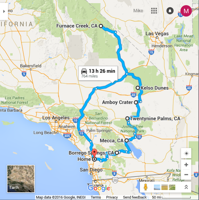
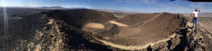
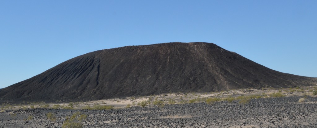
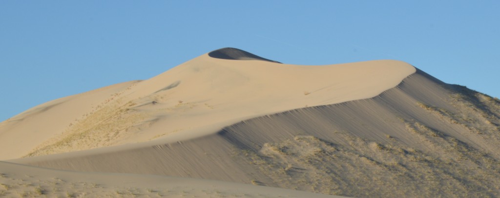
I fight off the urge to end the trip by just barreling down a freeway to get home as quickly as possible. We continue our trek south to 29 Palms, through Joshua tree, with its prehistoric looking rock formations, by the Salton sea, through Anza Borrego desert and finally home, 750 miles later in three days, still wearing the same clothes I started in having gone to two National Parks, a National Preserve, a National Monument, a Sea, and a state park, two nights under the stars in some of the most rugged and remote areas one can find in California. I can only sum up the trip as “We saw a lot of shit and I better take a shower soon because I am starting to smell like a lot of shit”.
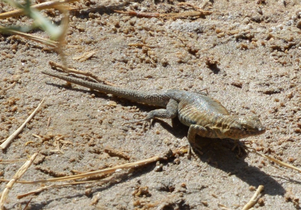
 DSC_0188_Lizard

Amboy Crater

Reading Time: 2 minutes

Water and good hiking shoes recommended. I looked everywhere. No where is it approved for motorcycle boots, long underwear (under motorcycle pants of course), and not so much as a drop of water. Same sign, different day. I’m still wearing the same clothes I started the trip in and the same boots and the same long underwear. The long underwear makes perfect sense, riding in the morning chill when it is 40 or 50 something out. Not such a great idea at 80 degrees in the middle of the day on a hot dusty trail but it is somewhat inconvenient to strip down in the middle of a parking lot. I’ve seen the Amboy crater on the map and always wondered about it. But it is so far out of the way and always on the path to nowhere, so I’ve never stopped by to check it out. It is this black cylindrical charcoal heap in the middle of a huge expanse of flatness marked by a dry lake and a distant perimeter of mountains.

DSC_0263_CharcoalPile

From the rim of the crater, I think it should actually be called a caldera, since it is the remnants of a volcano that was active as recently as ten thousand years ago. There are a few heroic plants that grow out of the black rock. Not too far away is the town of Amboy, a vestigial town that once served as a stop on historic route 66 marked only by Roy’s diner who sells overpriced $5 a gallon gas and wears a gun on his hip as he serves me my cup of coffee.

Singing Dunes

Reading Time: 3 minutes

The sign says “Water and good hiking shoes recommended.” I looked everywhere. No where is it approved for motorcycle boots, long underwear (under my motorcycle pants of course), and not so much as a drop of water. But that is how I hiked the 600 foot Kelso dunes. The hike up is a trudge. Two steps forward, one step back, the thighs burning, and the heart working hard. I opt for the circuitous trail that traverses the face to the saddle point, and then up along the ridge line. Chris opts for a frontal assault the shortest, steepest route. At the top, I take a picture of Chris still fifty feet off the summit making sure he knows I am there in a deliberate attempt to break his spirit.

DSC_0243_Dune

The view from the top is fantastic looking out over the Mojave desert. Cameras just don’t capture big sky, the feeling of being up on top, surveying the land, that feel of distance and space. Of course, it doesn’t stop me from trying. Curiously, I pick up a stray cell tower, that delivers a number of text messages, the nearest civilization fifty miles in any direction. I also take a survey of the area near the dirt road we came in on. I can see a group of trees that look like a perfect spot to make camp for the night. The ninety minute walk up is a thirty minute walk back. I run down the steep part of the hill that Chris came up, taking twenty foot strides running down, covering the distance that Chris just came up on hands and knees in a couple of seconds, the grains of sand avalanching with each foot fall, the grains rubbing together making a high pitched singing sound as the sand slides down the hill. Water awaits back at the trailhead and while my motorcycle boots might not be optimal hiking boots, they keep the sand out and I think are snake bite resistant. Luckily, I don’t have the opportunity to test that hypothesis.


We find our campsite that we picked up from our summit search, a primitive campground under some tamarisk trees, the surrounding land dotted with white poppies and creosote bushes. DSC_0257_PoppyClusterThe high altitude makes for a much colder night than below sea level campground of Death Valley. Brooke has taken all the food north to San Francisco, so Chris and I dine on the Ramun noodles and each drink a bottle of wine, the only food we can fit in our saddlebags, admiring the intensity of the starlight in the clear night sky and taking on such topics as abuse of electronics and the value of DIY and how far we are from anything like civilization. Just as we are about to call it a night, three van loads of UCSC students camping on their spring break pull in, and in the dark, setup their camp, destroying our short-lived illusion of solitude. But they settle in quickly, I am not sure if they even know we are here.

Disney Land

Reading Time: 3 minutes

Another kid walks by with a Disney t-shirt. An air-conditioned tour bus is parked in the lot. Spring always brings people to the desert but with all the news stories of the once in a decade bloom, Death Valley is actually crowded, at least for Death Valley.DSC_0156_Purple 
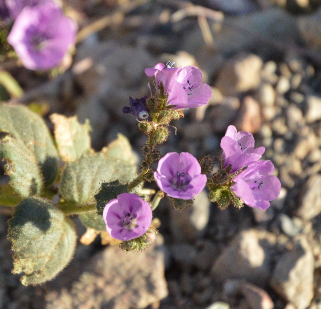
Flowers dot the landscape, but I wouldn’t use the word carpet the landscape, we probably missed the peak of the once in a decade bloom, flowers already seeding the sands for their next decade festival.

With a limited amount of time, we do the Disney tour of Death Valley. Death Valley has a number of attractions, no wait a minute, Disney has attractions, Death Valley has features. Our first feature is Badwater. A sign some two hundred feet over head on the hill shows us where Sea Level is. The salt basin in Death Valley is immense stretching over some two hundred square miles. At Badwater, you can walk out onto the salt flats. Chris braves the dirt and trampling feet to sample the saltiness of the salt and is not disappointed. Imaginative photographers stage pictures, people jumping in the air, head stands, attractive women doing photo shoots. I take a copycat of Brooke and Max jumping in the air.

Our next stop is the natural arch. The washboard road rattles Brooke’s car as Brooke debates the wisdom of the mile and half off-road adventure in her city car. The Natural arch is a mile hike in a fairly wide slot canyon. The adventurous climber can work their way to the top of the arch.

The artist drive is a one way paved road that winds through badlands, wending its way through the steep canyon walls. The artist palette is a rainbow of mineral colors including titanium and magnesium but the sign informs that the green is not copper.

The Borax Works pays homage to the brief Borax industry. 20 mule teams hauled the Borax out of Death Valley to the nearest railroad some hundred miles away. Not surprisingly, the industry only lasted for five years but its existence lives on in the off-the-shelf 20 mule team borax packages that you can buy in many grocery stores.

Salt Creek harbors the pup fish, a species of fish that lives its year of life surviving frigid cold waters in nights of winter and 100 degree water temperatures in the summer. DSC_0186_PupUpClose
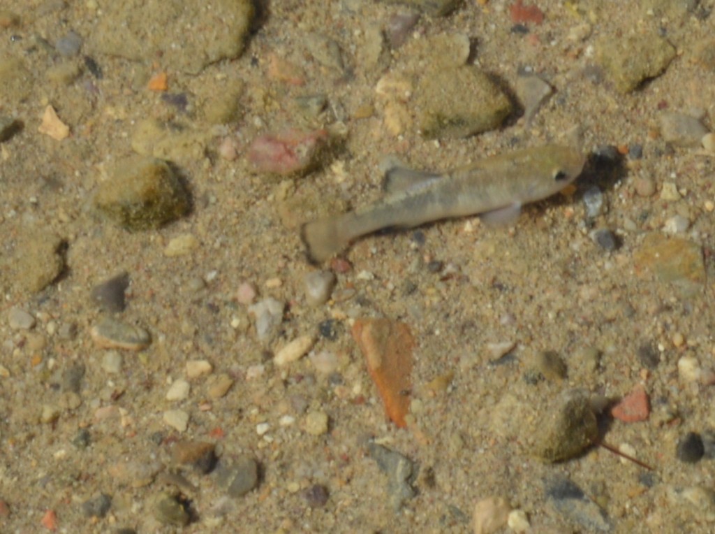
These hardy species have adapted themselves as the salt lake in Death Valley evaporated giving way to the salt flats we already visited. The trail is a boardwalk that thoughtfully keeps the foot traffic up and off the salt marsh that these fish need to survive.

Last stop is the mesquite dunes. Nobody wants to hike the mile out to the dunes, so we settle for some pictures. DSC_0199_Brooke
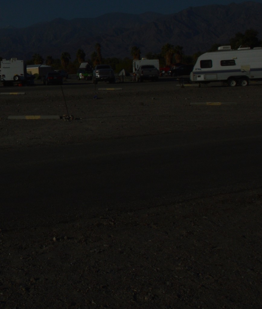
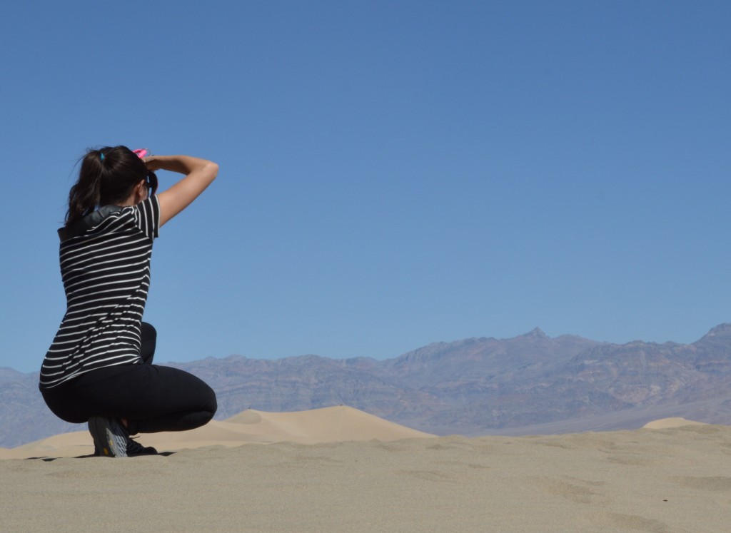
And this is where we part ways, Max, Brooke, and Ian off to Northern California, Brooke wanting to get back on Saturday, so she has a day of off. Chris and I head South, our only plan is to avoid the freeway on the way back.

Night Flight

Reading Time: 3 minutes

A couple of hours ago, we all sat on a tarp playing cards, eating our hot dogs, and drinking some beer under my LED camp-lights and the light of a full moon in the somewhat dismal Sunset campground that is more like a tailgate at a football game than a real campground with a gravely parking lot, neighbors on either side of us, and campers running their generators.

DSC_0172_SunsetCampground

Now, the temperature is perfect for sleeping under the stars but the wind has picked up and is really starting to gust. Max and I sleep on a tarp on the outside of the tent even though I’ve pitched the tent and literally nailed it into the ground with my rusty nails that are about the size of railroad spikes.  I don’t think twice about securing the empty tent or someone else’s tent I saw tumbleweeding down the road earlier.

I mind the strong moonlight more than the wind and place my riding jacket over my head. The wind gets worse gusting to thirty miles an hour, maybe more. I can hear all the tents flapping violently in the wind. A blast of wind rips by. I hear what sounds like something sliding over the rocks. I remove the jacket from my head in time to see the tent slide, flip over, and then once the wind grabs the water proof bottom, the tent lifts into the air, clearing Chris’s tent, flying like one of those cows you see caught in a tornado in the movies or like the makeshift sail in “Castaway” that finally leaves the raft in a violent storm.

I jump up and give chase in my underwear, my bare feet ignoring the uneven gravel in the heat of the chase. Max secures my inflatable mattress, sleeping bag, and pillow as they try to chase after me.

The tent cuts perpendicular over the road and then over a couple of campers before landing and rolling coming to a stop about hundred feet away having just narrowly missed four different groups of unsuspecting sleeping campers. Where have the nine inch nails gone as the tent flew? I have grisly images in my head of the nails sticking out of the forehead of one of the hapless campers I just ran over.

Max and I aren’t the only ones sleeping under the stars. Amazingly, the tent has held together. Back at the campsite, I disassemble the tent and hold it down with heavy objects like our cooler, equipment bin and rocks. In the morning, I will discover that top pole is bent about 45 degrees at the tip. All the equipment I left in the tent including my very expensive camera was dumped out when the tent first turned over and didn’t go along for the flight. My wallet and keys are still in the stuff bag I secured them in. Max and I move our tarp and sleeping bags behind Brooke’s car the wind still gusting. I manage to get plenty of sleep. In the morning, the fifty mile view of Death Valley of yesterday has turned into the haze of sand hanging in the sky like a fog bank over the ocean. Both Max and Brooke say they didn’t sleep a wink. Aside from my midnight run, the perfect temperature and the wind help me get a very good night sleep.

Death Valley Junction

Reading Time: < 1 minute

DVC02379

The air chills as we gain altitude cruising along a long straight stretch of the 127 heading North from Baker to Furnace Creek in Death Valley. The solitude of the road is a welcome change from the madness that races along the 15 to Las Vegas. The road stretches to the horizon and then disappears into the mountains splitting a basin, the green balls of creosote bush turning into a distant lattice of green pixels as the ground slopes up gently before giving way to rugged slopes of tan, brown, and chocolate mountains. A long band of cirrus clouds reaches up from the mountains their tips curled back like fingers beckoning me to come this way.