I made a second attempt to hike the Ansel Adams wilderness with my photography buddies. (First attempt entry: https://www.thetembo.com/clip/2020/06/07/backed-out-in-the-outback/). Wow! What a difference a month makes.
Since my abortive first backpack to the Ansel Adams wilderness in early June, attempts are being made to reopen the backcountry, the state, and the country. A month ago, the 3.5-mile road to the trailhead was closed and its parking lot empty. This time, arriving at 7 on Thursday morning in July, we barely scored parking spots for our cars at the packed Agnes Meadows trailhead parking lot.
I for one am glad I didn’t have to hike the 1000 foot elevation gain over the 3.5-mile at 9000-foot elevation road a second time but this time with my forty-pound pack. I had renewed appreciation for the June hike up the road as I was driving my car trying to squeeze by others on the narrow winding street. Since I only day hiked the trail on the first outing leaving my friends to their backpacking adventure, I trekked up the empty road by myself on the way out stopping in the middle of the pavement at my leisure to take pictures of wildflowers, wildlife, and scenery or simply just catch my breath. Not one car or bus.
This time, on the drive out, the line to get on the road at the pay booth entrance near Minaret Overlook was a mile long. I do not think I exaggerate the distance. I can’t blame anyone for wanting to get outside in the wilderness on a beautiful 4th of July day, but that long of a wait and only to discover that you might not be able to park anyway would just suck the joy out of the experience.
On the first trip, I was able to get a hotel room, but restaurants only offered carryout or drive-through service. Bars and basically anything with a hint of a gathering was closed. This time, the hotel didn’t offer breakfast or coffee and the amenities were handed to me in a plastic bag when I checked in. The restaurants and even bars are open again under the weird rule that I’m only mildly comfortable with, you don’t have to wear a mask at your table but you have to wear it everywhere else. Of course, it’s the same everywhere in California. Outside is better than inside. Open is better closed. Distance is better than closeness. If you have to be indoors, good air circulation preferably with filtering would seem to be the option of last resort. It seems oddly weird to watch people sit indoors with a bunch of other people in the midst of the pandemic while hikers pull their masks up over their noses as you pass on the trail.
The forecast for this trip was abundant sunshine with overnight lows in the upper 30s and lower 40s. So, sans the threat of daytime rain and overnight temperatures in the teens, I ventured into the wilderness with my forty-pound backpack, which is eight pounds more than the recommended maximum of 20% of body weight. I could have gone a little bit lighter on the clothes but not much. When I packed for this trip, I ditched my rain jacket for an emergency poncho knowing the forecast for intense sunlight, so I saved weight there. I don’t own a lightweight jacket so I compensated by carrying a couple of long-sleeve shirts. I could possibly lose a little weight there. I definitely should have left the crampons behind since we never had to negotiate any ice packs. I took two camera bodies instead of one so I didn’t have to change lenses every time I shifted from a closeup to a scenery shot. The camera body is light, the wide-angle and telephoto lenses are heavy. I took a lightweight fold-out chair which was really nice to have but not necessary. Camera equipment is heavy but when your mission is to take the best possible pictures, good equipment is not something you want to leave behind. I should have carried a first-aid kit, but didn’t. I really liked having my life straw, a water bottle with a built-in filter that I used to fill up at a stream whenever I needed to instead of stopping to put together a filtration unit. If there is a next time, I will work harder to get the weight down.
The things that worry me the most are not the expected problems of high altitude and fatigue but the structural pains such as a sharp pain in the knee and excessive hip pain especially on the downhills under the straining weight of the pack. But all-in-all, this old body protested but did not crumble.
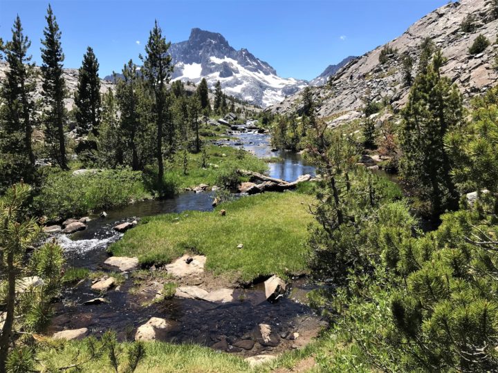
For the record, the trip was three days and two nights long. We hiked ten miles to Thousand Islands Lake on the Riverside Trail doing some back and forth once we arrived to pile on extra mileage. We hiked two-plus miles to Garnet lake reaching the highest elevation of 10,400 feet. Both lakes are at 9,800 feet in elevation. And then the seven-plus miles back to Agnes Meadows.
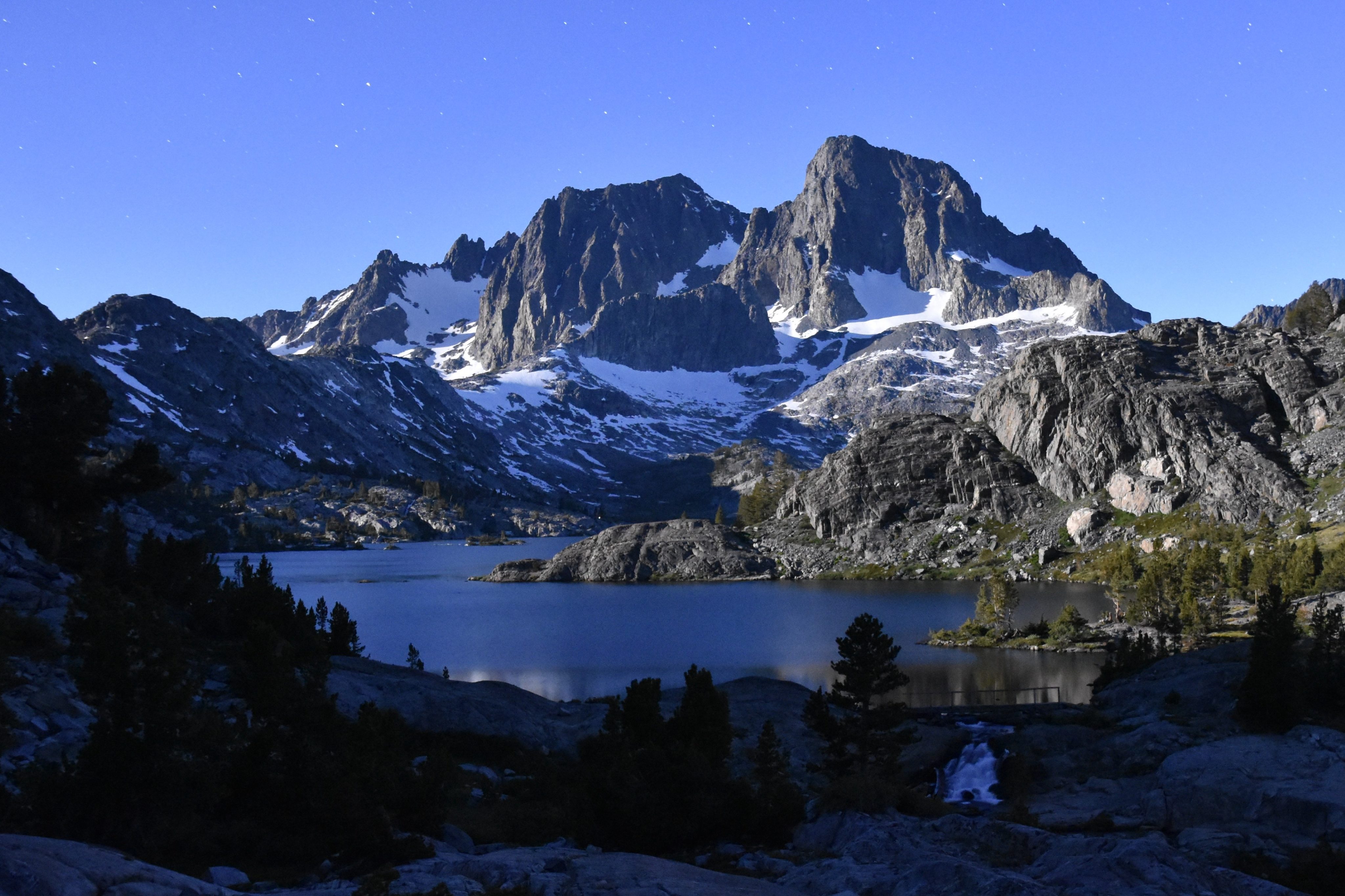
On the success of the mission from a photographic point of view, I will leave that to your judgment. We didn’t get any clouds, which as long as they don’t obscure the subject matter of interest, add significantly to the drama of the composition. We didn’t time the night pictures very well. If we had woken up at three-thirty instead of two-thirty, we might have had a full moon over the mountain and its reflection in the water. Then again, the incredible glow of the full moon presents all kinds of challenges for night photography. For one, it rules out capturing the Milky Way as a backdrop to the mountains. All-in-all, I’m very happy with my pics, at least until I see the other guys. The fun thing about traveling with a purpose, in this case attempting to take great photos of incredibly scenic backcountry, is that you end doing odd things that you wouldn’t otherwise do, like get up at two-thirty in the morning for shots of the night sky and then again at five to take pictures of the mountains in the sunrise. Or walking up and down the same shoreline over and over or climbing high up on the rocks looking for that perfect composition. It’s great traveling with experts because they have a great sense of composition and great command of the technology. If they allow it, I will share their links here.
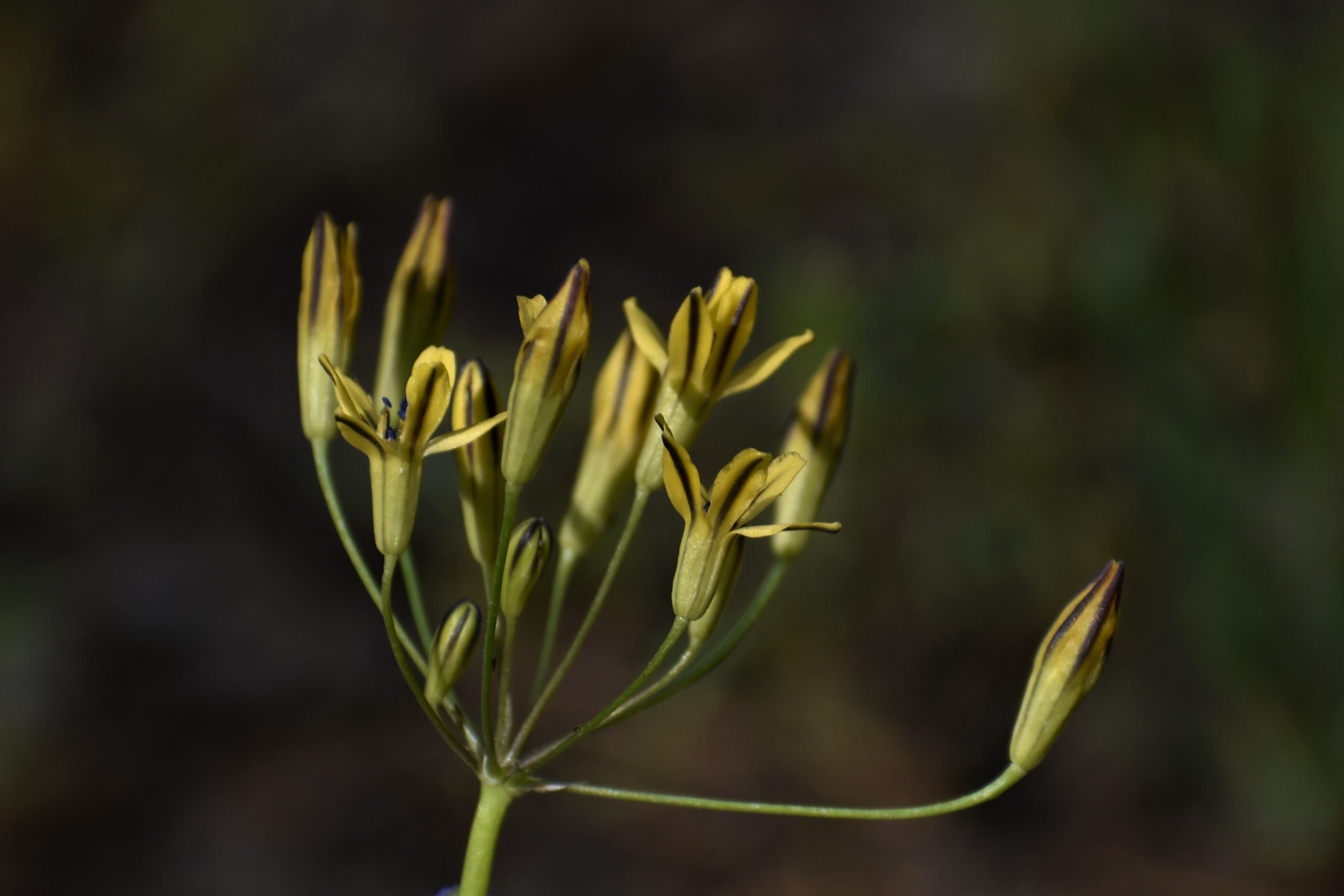
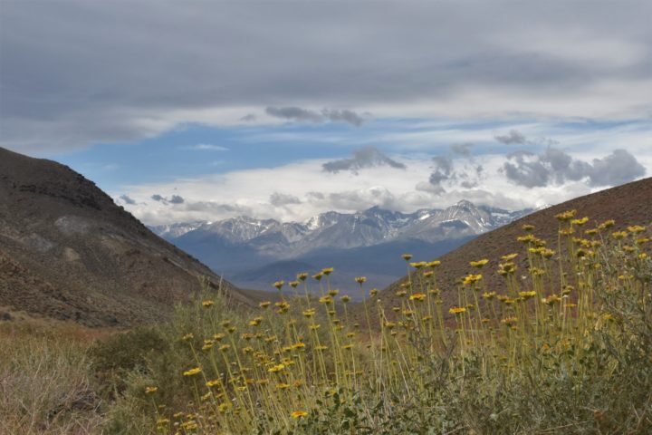
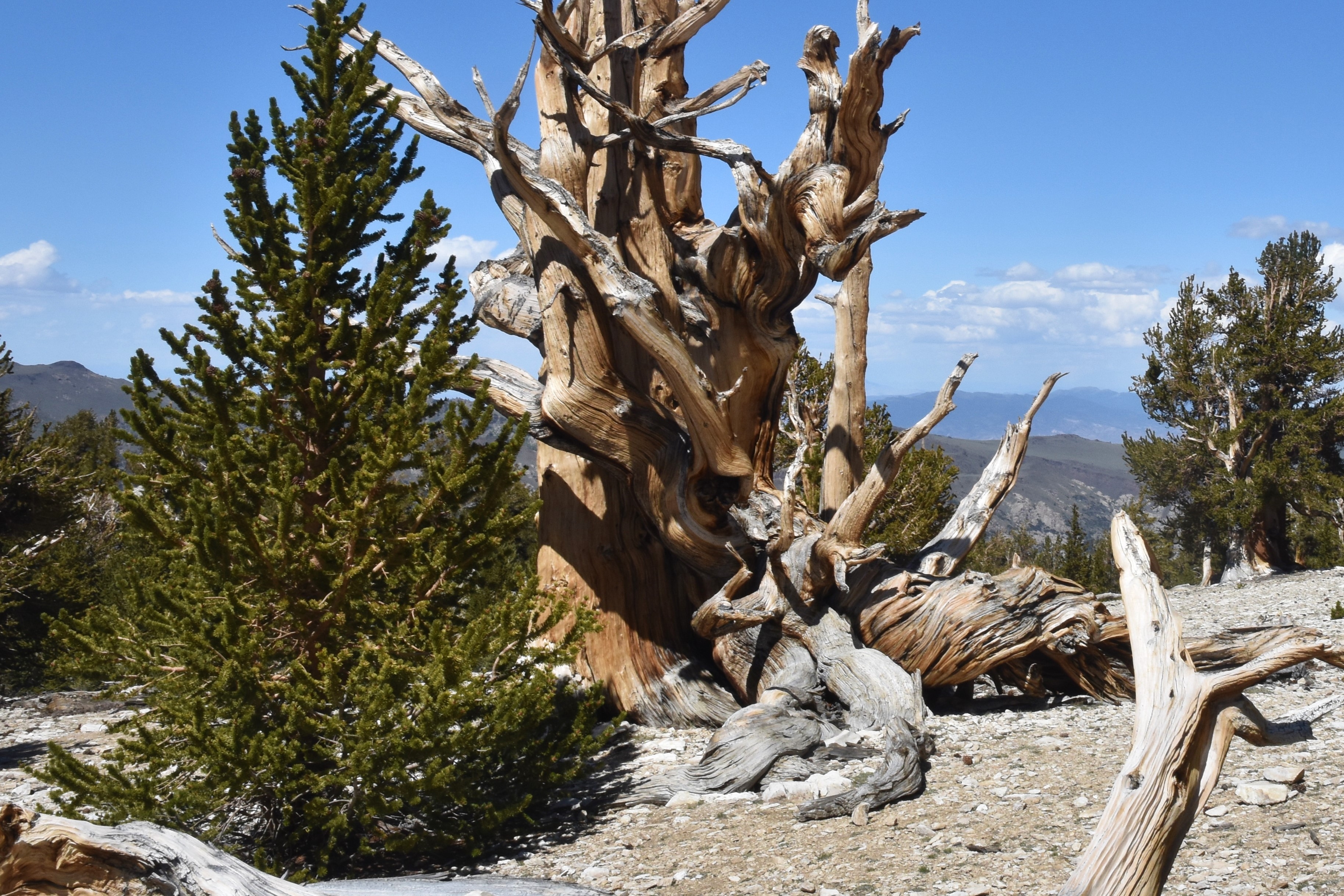
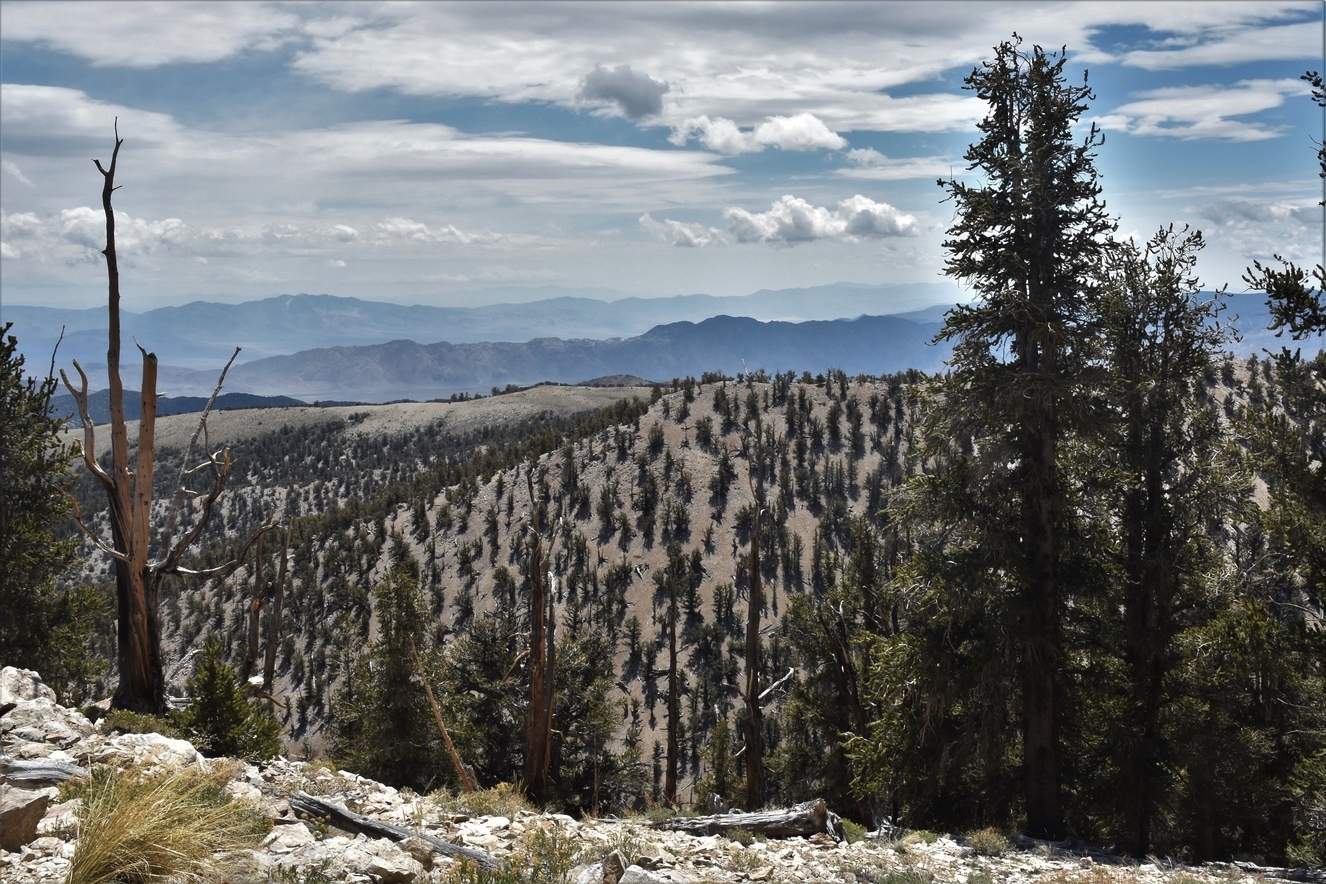
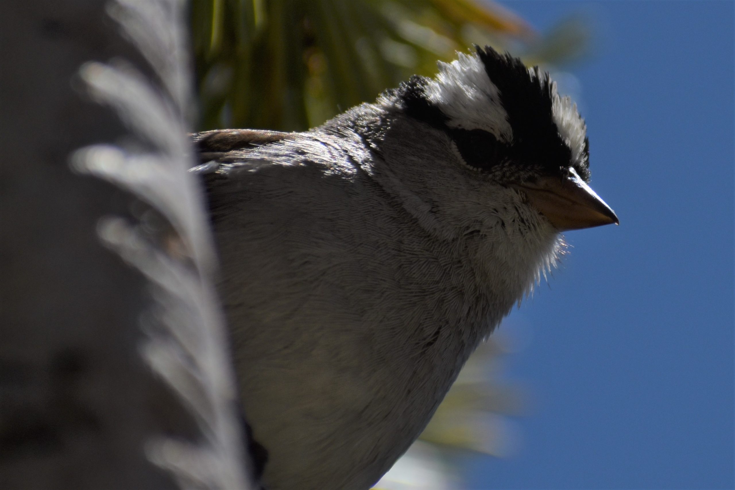
On the success of the mission from a nature point of view, I would claim a resounding victory. You can find beauty and intrigue in the large and the small and everything in between. Aside from the mosquitos, which can be a complete nightmare if you don’t bring repellent and even some mesh, the beauty of the water and the mountains is amazing and a picture can only begin to give you the feel of the immensity. The wildflowers are in full display. Mountain wildflowers tend to be smaller than their lower elevation equivalents. You have to look harder, but if you take the time to look, they are everywhere and of surprising variety. The insects are also everywhere too busy flitting from flower to flower and buzzing about doing whatever it is that they do. Be sure to check out the proboscis on that fly/bee insect in the photo. I was lucky enough to get a shot of one at work on the long narrow tubes of purplish flower. Regrettably, the one interesting mushroom I found growing under a pine tree, which resembled a hot-cross bun, didn’t turn out.
On the success of the mission from a spiritual point of view, perhaps the most important aspect of the trip, three days really isn’t long enough to truly disconnect but only to feel a vague uneasiness that those things, coffee, alcohol, and connection to people and news, aren’t there and to notice that your world goes on even inside your little nature bubble. Or is the bubble the other way around? I did leave a little something of myself behind, buried under a couple of inches of dirt and covered with rocks. Hey. Don’t laugh. Making do without modern amenities is part of the spiritual experience.
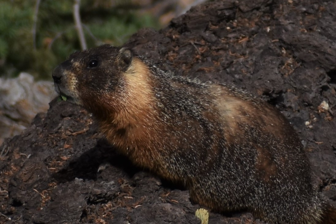
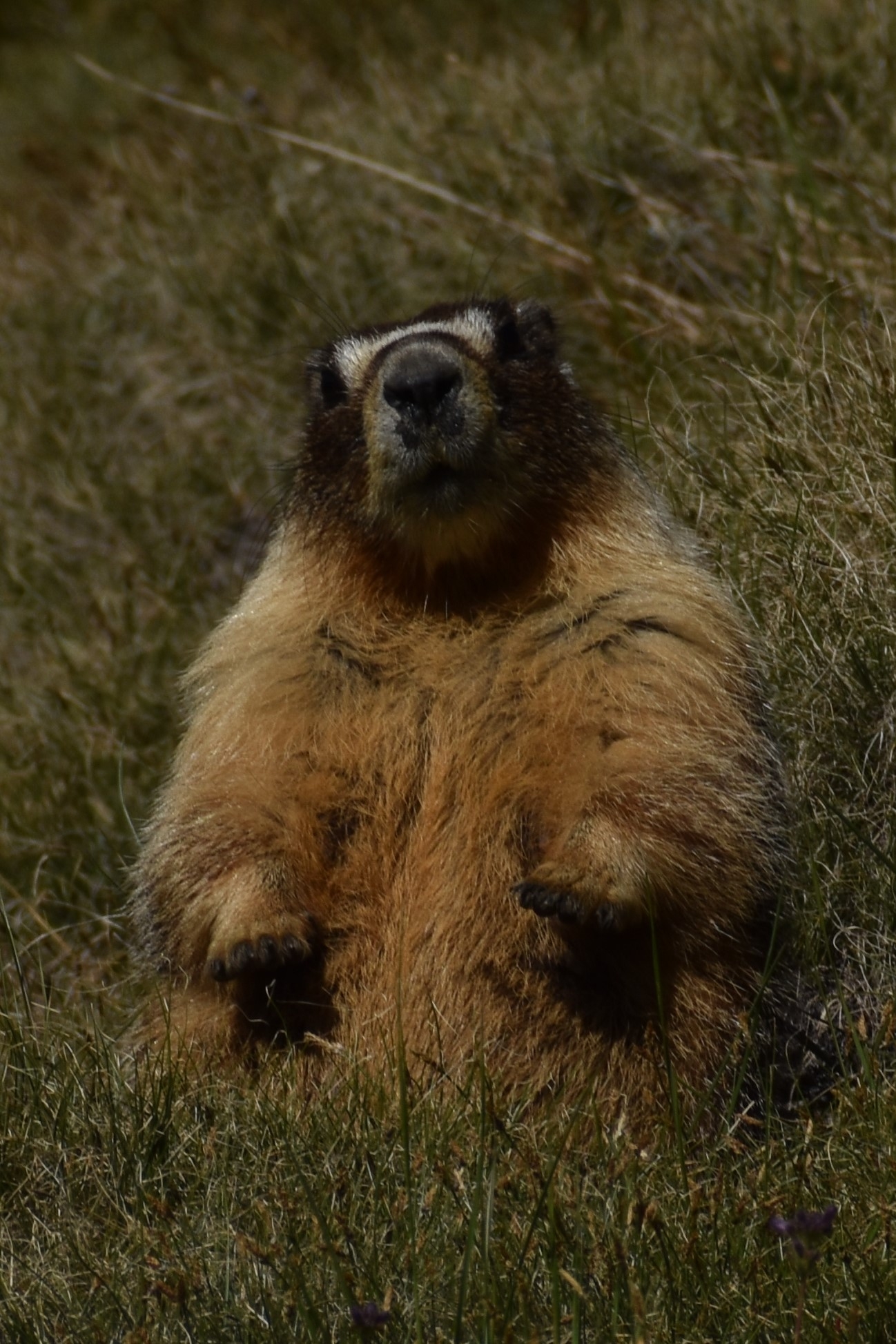
I don’t know on what other criteria you would judge a trip, but I would judge it a success. The thing that made me go back to Ansel Adams was my abortive first attempt. The things that will keep me going back is the wind whistling through the pines, a curious yet afraid marmot, and the raw beauty of a peak towering glacier-covered three-thousand feet beyond a lake full of jumping trout. The thing that will keep me from going back is the body. I’m not sure it’s up to it anymore.
Here are the pics. I hope you enjoy them. https://drive.google.com/drive/folders/1jCExUnmEMIIQO2Wz47l2KiZGCYReKc3P?usp=sharing