Daley Ranch 3

Reading Time: 3 minutes

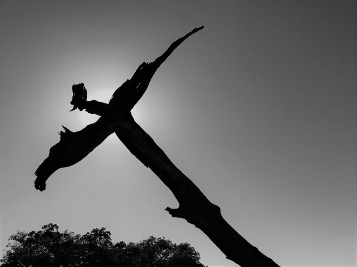
This is my third trip to Daley Ranch in the last two weeks. In the previous two outings, I started at the lesser-known Southeast and Northwest entrances. For the sake of completeness, for this hike, I started at the main park entrance of Daley Ranch. Not unexpectedly, the lot was jampacked with cars and people. The main road to the ranch is a paved road, loaded with kids in strollers and mountain bikes screaming down steep hills. I wear a mask as people pass but then usually remove it. It fogs up my sunglasses and I’m flying blind with both the mask and the sunglasses on. After one lady passes and I take off my mask, I can smell her perfume. If I can smell her perfume, can I smell her COVID?

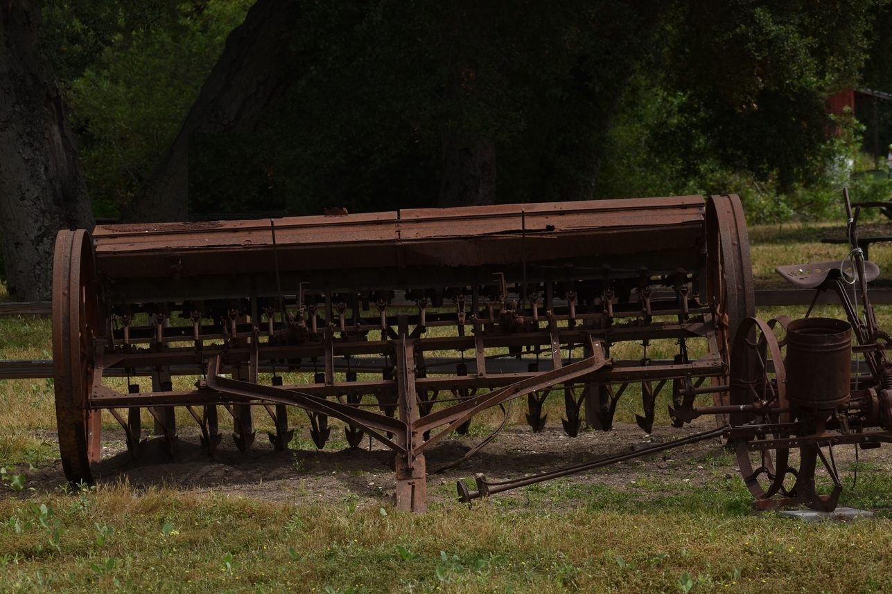
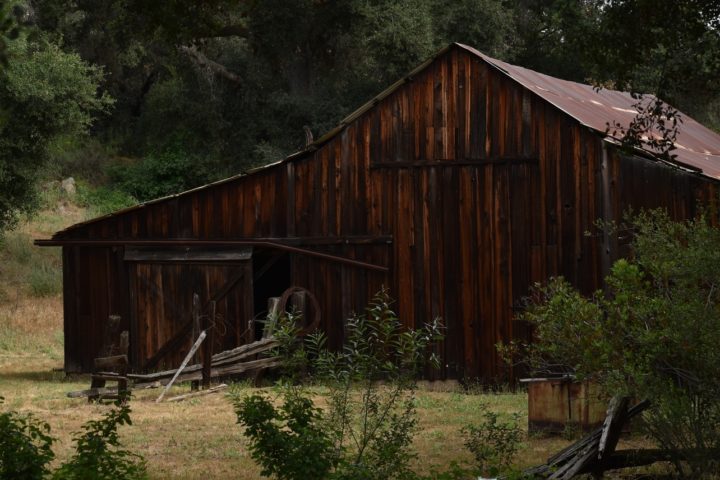
I figured since I took plenty of pics on the previous two hikes, this hike would be more of a training hike than a picture-taking hike, but I am always prepared. It’s about a mile hike to the ranch, which has some nice rustic buildings. If you follow the link to the pictures, the machinery is a grain planter. I took the liberty of photoshopping out the big white sign on the other side of it. The barn has some beautiful colors that contrast nicely with the soft green background. I took another liberty in photoshopping out a bright incandescent light hanging out over the barn door.

The very straight “Jack Creek Meadow Loop” trail leads north away from the exhibits for about a mile and a half. The trail tracks a gas pipeline through a meadow. The meadow is patched with invasive mustards, wild radishes, hemlocks, and dried-out grasses but also includes oaks and elderberries. I chanced upon a gliding hawk and had only a second to set the camera’s speed settings and snap off a couple of shots. With birds I find, you take what you can as fast as you can take it. Plants don’t tend to get away as fast. Patches of whites and yellow-greens and browns abound, but I just can’t find a good composition in the chaos. I tried with one elderberry but ended up using a software filter to make it stand out against its background.

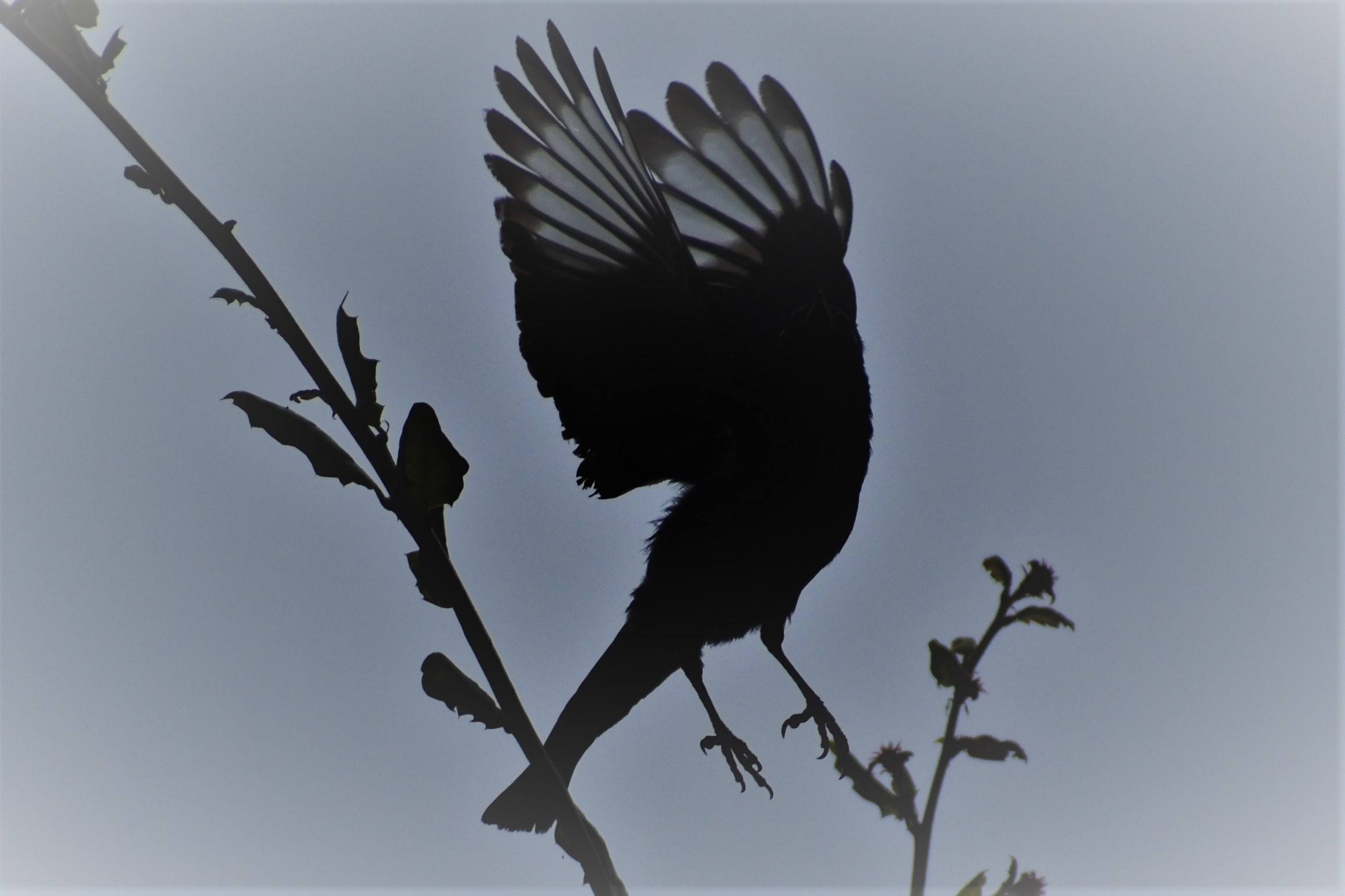
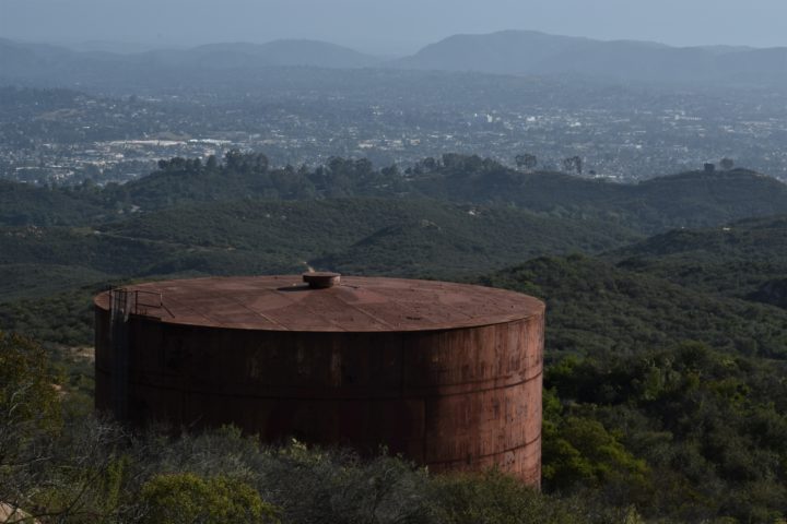
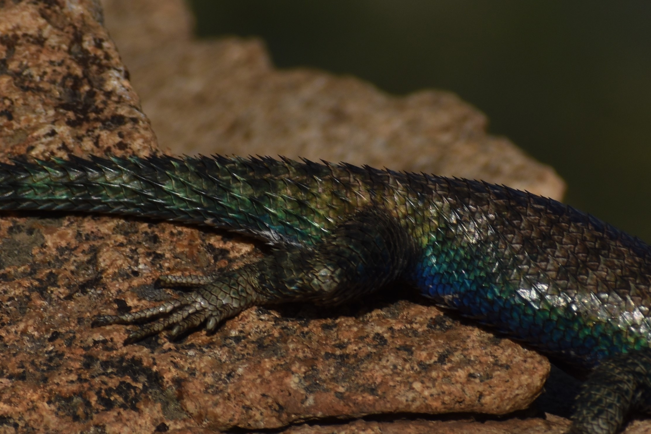
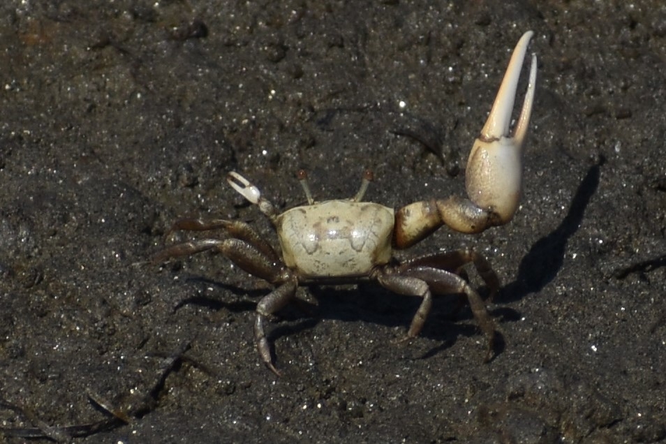
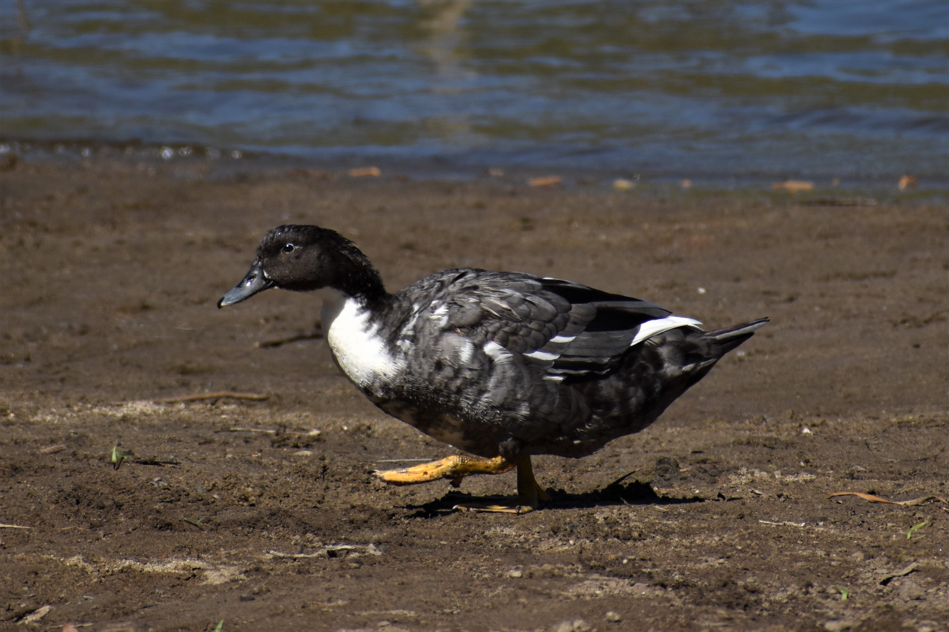
The path doubles back to follow a power line that also cuts through the heart of the park. The birds are a little more cooperative today. I catch a few in-flight or starting to fly away. The one with the chainmail breastplate I have never seen before and I can’t find it in the bird books. I catch another bird with its outstretched wings launching it for takeoff, it reminds me of Japanese ladies waving their fans covering most of their faces.

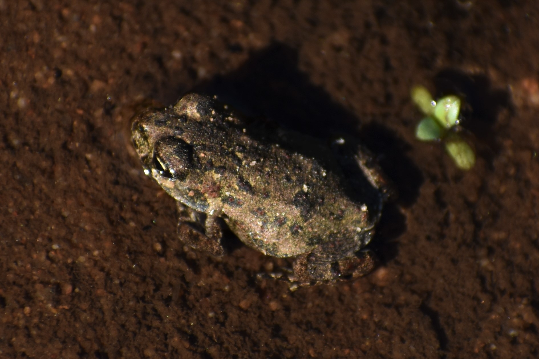
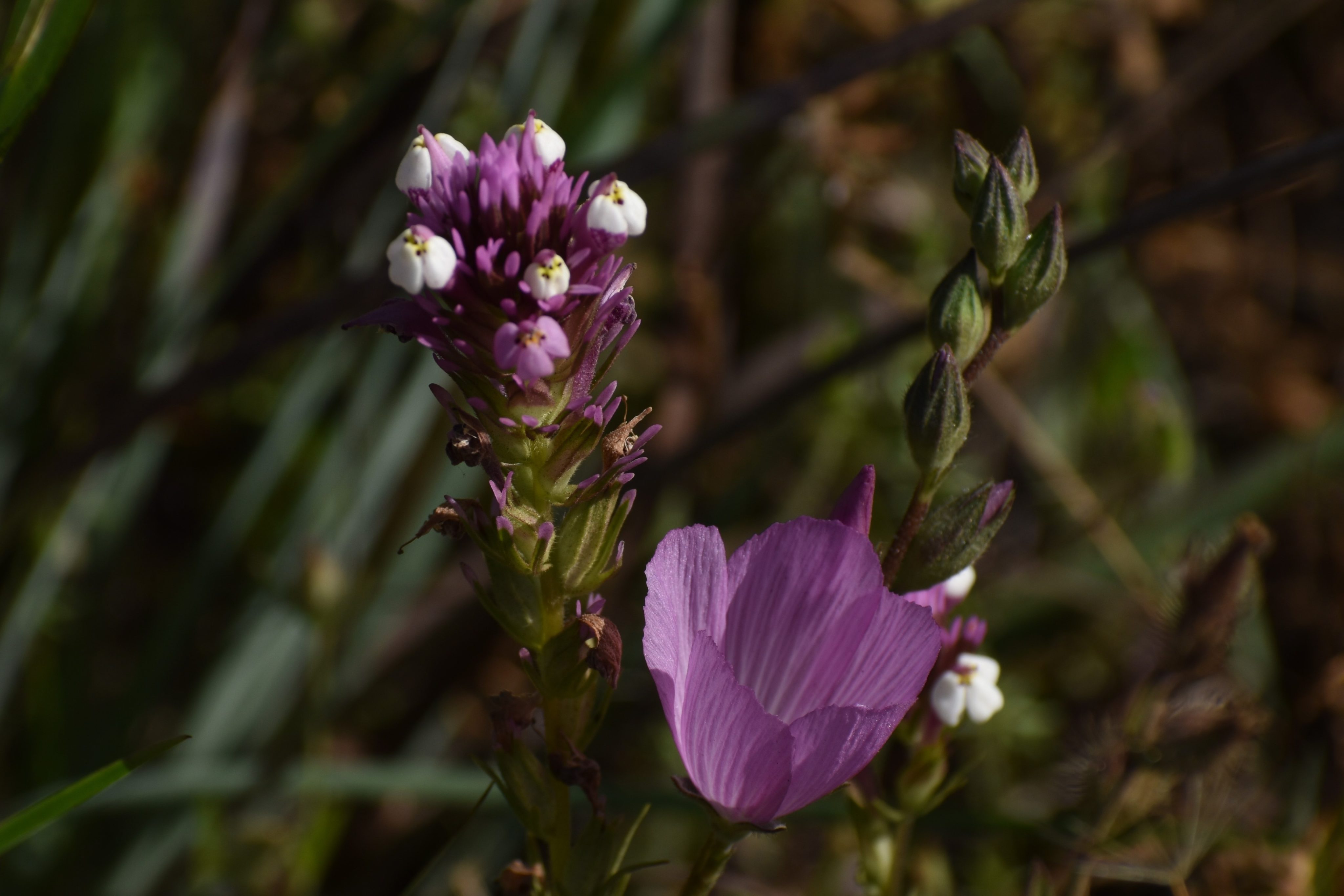
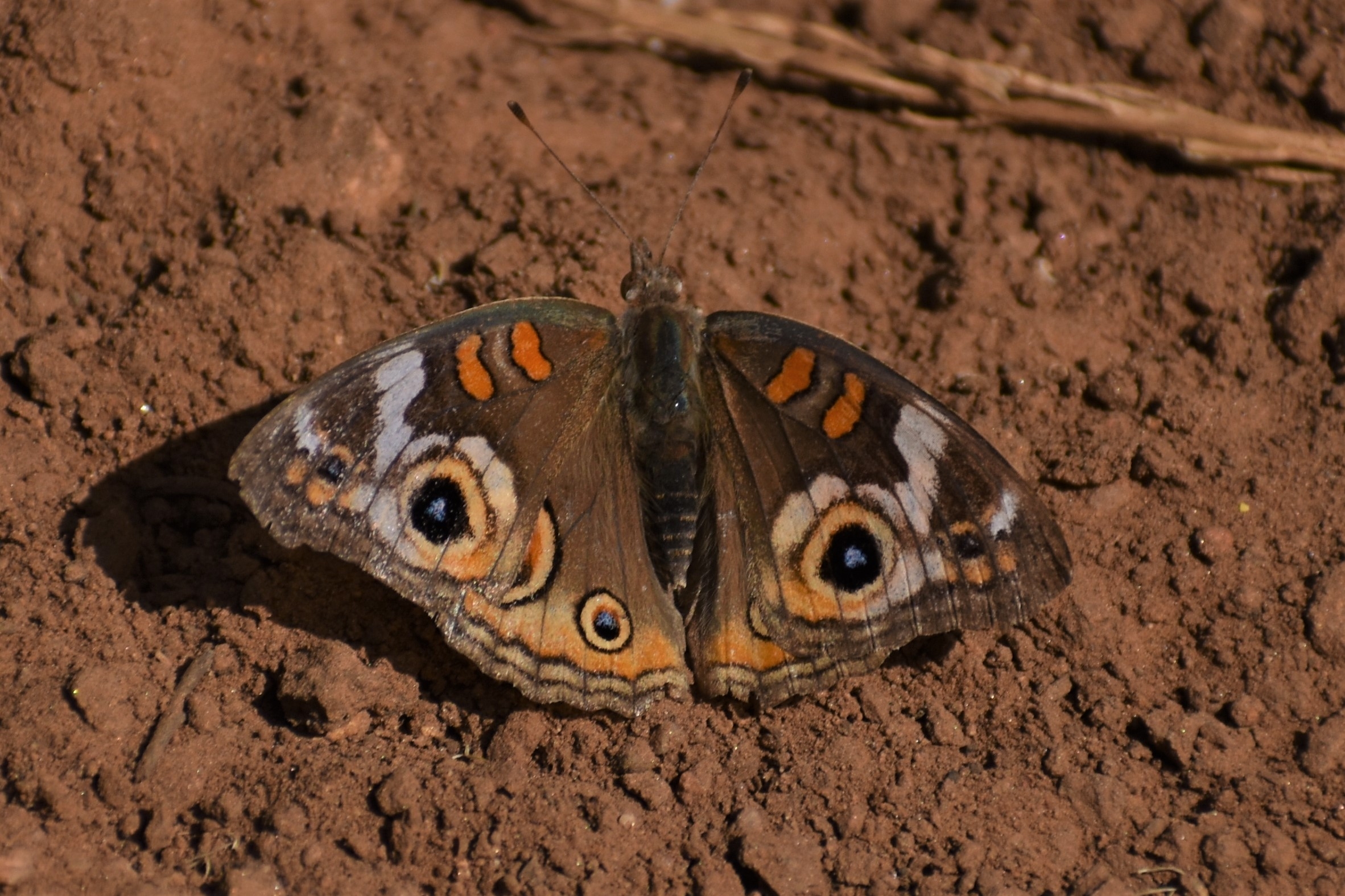
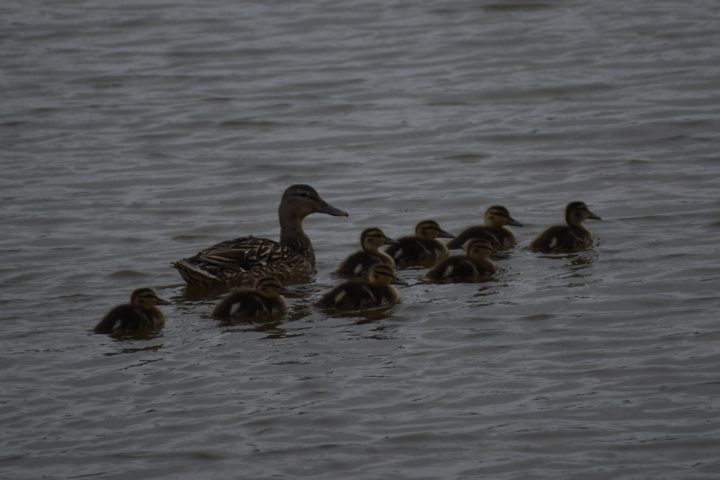
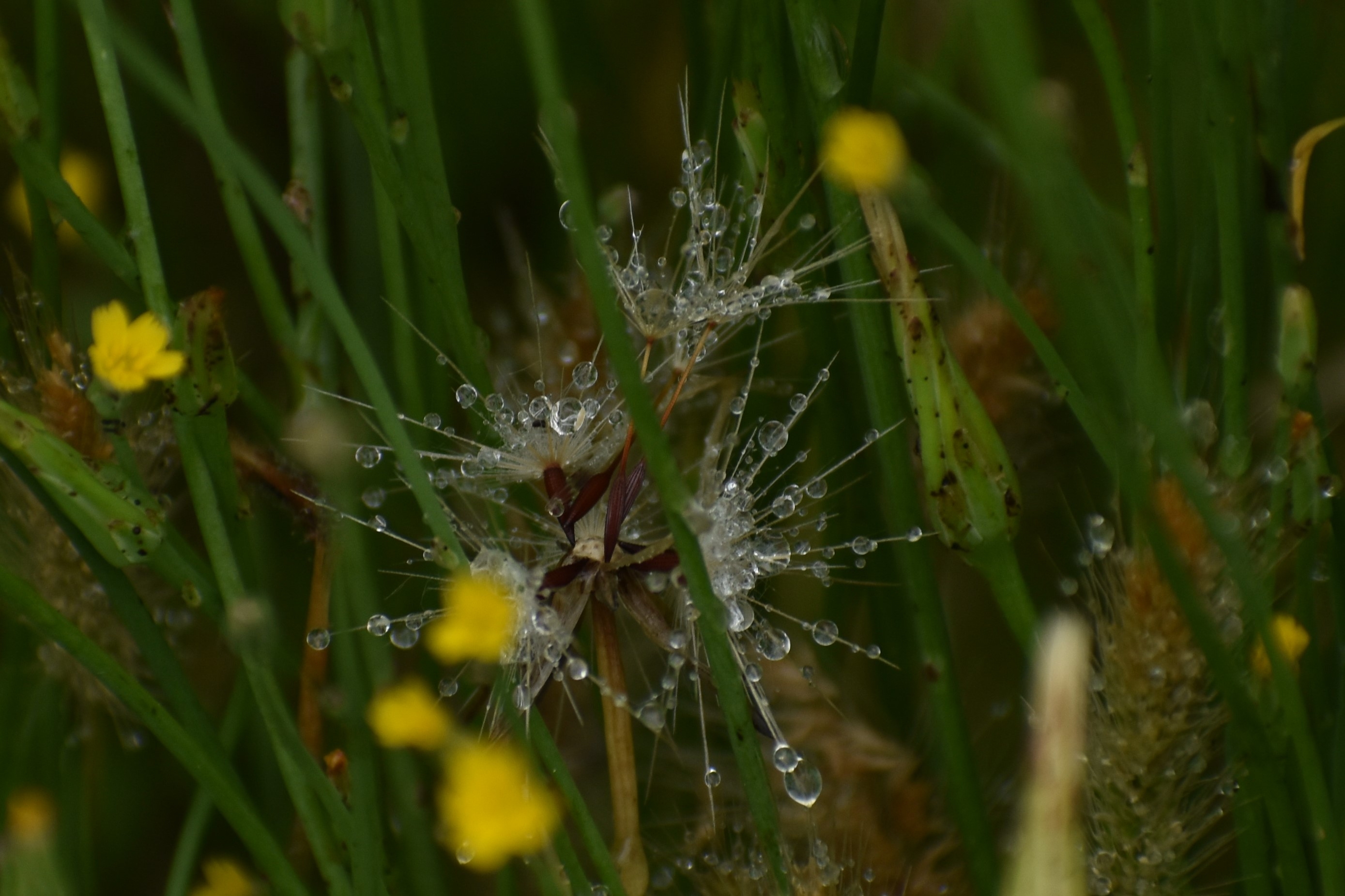
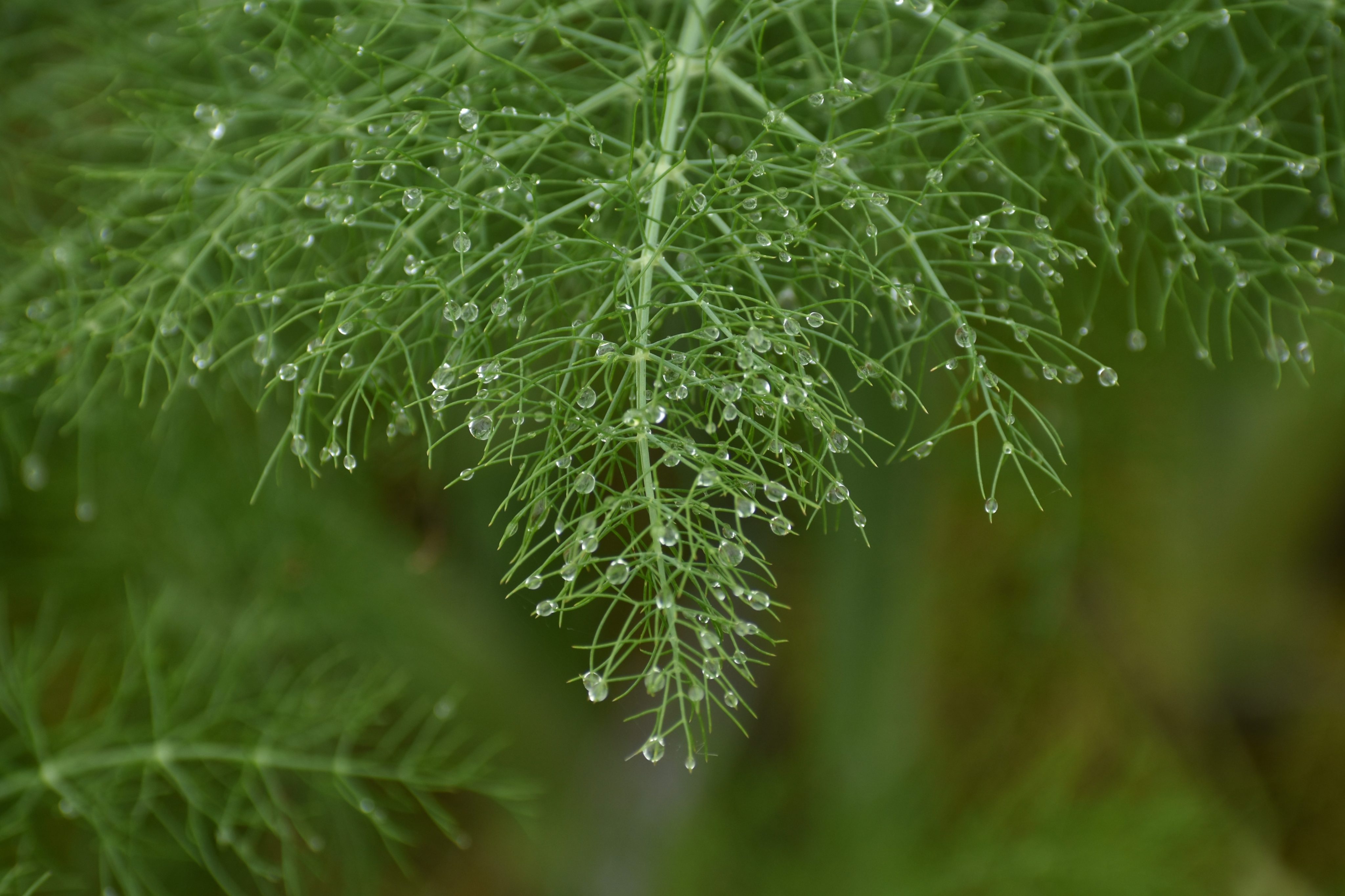
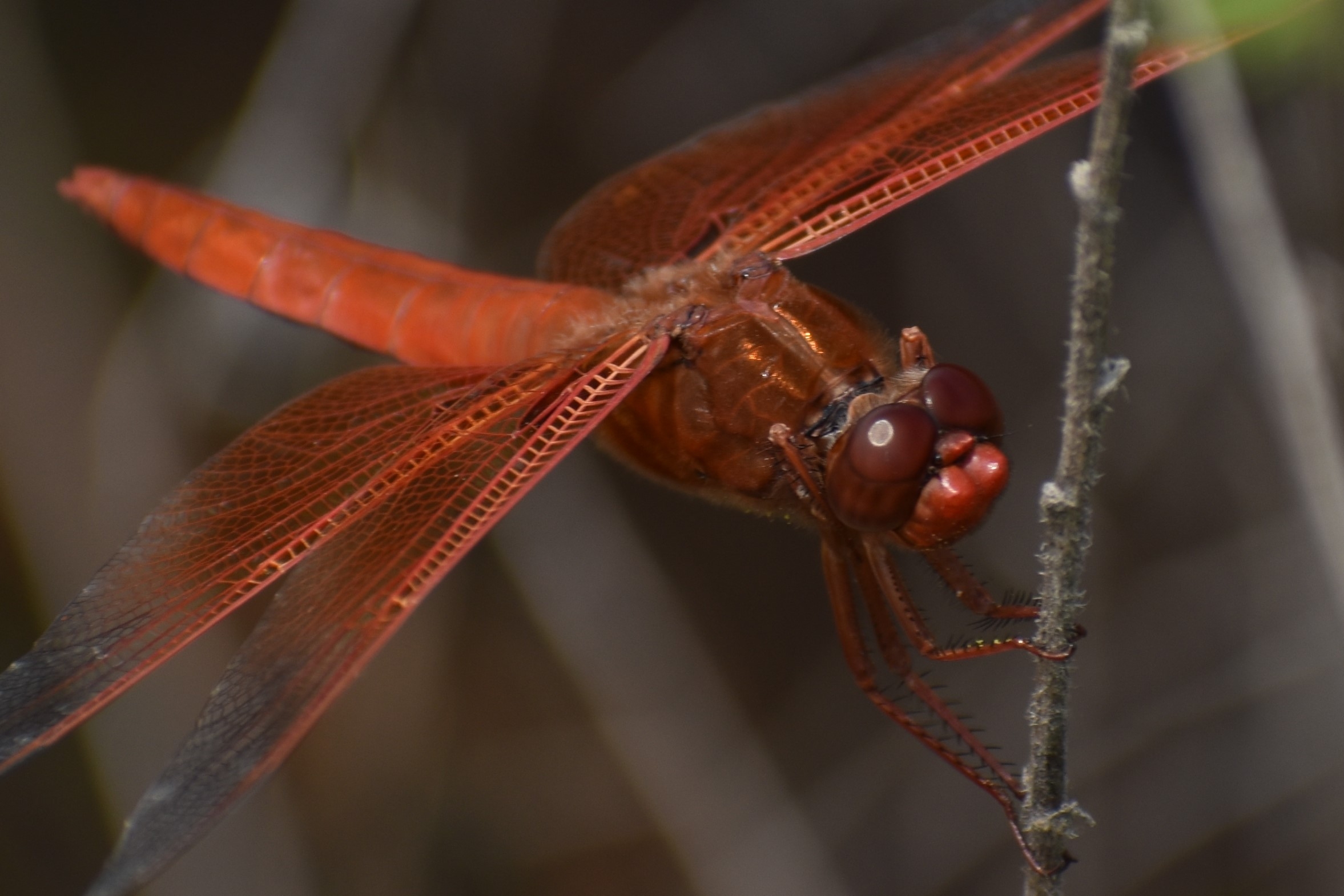
Just before the trail returns to the ranch, I veer off on to Sage trail. The vegetation changes to chaparral in a short but steep climb. I find a patch of spineflower, which makes for an interesting composition of red spineflowers, green shrubs, and brown grasses and rocks. I zeked it in the final presentation to test out the filters and because it looks more interesting. The bugs were cooperative too. The velvet ant didn’t turn out well enough to save but the dragonflies at Mallard lake more than made up for it. Both the blue and orange ones perched patiently on bushes right in front of me. I went black and white with a black and white butterfly. I think it shows up better against the rather oddly contrasting lime-green flowers of the mustard plant.

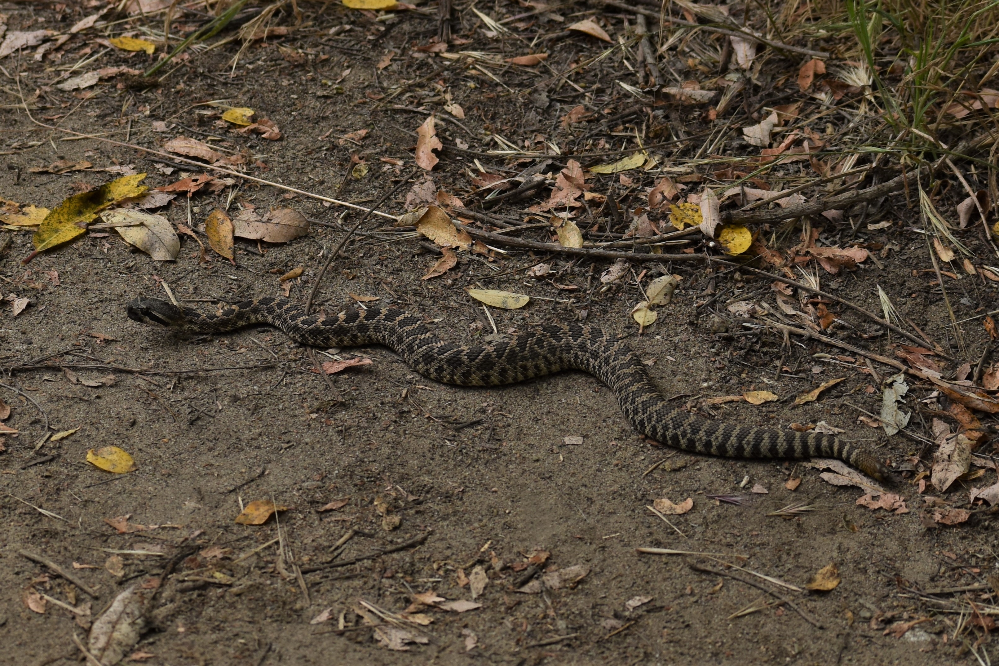
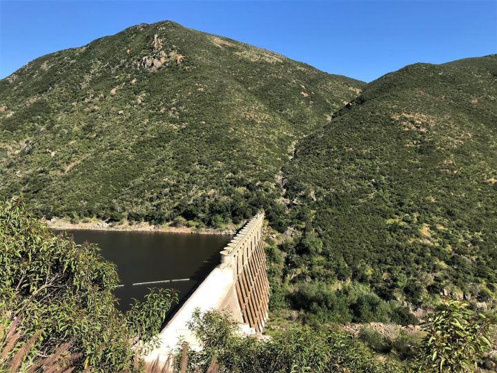
I cut around the backside of Mallard Lake through the chaparral tunnels on Diamondback Trail and the more open “Coyote Run.” I lost whatever cloud cover I had so I finished up returning to the main entrance via “Creek Crossing.” There is a creek crossing and it is rather pretty but hard to get a coherent shot through all the underbrush.

Pictures are here. They are mixed in with the two prior trips so you can see all of my Daley Ranch efforts in one viewing. I hope you enjoy them.

https://drive.google.com/drive/folders/1u6rWJyldXdskA8MigRMbM9DR3KcL8yfI

Daley Ranch Addendum

Reading Time: 2 minutes

In the interest of training, I decided to hike more of Daley Ranch. I hit the east entrance to Stanley Peak in the previous post. In this one, I circumnavigate Burnt Mountain. And if I stay healthy, in the next one, I will use the popular South entrance.

I started from the Northwest corner of the park for a 4.5-mile hike loop trail down Cougar Ridge and Engleman Oak. I’m sure this is the most obscure entrance, if for no other reason than I had to drive a mile or so of unpaved road to get to it and the fact that for the first two hours of the hike, I didn’t see another hiker. Only when I looped back onto Cougar Ridge towards the end of the hike, did I run across a few hikers and bikers more sensibly starting out the hike at the end of the day.

The Cougar Ridge trail is a dusty truck trail that dips in and out of the shade of oaks. A modest stream still parallels and even crosses the trail at one point, taking no more than a large step to cross. Most of the elevation gain of the hike is in the half-mile ascent to its intersection with the Engleman Oak trail.

The Engleman Oak trail was a pleasant discovery. The west trailhead has a small pond starting to show signs of drying but very much alive with dragonflies, frogs, and ducks. It’s a single-track trail with surprising views of Palomar mountains as it parallels Pauma Valley to the North.

A few pictures have been added to the original set.

https://drive.google.com/drive/folders/1u6rWJyldXdskA8MigRMbM9DR3KcL8yfI?usp=sharing

P.S. If you have a caption for the feature image, let me know. I kind of think of it as a guy that “Gives a Flying F**k”

Stanley Peak

Reading Time: 3 minutes

As part of my training for the Sierra’s, I thought it prudent to do some hiking with a little elevation gain to it. So I tackled Stanley Peak in Daley Ranch. From the parking lot to peak is about a thousand feet of elevation gain over the course of three and a half or so miles.

I started about three o’clock in the heat of the day in jeans, a good choice for trails with overgrown vegetation and the later hike in the shade, but not so great starting out. The spring bloom is still on full display with flowers showing every shade of red and purple that I could imagine. (Maybe there’s a book/movie in that? The colors red and purple.) The air smells of spice and the fields hum with the tinnitus of bees, particularly around the swaths of deerweed. When deerweed and buckwheat flower, the bloom is coming to its last phase before drying into the brownness of summer. Plenty of lizards scurrying along the way. A buckeye butterfly stopped to take a look at me. When I summit at Stanley Peak, I share the view with a Granite Spiny Lizard, which I think is better described as a scaly rainbow on four legs.

Horses, bikers, and hikers are all out today but I don’t think too many people use the Caballo trail entrance. A couple of guys ask me if this is an access to Dixon Lake. Not the way they are headed, down to the parking lot from which I just came. A few people have masks, a few people don’t. I wear mine so I can stick my tongue out at them without them seeing (jk).

I think we can come up with some better words for a collection of hikers than just hikers. On a single-track trail, from a distance, hikers that stick together on the twists and turns, especially those with walking poles, remind me of a centipede. A centipede of hikers? On wider trails, they tend to cluster in a ball and take up the width of the trail. A clot of hikers? On the way back and in the shadow of the hillside, many of the flowers I saw on the way up have closed up for the night, curling up like a wrung-out towel. It makes me wonder if they have any kind of awareness. There is nothing to prove that the electric pulse of a neuron is the only thing that generates consciousness. Anyway, photos and strange thoughts are how I pass the time on the trail.

My only scary moment on this hike is when I think I lose my glasses. In all fairness to me, when I see a photo opp, I move my sunglasses to the top of my hat. When a hawk flies overhead, I don’t have time. When I go to place my sunglasses back over my eyes, they aren’t on the top of my hat. I start looking on the ground thinking I may have dropped them before I realize they are still on my eyes. God, I fear for my brain.

Here are the pics. I hope you enjoy them.

https://drive.google.com/open?id=1u6rWJyldXdskA8MigRMbM9DR3KcL8yfI

Get Fit! Get Smart!

Reading Time: 5 minutes

I was just invited to go on a two-night photographic backpacking trip to Ansel Adams wilderness. With basketball and walking the dogs, I’m usually in pretty good shape and can just pick up and go without any extra training. But the last two months have killed the basketball and the dogs are slowing down limiting the walks from any distance. So, I chose the Del Mar hike of six miles, previously blogged here, https://www.thetembo.com/clip/?s=del+mar+triangle

The hike starts at the Torrey Pines Extension near Del Mar Highlands school. I figured the short cut through the schoolyard would be closed off, and I know there is a trail in the extension that stays on the south side, but I wasn’t sure where to pick it up at. I parked at a spot with a lot of other unoccupied, parked cars thinking maybe it was the access point I was looking for. It wasn’t. I walked around to another spot where I saw a trail going through a grove of Torrey Pines.

My first clue that this was a bad idea was the “No Public Access” sign that I ignored. My second clue was the sleeping bags laid out under a tree about a quarter-mile in. Still, I pushed on until the worn path ended but I saw a wooden bridge that I recognized as part of the trail that I was looking for. My third clue was the bushwacking I had to do get to it, paying the price with legs and arms full of scratches. My fourth clue was the twenty-foot bridge had a two-foot gap so I had to jump to get on to it and another two-foot gap on the other side so I had to jump to get off of it. My fifth clue was the tree that had fallen across the path so I had to bushwack around that. Finally, I found myself back on the main trail and hiked to the entrance at the bottom. My sixth clue was the fence I had to hop around to get out of the reserve with big signs on the other side saying “No Entrance. Park Closed.” Obviously, I’m not one to give up easily on a bad idea. I’m glad I did this part of the hike first because it would have sucked to come to the fence at the other side and discovered I had to walk around probably adding two miles or more to the hike.

The parking lot at Torrey Pines State Beach is closed but the beach is alive and well. As long as you are moving, you can hang out on the beach. No laying down towels and having little parties. I walked the stretch from North Torrey Pines Beach to the south side of the San Dieguito River. The beach is covered in a foul foam, my guess is that perhaps it is residue from the red tide, but I’m not sure. It’s a beautiful cloudless day and the low tide opens up the beach. I can’t blame so many people for being out. I didn’t have any trouble negotiating a path through the throngs at a safe distance, even at the most crowded point near Powerhouse Park in Del Mar. I only had one incident where a child ran by just missing me and the mom said so I could hear it, “Be careful sweetie, you have to watch out for the man because he isn’t looking where he is going.” (Not to pass judgment, but f**k her.)

I do this segment of the hike barefoot, walking in the very shallow surf, jumping over the nasty foam as the waves push it in and back out again. Brown Pelicans soar overhead taking advantage of the north-to-south wind. A woman in a thong bikini bends over in front of me to pick up a shell at an angle that makes it look like she is not wearing anything. The only thought that passes through my head is that I’m sure they are worn for comfort and not for show.

At the race track, I take the path along the south side of the river passing the lagoon and then over the train tracks, watching terns patrol the waters and kids fishing on its banks. I cross Jimmy Durante road at the Viewpoint Brewery company, which is open for takeout but not for sit down. There is a nature trail that leads to an observation pier. At low tide, fiddler crabs infest the exposed mud banks. They seem to keep a proper social distance from one another. I watch one do a little sidestep, lifting its big claw into the air, take a step to the left as if pulling itself along on an invisible rope, and stop. It repeated this movement several times. The whole mudflat was alive with the incomprehensible social signals of the asymmetric crabs.

I then followed the river road to the Crest Canyon North entrance. The Crest Canyon North entrance is fenced off for construction with nothing but heavy equipment and yellow trucks on the other side. I ask a lady walking by on the road if she knows of another access point. She thinks there is a path in the pines ahead but she offers that I can probably just go through the site by walking around the fence. She tells me, “It would be a little adventure.” I take her up on her offer, but I’m not sure it’s such a good idea. My first clue is that I have to breach a fence by squeezing through two sections and past the signs that say “Warning. Danger. Do Not Enter.” Clearly, these signs are more guidelines than rules. On the other side, is a yellow front loading shovel truck of the Caterpillar variety. My second clue that this wasn’t such a good idea is a second fence perpendicular to the trail. I find a spot where I can belly crawl under and do so. Based on my observation of a large section of rusted out pipe, it looks like they are digging out old sewer pipes that must have run down the length of the canyon. My third clue is the third fence. I part the makeshift gate slightly to squeeze through. My fourth clue is the fourth fence. This one I have climb over the top. It’s not staked into the ground so it is a little bit flimsy as I negotiate over the top and then leap to the ground. The whole thing reminds me of the different gates that Maxwell Smart had to negotiate to get into Control at the start of every “Get Smart!” episode. Lesson learned, never trust random ladies on the hiking trail.

The final stretch of the trail gets me back to Durango and back to my car. The highlights of this trip are not getting fined, arrested, or injured in a canyon with no other hikers for help. Oh yeah, and that girl back on the beach. I won’t be recommending this trail anytime soon, as for the moment, a good chunk of it is not actually a trail. Eight miles, twenty-seven floors, and some discomforts of age. A lot of work to do to be ready for the Sierras.

https://drive.google.com/open?id=1lBTSqD144AoMMV_J95_4K2f6pc1dJGft

San Elijo Lagoon

Reading Time: 3 minutes

The weather has cooled off and the coastal clouds are back. It rained earlier in the morning at least for a little bit. So what to do on a mom’s day? Take a hike.

I decided on San Elijo lagoon starting at the La Orilla entrance on El Camino Real on the preserve’s east side. Since its a single track trail, I donned my mask for COVID safety. The east end trail is swampy. Wild grapes and parsley grow under a canopy of oaks and eucalyptus and willows. The first quarter of a mile or so has a jungle feel to it but quickly opens up into chaparral.

On this day, the lagoon still has a San Diego spring feel to it. Everything is in bloom even after the week of heat. Black mustard dominates with its sweeps of yellow-green flowers but there are lupes, primroses, phacelia, popcorn flowers, wild peas, thistles, mallows, prickly pears, and paintbrush to name a few. The late bloomers like cactus and buckwheat are starting in and the black mustard is man height signaling the beginning of the end of the spring flourish. The brief morning rain left its mark on flowers and spider webs while the thick clouds made for great hiking weather and muted pics.

The path under the I-5 is under construction so I didn’t get quite as far as I intended. Also, the trail that cuts across the river from the south side trail to the Manchester access on the east side of five is fenced off and blocked by an impassable river crossing. It usually is a great spot for bird watching and picture taking. I found a mother leader her ducklings, a suitable image for a mother’s day. I also managed to get a pic of a fish leaping out of the water, usually not an easy task unless there is a hook in its mouth. The fish were jumping everywhere so it was just a matter of a few snaps over a couple of minutes before I was lucky enough to get one at the apex of its leap.

Baby Diamondback

I elected to drive around to the west part of the reserve to do the short hike on the Nature Trail. It too is undergoing some construction but I was able to do most of the short trail. My reward for the effort was a nice set of close-up bird pics. A night heron wasn’t intimidated by my close approach on the trail. A brownish duck paddled by in the lagoon sounding more like a croaking frog than a quacking duck. I found a covey of sleeping ducks while nearly walking over a baby diamondback rattler pointed out to me by hikers coming from the other direction. Its a quick trail but the closeup with nature made it well worth the effort.

https://drive.google.com/open?id=17o8ctUub0-qc8E39W9VB9UJleq6WaLO6

North Shore Hodges

Reading Time: 2 minutes

Dying to get out, so to speak, as so many of us are ready to do after six weeks of hunkering, and on a warm, cloudless, contrail-less, blue sky day, I decided to hike the North Shore Trail of Lake Hodges. This is a little piece of trail I missed or wasn’t open yet, back in the days when I hiked the Coast to Crest trail from Del Mar to Julian. The parking lots are still closed due to COVID but there are plenty of access points along the trail just North of the Hideaway on Lake Drive.

I picked up the trail just North of the Hernandez Hideaway, which looked like it was re-opened for business, with people being served at an outdoor table. I followed the trail south to the Lake Hodges dam paralleling the shoreline on one side and the Del Dios highway on the other. The car traffic of the Del Dios Highway is seldom out of earshot but also not visible either, always at a higher altitude than the trail. The foot traffic was light from the Hideaway to the point where the trail joined the gravel road and then non-existent from that point to the dam.

The trail cuts through chaparral, still blooming with carpets and clusters of black mustard, black sage, monkeyflowers, garland daisies, chamise, ceanothus, lemonade berry and at least a dozen other species. The trail skirts around the Olivenhain Pipeline pump house, a water authority project that connects Lake Hodges to the Olivenhain Reservoir. The trail joins with the gravel version of Lake Dr skirting by another facility before turning back into a single track trail in the Del Dios Gorge which funnels into the Lake Hodges Dam.

I saw plenty of birds along the way including a roadrunner, dozens of California quail darting into bushes, hawks, egrets, herons, grebes, hummingbirds, red-winged blackbirds, and a bluebird. The trail stays fairly distant from the shore, so close viewing of the aquatic birds is a challenge, although there are a few access points to the shore. I did come across a cooperative duck or goose with little fear of people that posed for several closeups. I have not yet been able to identify its species.

I thought the sign said three miles from the trailhead to the dam, but I think it was at best four miles round trip. I did it in two hours, stopping to take many pictures along the way. Hope you enjoy.

https://drive.google.com/open?id=1vpWHsRrYOBaNQejC5nuk-Eek6ah3OvnE