Reading Time: 22 minutesReturning from my twelve mile hike to “Mirador Del Torres”, Eric asks “How was it?”. I respond,
“I think one of my top ten day hikes of my life”. Of course, I should be more careful to throw out such open ended statements because it invites the inevitable question “What are your top ten hikes?” which I wasn’t completely prepared to answer. I threw out a couple of the hikes I mention in my list, gave some details, and I left it that.
So now that I have time to think about it, here is my list:
10 Yosemite Falls, CA
9 Laguna Torres, Patagonia, Argentina
8 Mt San Jacinto, CA
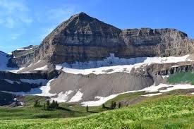
7 Mirador Del Torres, Patagonia, Chile
6 Cinque Terre, Italy
5 The Narrows, Zion, Utah
4 Angel’s Landing, Zion, Utah
3 Half Dome, Yosemite, CA
2 Mt Tim, Utah
1 The Subway, Utah
I’ve left off two outstanding hikes, the “Lost Coast” hike in Northern CA coastline because I’ve already written about it extensively, and because it was a backpack adventure, not a day hike. I’ve also hiked the Grand Canyon twice. I would rate it much higher based on my second trip, but that also was a backpack adventure. Honorable mentions are almost too numerous to mention: there are many beautiful spots in San Diego county, all over the West, in Kauai, in Alaska, and so many shorter hikes that I can’t even begin to mention them all. Urban hikes can be equally amazing, but I don’t include them in this list as they are a different category unto themselves. So I have to choose. What makes a great hike? For me, the hike has distance, unique challenges, and great scenery.
10 Yosemite Falls
Brooke is a switchback ahead, now two. Max walks ahead of me, he hits the corner on the next switchback, stops, pouts. I catch up. “We are almost to the top”, not quite a lie, all things being relative, but I know the top is not just around the next bend either. “This is so stupid” he yells at me. “Why can’t we go back?” “Because the point is to make it to the top”, I explain. We walk on, he quickly gets ahead of his old man. Brooke waits patiently for us to catch up, takes off when we arrive, then quickly gets ahead. Both of them walk faster than I up the steep trail that rises 3000 feet in 3 miles, yet I am the only one who seems to appreciate the effort and the view of the Valley and Half Dome in the distance. Yosemite Falls barrels over the canyon wall falling nearly 2000 feet, still impressive even in the fall when the water flow is diminished deprived of spring melts and summer rains.
We progress to the top in this unrelenting climb in this awkward manner, Brooke walking fastest, Max walking fast but then stopping at the turn for the next switchback, asking the same question on every turn “Can we go back now?” with the same answer “No” every time. Of course, we finally do summit. I am proud of both of them for making this tough hike. We check out the views and look over the top of the falls, Max scaring the shit out of me by hanging over the edge of a rock, checking out the drop.
Footnote: I’ve actually done this hike twice. Once with Pat and Ron, back in the days before all my friends were married and before they all had kids. One by one they stopped hiking with me. Pat and Ron were two of the last. Pat (and Mia) moved to Texas. Ron fell ill after a hike up San Gorgonio (an honorable mention) and spent 45 days in the hospital with abdominal issues
Footnote: Best guess, trip around 2005, making Max 8 and Brooke 13. Taken enroute to Northern CA to see my brother by way of Yosemite
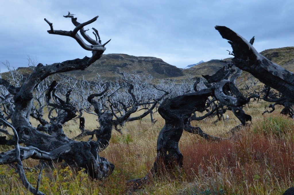
9 Laguna Torres
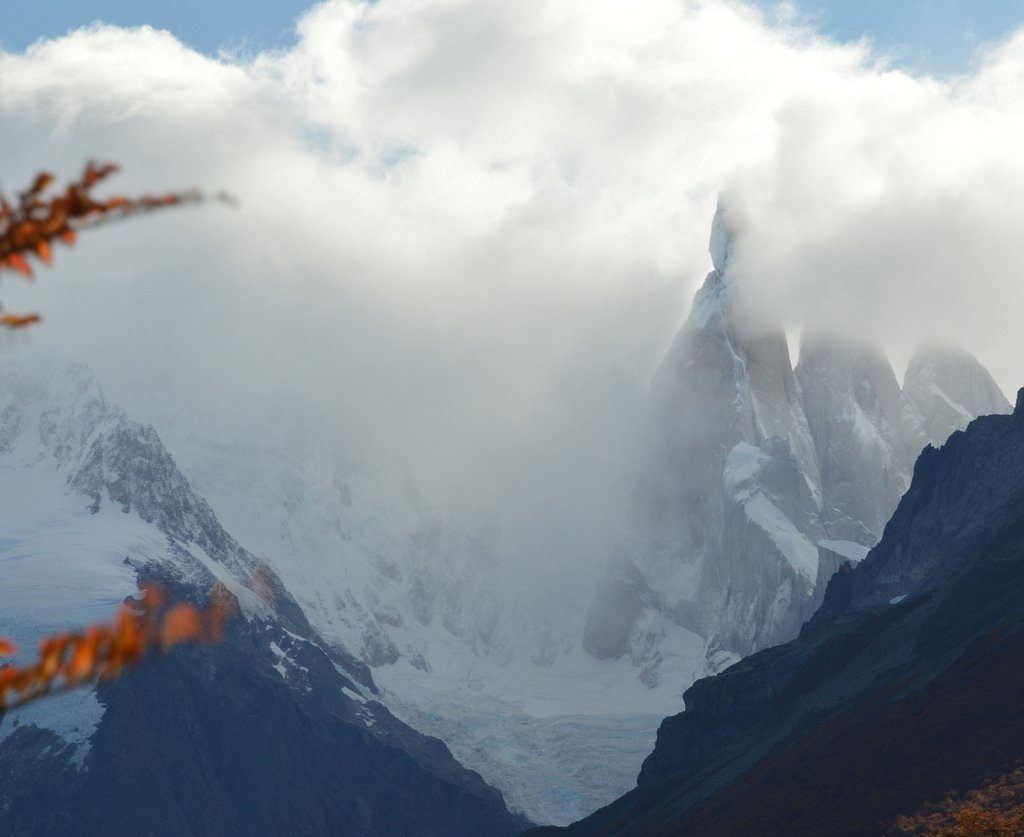
The wind whips across the green silted, iceberg studded lagoon. Snow blows in from the side. The jagged spires of Cerro del Torre play hide and seek in the clouds, their feet covered by the deep blue of glacial ice. As a photographer, I might be disappointed by the lack of clear views of the mountains and the stirred up waters of the lagoon. As a hiker, it is a thrill to be hiking through changing scenery and conditions.
The weather isn’t nearly as bad as we thought it would be. I say we, because this was a scheduled hike for a photo workshop. Our entourage woke up at four in the morning with the intent of hiking in the dark to the Laguna Torre to catch the peaks basking in the rosy-pink light of dawn. At four in the morning it was raining. Three of five reconvened at seven, not raining but totally cloud covered. And then it was just me, hiking alone on unknown trails in an unknown land, setting off by myself after breakfast.
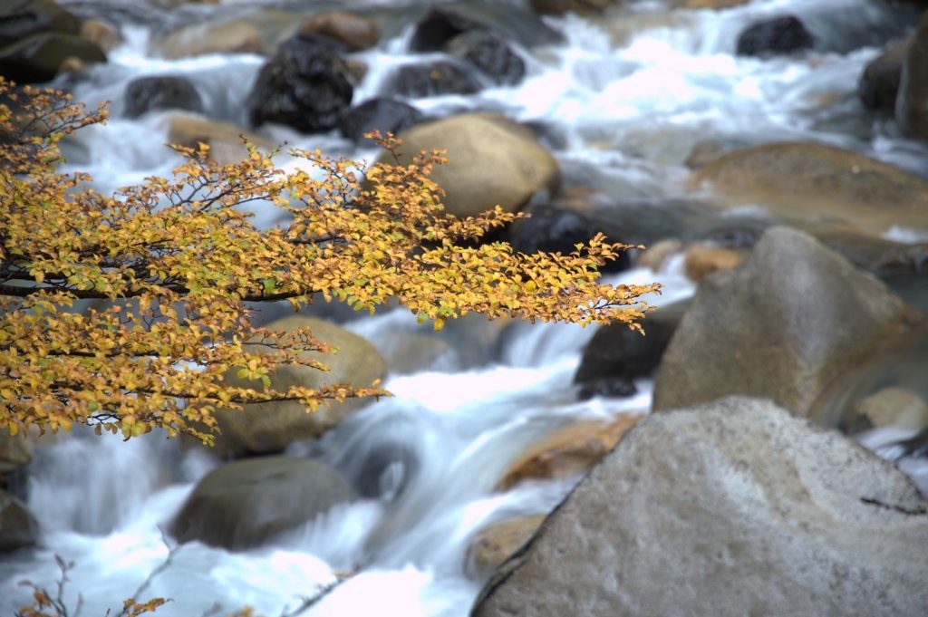
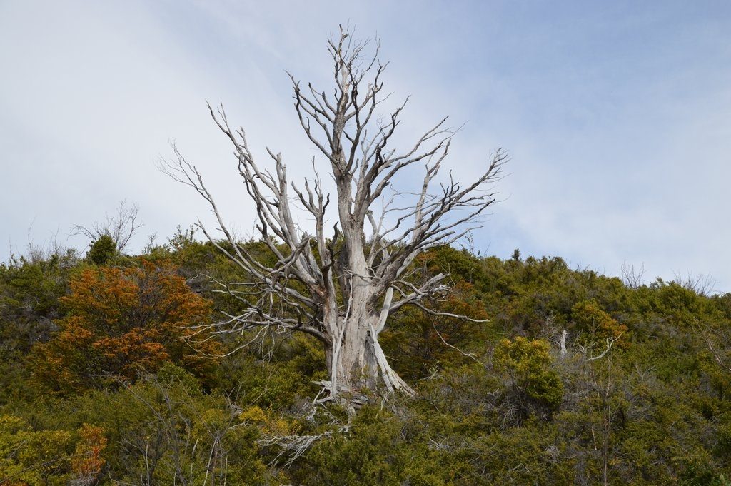
By the time I hit the road, the sun started breaking through the clouds. No rain. A little snow near the mountains with a cold wind blowing down from the snow covered mountains. I am rewarded with views of mountains freshly covered with snow, lenga beech forests of green, yellow, orange, and red, spanish moss covered trunks under the canopy of tall trees, views of Rio Fitz Roy river high in the plains, a ghostly grey forests, stream crossings, and of course, the mountains.
Footnote: Patagonia trip, April 2016
8 Mt San Jacinto
Downtown Palm Springs is lit up to the east. We are above it a couple hundred feet, supposedly on a trail that will take us to the trailhead that will lead us up the flank of Mt San Jacinto. “Man, this can’t be right.”, I say to Ron and Pat. The sun hasn’t risen yet but we are losing the advantage of our early start. The trail I am on has petered out. I’m bushwhacking through a clump of some shrubs, I can’t really tell what they are in the dark, but I know they wouldn’t be there if I was on the right trail. I back up.
This spot is very popular for people trying to get a glimpse or a photo overlooking Palm Springs. So everything is a trail. The trails reticulate all over the hillside. Somewhere along the line, we lost the real trail. We retreat back down the false trail until Ron finds a more promising route. Finally, we find the sign that points towards the summit.
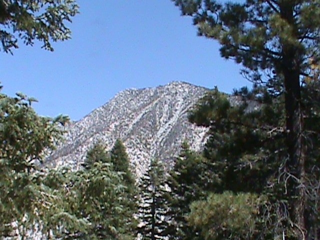
The sun is up now and heating up the desert floor quickly. We’ve wasted a lot of time and need to gain some elevation before the desert heats up to its expected 110 degrees for the day.
…. 8 hours later, 8 miles, and 8500 feet higher in altitude…
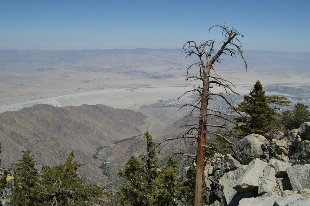
I’m sitting down at the Peaks Restaurant at the tram station working on my second beer. From our table, 8500 feet over the desert to the east, I can see all of Coachella valley, as far as a hundred miles to the east out over Palm Springs, Palm Desert, past the Salton Sea. I look to the north seeing the rugged mountains of Joshua Tree (not then a National Park) and to the southern tip of the Sierra’s beyond that. “Should we go for the summit?”, Pat asks. Strangely, I’m actually cold and shivering a little bit. I know I’m dehydrated from our 8500 foot stair climb and now I’m way too comfortable sipping on my beer.
I’m more than satisfied with our effort conquering the “Cactus to Clouds” trail. I’ve read a lot of people die on this trail going up because it is so difficult and going down because it is easy to lose the trail and fall over an edge. I quote “The Cactus to Clouds Trail from Palm Springs to San Jacinto Peak has the greatest elevation gain of any trail in the United States.” I’ve conquered the most difficult part of it, or perhaps I should say survived the most difficult part of it. I’ll save the hike to the summit for another time*. After a hearty meal and another beer, we hop the tram for free, taking the easy way back, down to the searing heat of Palm Springs.
* Footnote: I did finally summit San Jacinto on a camping trip with my neighbors the Schlesinger’s whose kids seem to actually enjoy hiking.
Footnote: Best guess. Maybe around 1995 taken on summer trip to Palm Springs with Pat and Mia, Scott and Michelle, Ron and Andrea, Dave and Maureen.
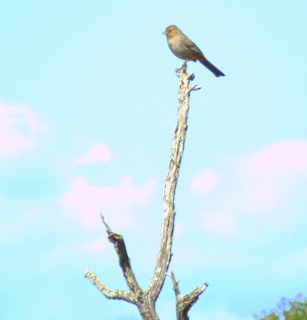
7 Mirador Del Torres*
Recently described in https://www.thetembo.com/clip/2016/04/27/sublime/
Footnote: Patagonia trip, April 2016
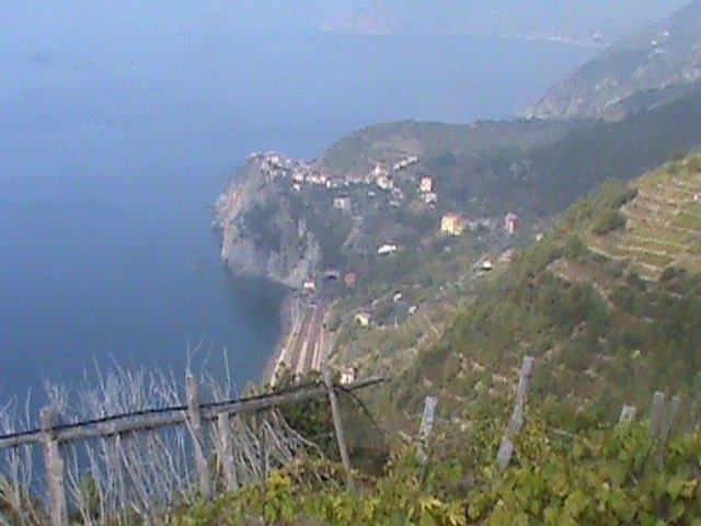
6 Cinque Terre, Italy
How would you design the perfect hike? Well, I would probably hike with a gorgeous woman, no wait a minute, let’s make that two. The perfect hike will be on the sides of a cliff above the rocky shores of the Mediterranean, and just for good measure, I will throw in an impossibly positioned pastel painted village every two to three miles where I can stop and grab a glass of wine and a slice of pizza. This hike is the Cinque Terra trail that starts in Riomaggiore, traverses Manarola, Corniglia, Vernazza, and Monterosso al Mare.
On this day, the perfect hike has a flaw. A landslide from a recent rain blocks the trail from Manarola to Corniglia. We have to go up the mountain to a high trail, follow a ridge line, and then come down into Corniglia from above. Rachel, Laura, and I are up to the challenge. We find the stairs out of Manarola that lead to the high trail. Up, up, and up the stairs we go. By my guesses, maybe a thousand stairs.
Rachel looks like the picture of sunshine. Laura is looking a little peaked. I can tell she is struggling a bit by the number of times she stops for a gulp of water. I know Laura works out regularly. An outdoor workout seems so much more demanding than a gym workout. Maybe because gym workouts are under such controlled perfect environments, maybe because they are so compact.
We finally hit the upper trail. The upper trail follows the contour of the hills through terraced farmland, forests, and vineyards. We glimpse Corniglia in the distance, a town perched on a narrow hill, the pastel-painted buildings suicidally perched on the cliff edges, overlooking the rocky shores of the sea.
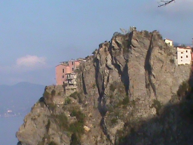
As we hike by, I wonder how they can actually farm on these steep, terraced slopes, like farming the upper deck of a baseball stadium, but somehow they manage. The upper trail reaches the heights of Corniglia. We follow a spur trail down to the town to get back to the seaside trail proper. The walkways of the town are narrow lined with tiny shops and markets. We find the perfect outdoor restaurant to refuel on our diet of pizza and wine: the same stop in each town, one I have no trouble adapting to. It doesn’t get any better than this: incredible ocean views, quaint little picturesque towns, outdoor restaurants with wine, food, and two good hiking friends.
Footnote: First Italy trip taken in 2011
5 The Narrows
I easily cross the river wading through thigh high river water feeling out the unseen bowling ball sized rocks with my hiking pole, my rented rubber soled water shoes gripping the bottom as I head towards the opposite shore to pick up the trail paralleling the river in a wider part of the river. Phil asks, “How come that was so much easier on the way back?” “Training and confidence” I reply. We’ve had plenty of both on this ten mile hike up the Virgin river to Big Springs, our turnaround point. But I’ve paid a price: my knees are shot from wobbling back and forth and stumbling off the rocks hidden in the muddy waters.
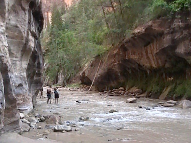
The river doesn’t run too high this late in the summer making for easier hiking. Still, in a couple of spots, we have to swim the trail. A waterproof dry sack stuffed in my backpack protects my gear, especially my camera. In many parts of the canyon, the river IS the trail. That is what makes this such a special hike.
The temperature outside the canyon is a blazing 100 degrees. Inside the canyon, the temperature is a balmy 80 degrees, the sunlight only occasionally reaching the canyon floor, the river constantly cooling our feet. It rained yesterday, ruining our plans to overnight in the canyon as the buses couldn’t make it up the washed out road to drop us at the start of the canyon. Instead, we’ve hiked in from bottom of the canyon starting from the “Temple of Sinawava”. The rain itself has passed. We’ve checked the weather reports and the danger of flash flood is low today. Flash floods in parts of the canyon with no high ground would be lethal.
I half look where I am going. I half look up at the thousand foot walls on either side of me, the afternoon sun illuminating one side of the orange-red walls. We take a little side trip down Orderville canyon, a shady narrow canyon, scrambling over the rock and through a small waterfall before we get to an impassable climb. We head back to the main canyon. Again passing by “Wall Street” (a narrow section with high walls) hiking in the river and “Mystery Falls” a picturesque small waterfall dripping down the side of a sloped rock outcrop working our way downstream taking pictures and memories. I consider this one of the premier slot canyon hikes in the United States.
4 Angel’s Landing
How do you top an unbelievable ten mile hike in the Narrows? You climb Angel’s Landing the very next day. My knees bitch and moan and complain up the backside of the trail, two miles of unrelenting up. Phil and I at least had the foresight to get out early to beat the heat and to beat the crowds.
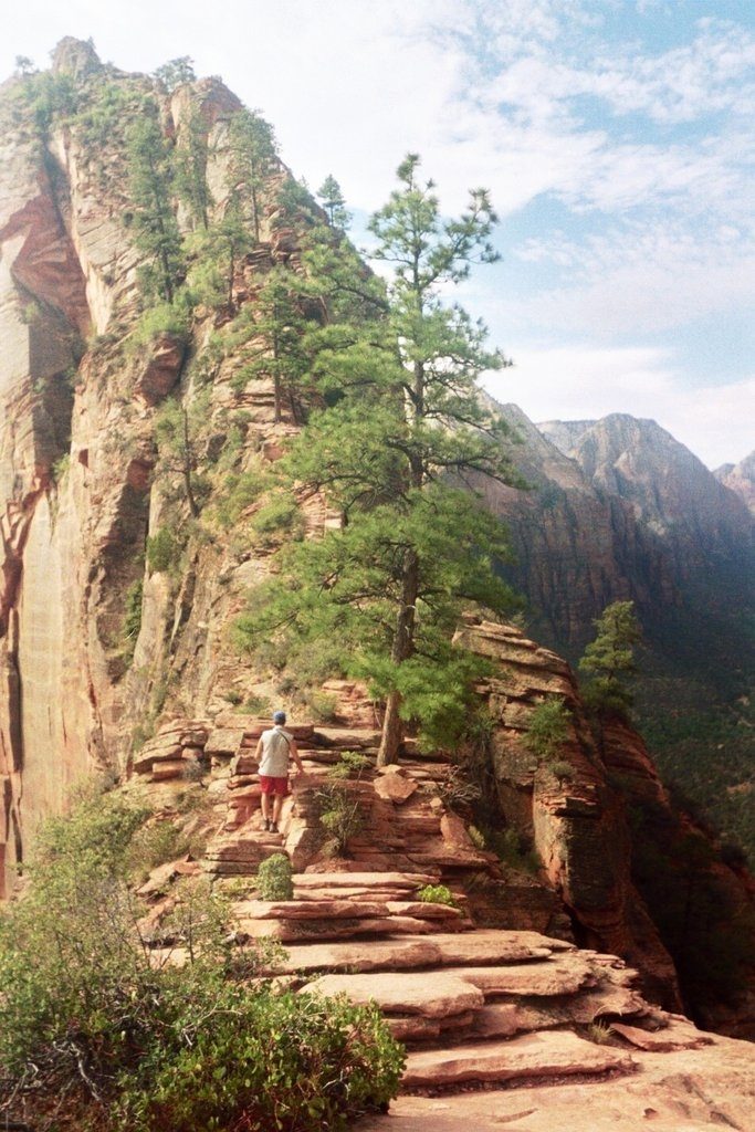
And then we come to the jaw-dropping base of the landing. It looks like the whole thing could just topple over like a giant domino. “What? Are you f**king serious? I’m supposed to walk out on that narrow spine up that ridge?”, saying these things to myself only in my head. I stand there for a while, needing to study the possibility. If ever there was a stairway to heaven, this is it. We’ve already heard the news that somebody fell to their death yesterday, although the skuttlebutt is that the guy had a heart attack on the trail. Bad timing, dude. He took his own stairway to heaven, perhaps one more literal than metaphorical.
I see some people working their way up the stairs, little dots high up on the trail. This is the proof that I need. I start off. Phil says he is hanging back to take pictures. I think he is hanging back to test my resolve. I am resolved. He catches up and we work our way up the narrow spine of this odd canyon-surrounded promontory into the sky.
At one point, the trail separates, going around a large rock outcrop in the middle of the trail. A waist high chain and a two-foot ledge are all that keep me from a 1500 foot drop into oblivion. I don’t have a fear of heights, but I am not fearless of heights either. It’s not so much that I fear falling as I fear dying. Concentrate and keep moving, this is no time to give into the beauty of the scenery or into my fears of an unplanned skydive terminating in an unholy splat. The trail recombines. It is still a crazy, chain-holding ascent but a simple slip isn’t likely to send me careening over the edge doing some crazy swan dive into immortality. At the top, the promontory widens and the stair trail turns into sloping rock eventually flattening.
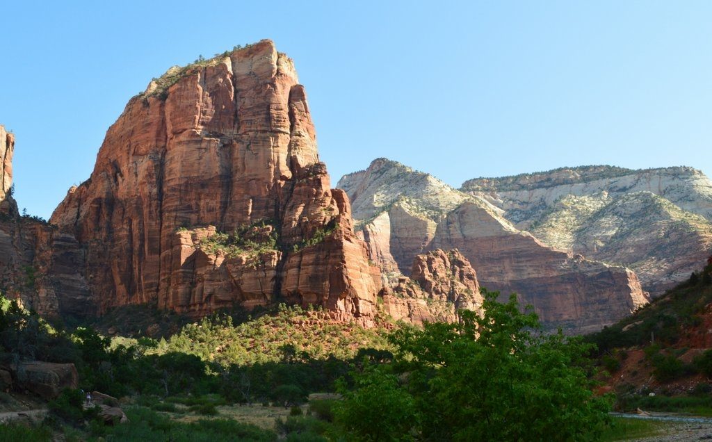
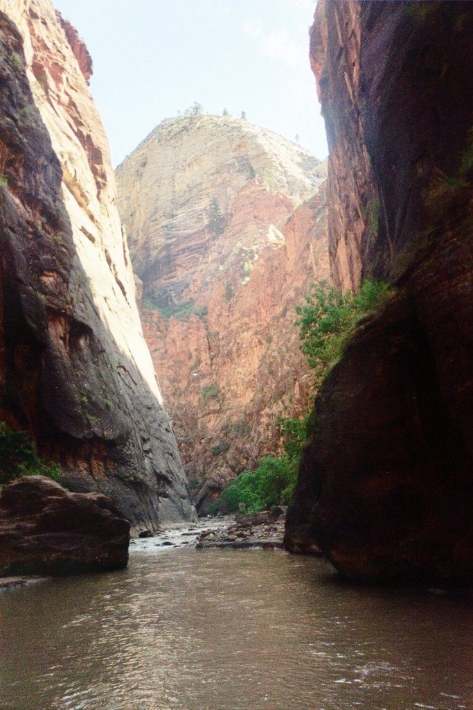
The view of the canyon is nothing less than stunning. The reddened walls of the canyon converge to the north to form the slot canyon that the Virgin river flows through (the Narrows hike previously mentioned). To the south, the verdant Virgin river twists and bends its way, enclosed by steep canyon walls and even higher mountain peaks. Phil and I take our time at the top admiring the view, taking pics. Physical challenge, mental challenge, and stunning beauty make this one of my top hikes of all time.
3 Half Dome
I arrive at the base of the Half Dome. I look up the mountain following the parallel cable’s paths as they merge in the distance on their rise to the top. “Holy Shit! You can’t be serious!”, I say out loud even though I stand by myself.
There is not one person on the entire stretch of cable that I can see. And for good reason I think, they have all fallen to their deaths on the slick, white and black, granite rock. I sit down in disbelief next to the first pole that anchors the cable handrails to the mountain.
I sit cross-legged facing the dome. I rest my chin on my index fingers, which make a little temple in front of my interlaced fingers. My eyes look up. I watch. I need convincing to overcome my disbelief. Seeing is believing and I don’t believe that any one is stupid enough to climb this, uh, trail. I hesitate to call it a trail. A trail is a path in the earth with signs of wear and tear. It is more like a track, a railroad track with two parallel cables and the occasional wooden railroad tie perpendicular to the cables held in place by adjacent posts. Am I the little engine that could? Or am I the little engine that couldn’t?

The very top of the trail curves out of sight as it starts to level off at the top. I wait. Finally, distant hikers appear over this horizon making their way down the cables. This is for real. Ron and Pat catch up. We have a discussion. The mission is a go. I start up this difficult and dangerous hike walking up the middle of the track fixing a grip on the left cable, swinging my other hand to secure a grip on the right. Maybe it is the nearly nine miles of hiking, maybe it is the altitude, maybe the steepness, I am burning hot, sweating with exertion, and sucking oxygen to fuel my exhausted legs. I stop about every fifty feet to catch my breath and welcome the stop to let descending hikers pass by. I think I can! I think I can!
Ron summits. Pat summits. Finally, I summit! The reward is at hand. I am standing on the flat roof of Half Dome. I have a great view of Yosemite Valley, the Merced river, El Capitan, the world. I might call it a breathless view, but I wouldn’t want anyone to think that I am referring to my inability to breathe after my assault of the summit. Pat daringly lays down on his stomach and pokes his head over the edge to look straight down its ninety degree drop. I feel more comfortable keeping a couple foot buffer between me and the edge. You never know, someone might turn psychotic and try to push me over the edge. I can’t believe anyone actually climbs that vertical face. But they do!
It’s not starting out at 5 in the morning before daylight. It’s not the 18 mile hike. It’s not the 4,800ft elevation gain. At a tippy-toeing, oxygen sucking, forty five degree angle, fighting eight hundred feet of elevation on slick granite while holding onto a cable, it’s climbing the dome itself that is completely insane. But all these things, the difficulty, the danger, and the beautiful view from the top, make this one of the best hikes I have ever been completed.
2 Mt Tim **
Phil and I, both under dressed in gym shorts, t-shirts, and day packs, work our way up a snow field leaving behind a cacophony of wild flowers on the lower verdant flanks of the mountain. At 11,000 feet in altitude, the weather is just a little bit cooler than the balmy June temperatures down in Salt Lake City. A meadow separates the lower mountain from the upper. The upper mountain is an exposed, rocky edifice, that looks like nature’s own temple. The second half of the climb will have us climb up to its roof and then to the very top of its steeple.
The snow pack ends and the trail follows a number of switchbacks to rise up the razor thin ridge line. It then follows the ridge line to the peak. This trail is more fit for mountain goats than hikers, the narrow trail edged with scree, and no hand rails or chains to hold on to. More often than not, I’m leaning into the mountains as the trail doubles back to traverse up the face of this mountain.
At the top of the face, the trail runs the ridge line, sometimes a little off center, but always with a deadly drop to the exposed side. When hiking directly on the ridge line, the valleys on either side seem to walk along with me trying to induce an ill-fated vertigo. Salt Lake and Salt Lake City are visible in the distance, the fog having long lifted in the midday sun.
At the summit, we step into a lookout hut, wondering how someone ever managed to get this structure up here. From the top, I think we can see all of Utah. Snow-capped peaks of the Rockies to the South and East; the urban landscape of Salt Lake City to the North and East. It is an airplane-like view, except we are out on its wing. I never hear anyone describe the view from a 7 mile high airplane as spectacular. Too high up making everything flat and uninteresting? The Grand Canyon is grand when you are at its side but hardly worth looking up from your book or movie when you fly over it. Too jaded, the view doesn’t impress us anymore?
While Phil and I are admiring the view trying to pick landmarks out in the distance, we overhear a conversation about “Bombing down the glacier”. The savvy locals carry up sheets of plastic and then sled down the glacier. It sounds crazy to me and will add over a mile to a hike that is already 14 miles long and 5000 feet in elevation gain. Phil is excited about this idea and I don’t think I can talk him out of it. So, instead of heading back the way we came, we follow the ridge line down the other way heading to the southeast. Along the way, we happen upon a discarded or lost black garbage bag. We rip it in half. We have our sleds. The trail comes to an precipice that is the beginning of the ice-pack.*
Phil and I survey the potential ride, the drop is steep enough for me to worry about losing control dislocating arms and legs and crashing into the occasional exposed boulder. There are a couple of exposed rocks but they can easily be avoided. Since, Phil is so excited about this idea, I let him go first. He bombs down the glacier yelling his woohoos of exhilaration. I follow gliding on my makeshift black half garbage bag sled in my shorts and t-shirt. The very top is a steep drop and I quickly gain momentum sliding quickly down the slick surface. However, the bag proves a poor defense against the ice-pack and the mountain is quickly invading my shorts. I glide along for about a hundred yards, but the initial steepness of the drop fades and my shorts, full of ice shavings, act as a kind of brake, bringing my exhilarating ride, to a premature end. Yes, the ride was exhilarating in the sense of adrenaline excitement but also in the sense of losing your hot water while shampooing your hair in the middle of a shower. I jump to my feet shaking my hips and pulling the cloth of my shorts away from legs in a victory dance that also serves to release the accumulation of ice shavings back to its white carpet home. Phil and I give each other high fives. Phil brags about how much farther he made it. I think his longer ride can be explained by tighter fitting shorts and not by some latent talent for riding half a garbage bag down the side of snow-covered cliff. I mind my tongue and let him have his moment.
Up on the cliffs above our resting spot on the ice pack, I spot the proper denizens of this heavenly retreat, a couple of brilliant white Rocky mountain goats somehow magically clinging to the side of the mountain. I will never cut it as a mountain goat but I don’t have any plans soon to change species.
I don’t think we covered even a tenth of the distance of the ice-pack. I run down the rest of the ice pack using exaggerated strides to take advantage of the still steep downhill slope back to the meadow. Off the ice pack, the trail continues past a glacial lake heading back towards the lower part of the mountain. The trail parallels the edge of a drop off and then inexplicably drops six feet. No stairs, no handholds, no rocks. Nothing to grab. Just a straight drop. The drop ends on a five foot wide landing, a road compared to the ridge line trail, but the other side of the landing is a hundred foot drop with nothing to stop your momentum should you stumble or land funny. Really? People actually use this trail on a regular basis? We either have to retreat a mile to another route or make the jump. After checking for alternatives and checking my trail map to make sure that we aren’t in the wrong place, then planning and re-planning and checking our landing spot, we dangle our torsos and legs over the edge and then make the jump careful not to push away from the edge too hard.
Successful, we start down the trail when two blond-haired gorgeous women in tight khaki shorts with a small child and a small dog approach heading up to the spot we just came down. They will have to make the climb that wall with a kid and a dog. I can’t believe it. I just kind of stare at them. Phil and I offer to help. We boost one of them up, hand up the child, then the dog and finally help the other woman up. They gratefully invite us over to their place for a party that night, the kind of offer I would dream of as a single man, but I am married.
Just an incredible day of hiking, nature, wildlife, views, and adventure with a friend; so much more than I imagined when I planned this trip simply looking for a good way to spend $150 dollars in free airline tickets before the offer expired. The greatest adventures occur when you keep yourself open to and take advantage of the unexpected opportunities that present themselves along the way.
(*) Footnote: A little research shows me that the ice-pack is no longer a glacier since the ice-pack no longer moves even though it persists year round.
(**) Footnote: The actual hike is Mount Timpanogos. I read that the locals call it Mount Timp. But back in the day, I heard it as Mount Tim and it has always been Mount Tim in my mind.
Footnote: I don’t remember the exact date but next time I see Phil, I will ask. I have to think early 1990s.
1 The Subway
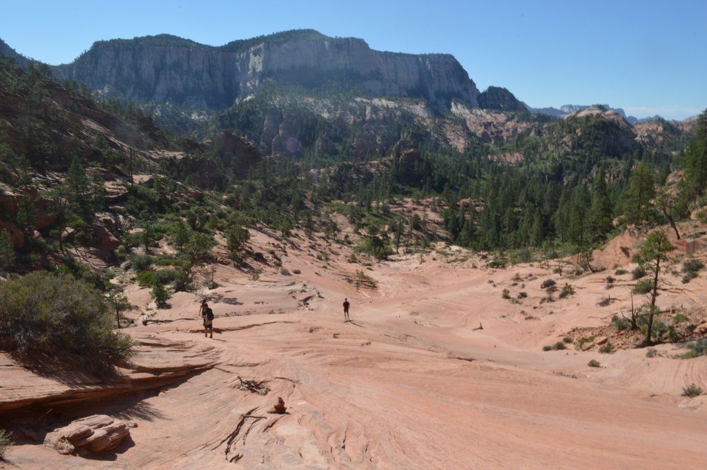 We’ve just traversed a rock face with no trail. I picked up the trail at the bottom and all of sudden it peters out into bush. “All right, this doesn’t look right” I say as I am standing thigh deep in a bunch of stiff branched bushes on a craggy slope. I have the map out and the notes out. My notes tell me that the trail might be difficult to find at some points. “No Shit!” I mutter to myself. I’m looking for where I might have lost it. Some eagle scouts that passed us earlier shout from across the canyon,”Go back! Go around!” They seem to be on the right trail.
We head back up the trail from whence we came and find what looks like the right trail. But it turns a corner and I am facing the top of pine tree growing out of the rocks some fifty or sixty feet lower from the side of the canyon wall. Max wants to go for it. But I can’t see past the base of the tree and the ascent looks wrongfully steep. I have that bad feeling in my gut that is saying this can’t be right. I am reading again. “Do not rappel down to Russell gulch. Your need 170 feet of rope to reach the bottom. You will die.” We retreat back up. Someone spots a cairn that marks a trail that disappears between a tree and a large boulder. We probably had missed it by no more than twenty five feet.
I’ve added at least an extra mile to our hike with the wrong turns but the rest of the trail is much more obvious for the rest of the hike. The descent from the top of the saddle down into the gulch is a 300 foot drop that has the steepness of a spiral staircase without the handrails, always uneven and slick with ball bearing size stones, sand and dirt. We hit rock bottom (couldn’t resist the pun) leaving our scenic topside views of the canyon, the cliffs, and the distant mountains for the narrow, tight walls and twisting passageways of the Lower Left Fork river.
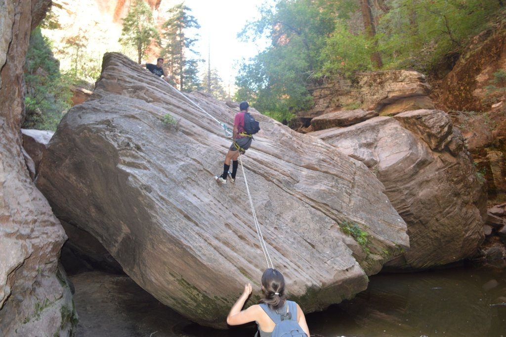
We come to the first technical challenge of the hike: a rappel down the incline of a thirty foot high boulder. Finding the bolt and anchor riveted to the boulder, I thread one end of the static rope through the anchor and pull it through matching up both ends so the rope is even on both sides. I throw both ends of the rope down the boulder. I push through the rope through my breaking device which is clamped into my carabiner which is clamped into my break rope which is clamped into my climbing harness. I secure the rope by fastening the loop to the inside of the carabiner and then tightening the gate. I test the whole arrangement by turning my back to the drop and letting the rope take all my weight and leaning backwards. It holds. I disconnect my personal anchor from the carabiner I’ve attached to the permanent anchor. I start to walk backwards down the incline. At the bottom, I step off the rock on a little 3 or 4 foot drop. I send my climbing harness back up for Ian. Brooke follows. Then Max. Then Ian. This is Ian’s first rappel. I have given him the on-the-spot tutorial and he executes flawlessly. I pull one end of the rope letting the loose end climb back up the rock and through the bolt at the top tumbling back down ready for its next use. We have all survived the first technical challenge of the hike. But this is just the warmup.
The gulch narrows to a couple of feet wide. The next challenge is a swim. There is no way around or over. Direct sunlight does not reach the bottom of the ravine at this point. This water is cold. The group looks on skeptically. I jump in and swim. I can’t feel the bottom. The cold water makes me “woohoo” in a way that only cold water can as my testicles retreat deep inside the insulation and safety of my body. I swim under a giant round rock wedged between the two walls and around detritus from previous floods. I’m dragging my backpack on the surface of the water as I swim. I come to a narrow passage that I have to turn sideways to swim through fighting my pack as it snags the sides.
The next technical challenge is a short rappel over the edge of a small waterfall and into a four foot pool of murky water. There is an anchor bolted to the side of the canyon about chest high. I probably don’t need to tie in on this one, just using the rope to secure myself to climb down, but I do anyway, I mean what the heck, we brought all of this equipment, might as well use it. I wade out of the pool at the bottom of the falls to dry off while the others take their turn to climb through the waterfall.
The bottom starts to widen a bit. We pass through the subway, the tubelike part of the canyon that resembles a subway and for which the hike is named. A slot canyon aficionado would most appreciate the pools and features of this section of the hike like some subterranean world you might see on your journey to the center of the earth.
And finally, we arrive at the fourth challenge: a thirty foot rappel over the side a waterfall. No incline this time, just straight down into the three foot pool at the bottom. Looking for the anchor near the waterfall itself, another hiker tells me that someone died here a couple of days ago trying to rappel down the middle of the falls. His line tangled, he turned upside down and drowned in front of his watching girlfriend. I find the anchor off to the side and then set up the rope. We each take our turn pushing over the edge then back-walking and down-jumping our way to the bottom. Downstream from the falls a bit, a bunch of people are standing around a sitting hiker. He has broken his leg. I heard he tried to climb down without a rope and fell. A rescue unit is on its way. But I don’t think they will be here any time soon.
The rest of the hike is more ordinary as the canyon opens up and the trail follows the water’s edge. The trail ends with a six hundred foot climb up the side of the canyon in the hot and now sun-exposed trail, an unwelcome ascent after nearly ten miles of hiking and a full day of work. I walk well ahead of Max and Brooke and Ian. I know Max is at the end of his rope so to speak. He went to sleep at four in the morning and I made him get at five to catch our ride to the trailhead. I see his body language and posture deteriorating as the end of the hike seems to drag on. And I don’t want to have a bad ending to what for me is a perfect hike.
I love this hike for the scenery, the slot canyon and all the technical challenges. After years of watching Bear Grylls have all the fun, I finally get my chance and I get to share it with both Max and Brooke and get a chance to know Ian. For the technical challenges, the misadventures, the beautiful scenery, the amazing hike in the slot canyon, and the family time, I make this my number one hike!
Notes: A good map and picture of the hike can be found here. http://www.everytrail.com/guide/the-subway-top-down-zion-national-park


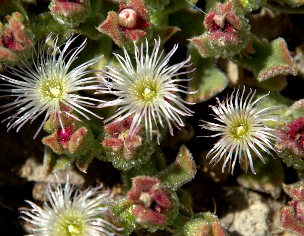 Ice plants (Mesembryanthemum nodiflorum) attract hoards of bees to their white flowers that glisten at their base with water storing cells that have an icy appearance to them. Storksbill (Erodium cicutarium), aptly named from the shape of its capsule, litters the landscape. The suncup (Chylismia brevipes), the very short version of a primrose, hide on the edge of the trail and under the edge of bushes.
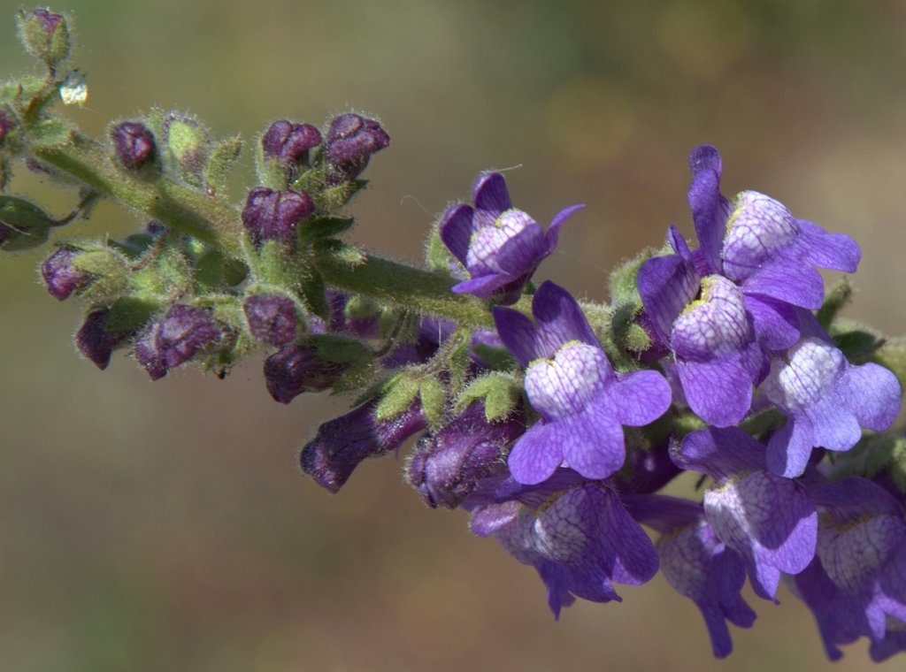
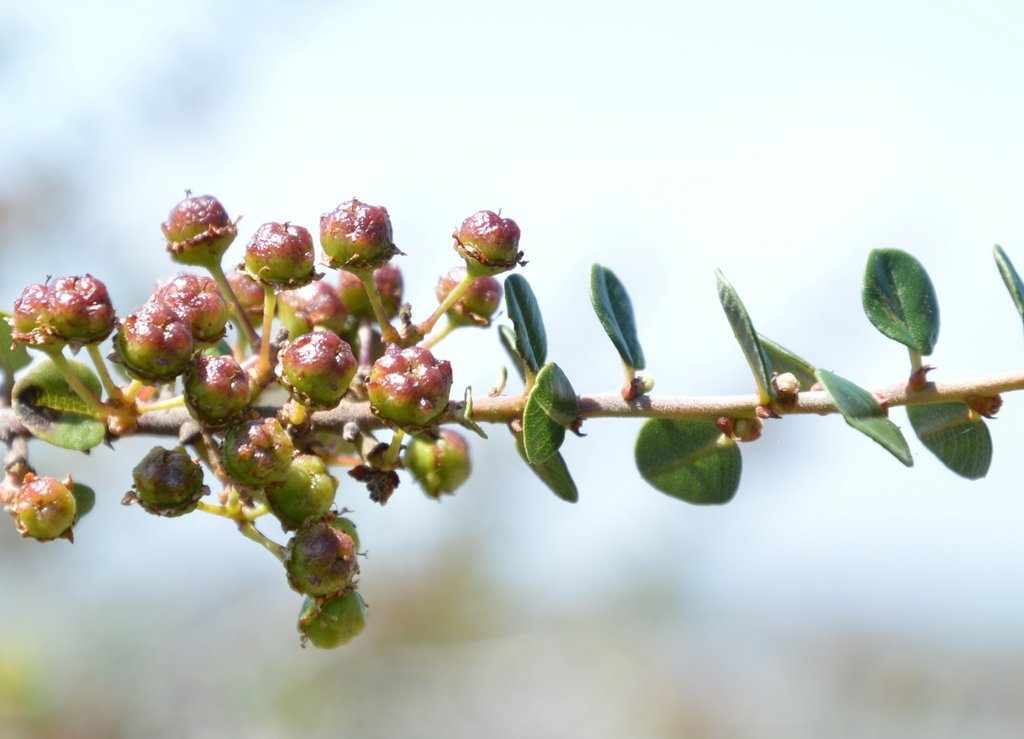 The rhino-size warty stemmed ceanothus (Ceanothus verrucosus) hides its little misshapen green and red berries.
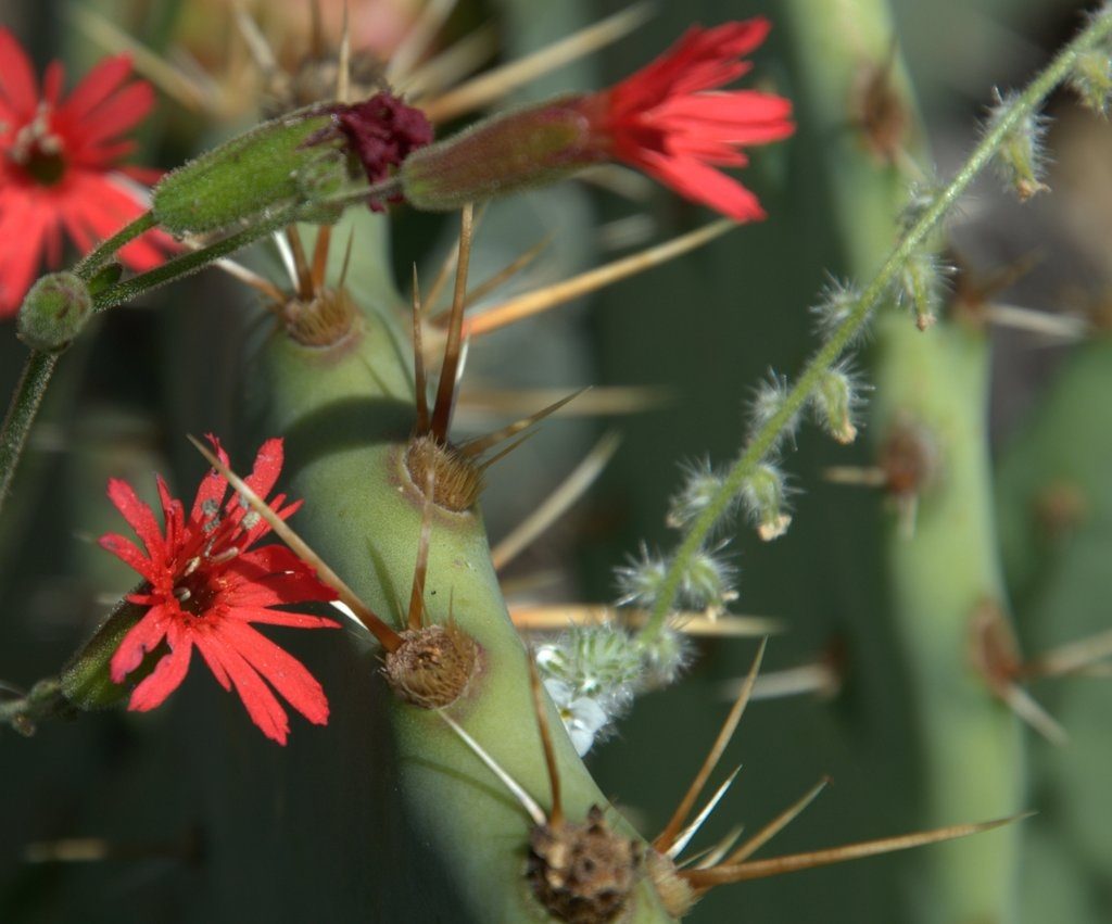 Indian pinks (Silene laciniata) poke out their showy red flowers with their fringed edges between the pads of a prickly pear cactus.
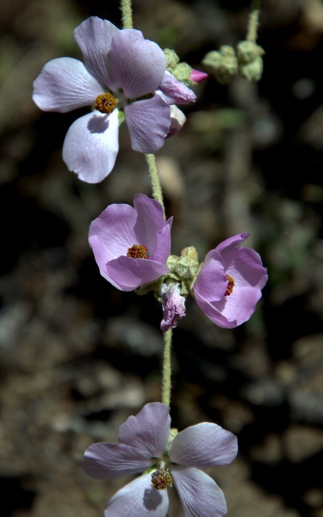 The bush mallow’s (Malacothamnus densiflorus) delicate pink flowers look like fragile china bowls with their own flower arrangement inside. A leafy daisy (Erigeron foliosus) competes for attention contrasting its light purple ray flowers with its bright yellow disc flowers. Rugged chamise’s (Adenostoma fasciculatum) white flowers point to the sky like a person checking white gloves for dust.
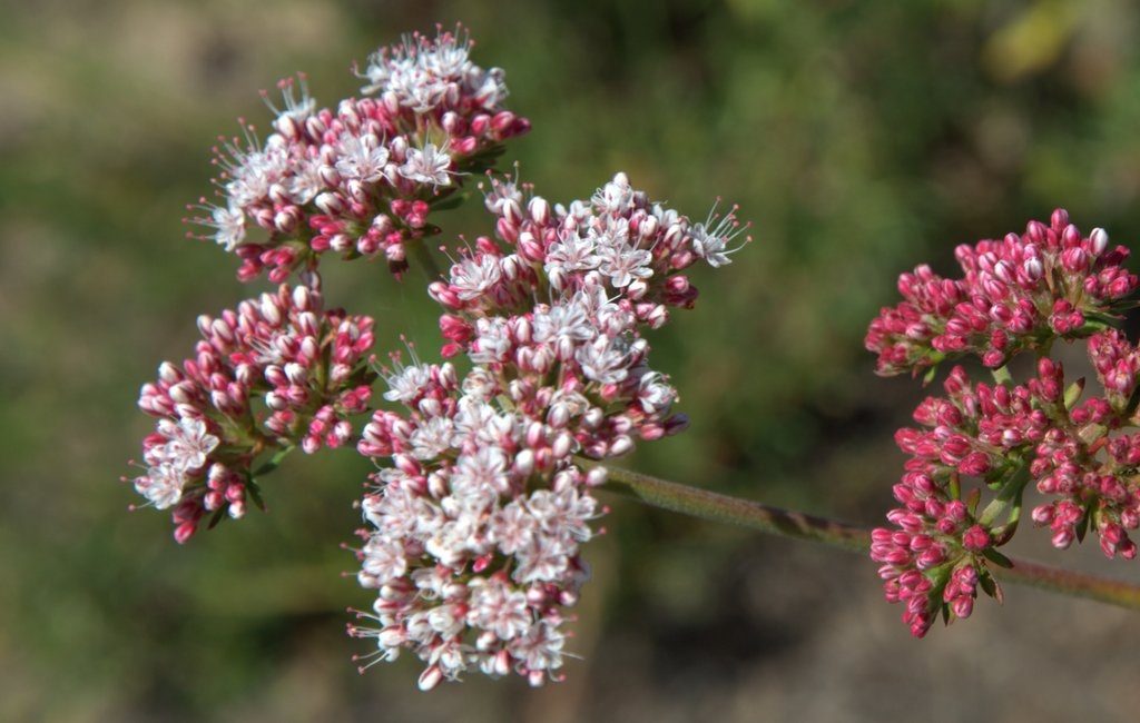 The flat-topped buckwheat (Eriogonum fasciculatum) flowers only begin to bloom not quite open yet, the flowers will start white but then end up as rust like a weathered piece of iron.
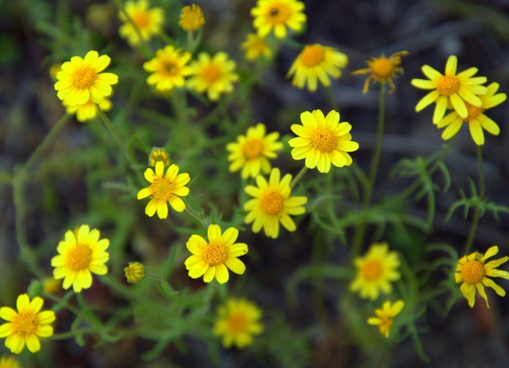 A cluster of goldfields (Lasthenia coronaria) look like a bouquet fit for red wine and fine dining tables.
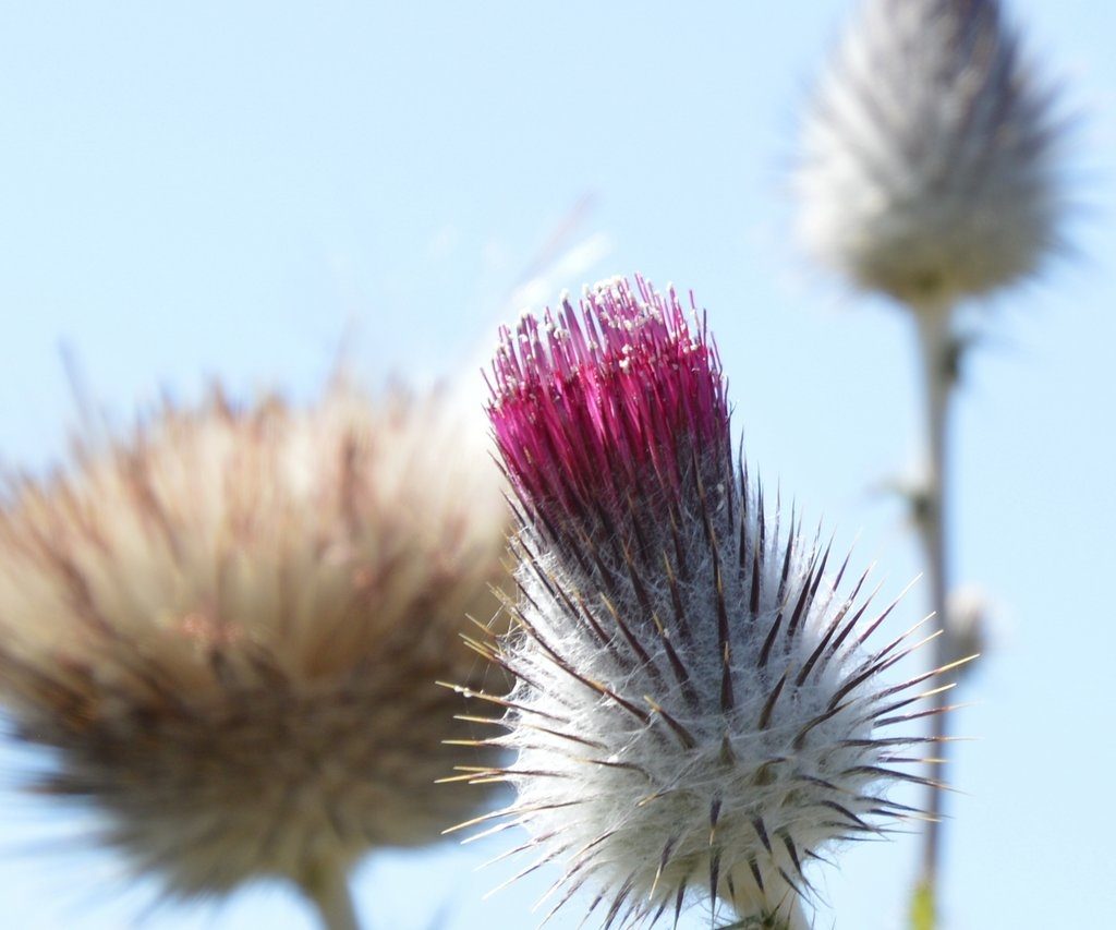
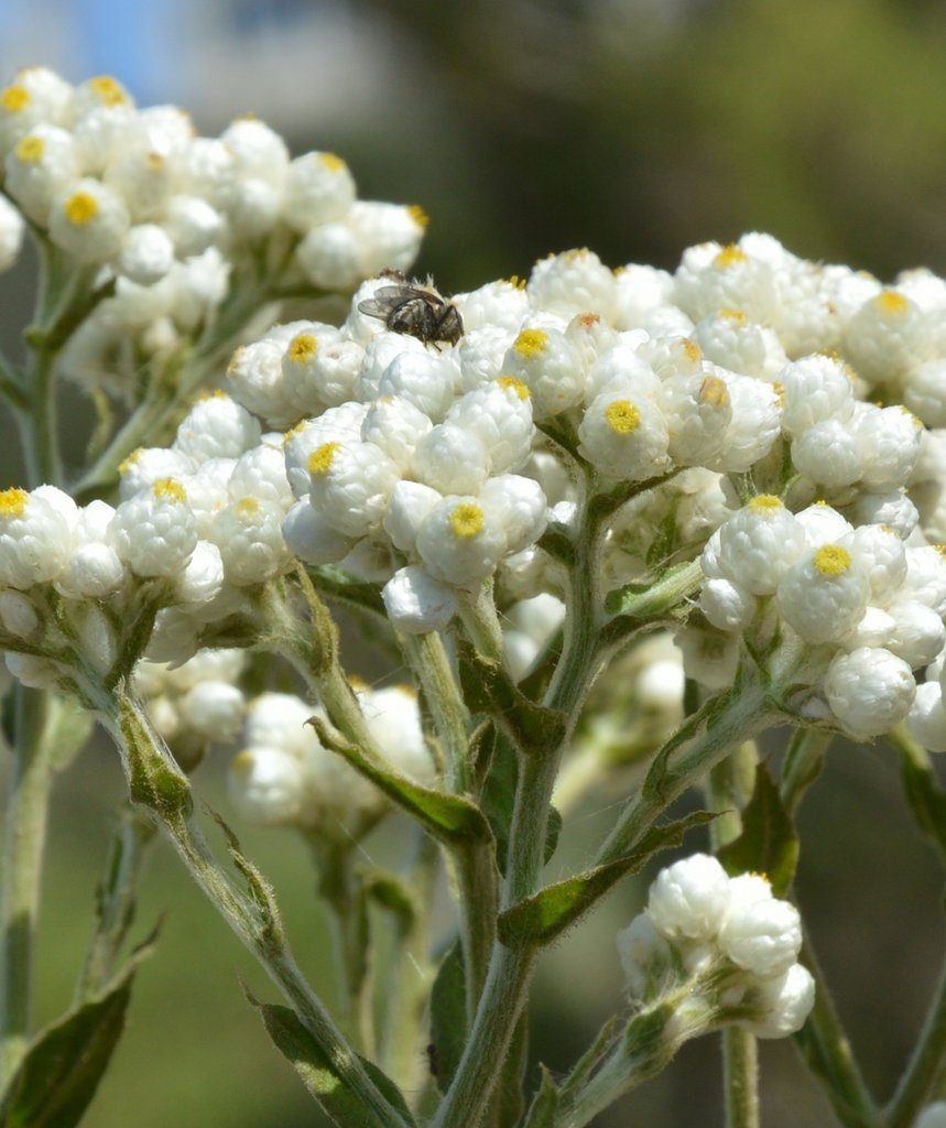 Cudweed (Pseudognaphalium californicum) looks like a bouquet of cigarettes until the flowers expand looking like a tar-stained eye wearily watching. Dudleya (Dudleya lanceolata) bloom late, so for now, the nascent flowers hide inside their green garbanzo bean shaped capsules.
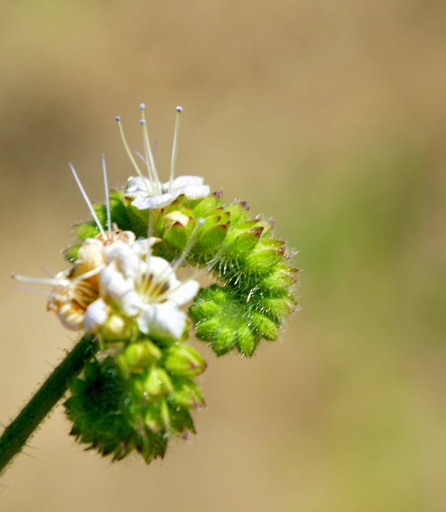 Phacelia (phacelia distans) flowers mimic little green caterpillar heads adorned with a white flower bouquet and their tails tucked in humility.
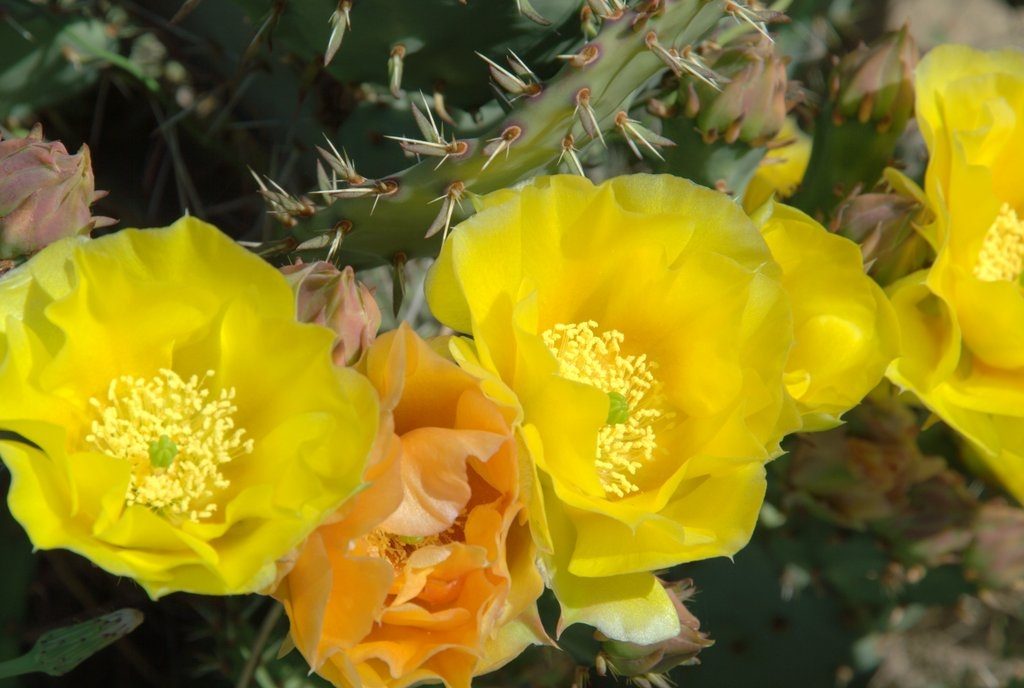 A prickly pear (Opuntia xvaseyi) seductively show beautiful arrangements of yellow and orange flowers enticing me to risk their prickly daggers. A mat of spiney fringe flowers (Chorizanthe fimbriata) blend with reddish dirt on the ground.