Author’s Note: See the first in this Astronomical Series: Totality
Day 1: 220 miles. Escondido to Kelso Dunes
“I was surprised, as always, by how easy the act of leaving was, and how good it felt. The world was suddenly rich with possibility.”
Jack Kerouac, On the Road
Annularity is totality’s brighter cousin in a rare competition where being dimmer is better. We aim to seek annularity in the backcountry of Nevada, an event predicted to occur on October 14th at 9:30 a.m. near Ely, Nevada. I wouldn’t have planned a trip so close in time to a trip I just finished. But a celestial event is on a rigorous schedule that you can’t slip to the right, no matter how skillfully you bargain with the cosmos or Sir Isaac Newton.
It’s already 2:30 p.m. before we launch and 550 miles to Ely. We, a convoy of two motorcycles and a Compact Prius, want to cover 220 miles of it to Kelso Dunes. There is no way to beat LA traffic this late in the afternoon. In Riverside County, the afternoon temperatures hit the low 90s. I’m expecting the cooler temperatures of San Diego County and the higher elevation of the desert. Long underwear is a poor wardrobe choice. The only way to beat the heat is to lane split through the on-again and off-again stalled traffic of the I-15, something I am loathe to do because it is the cause of so many motorcycle accidents, trying to wobble our way through cars and trucks. If the vehicles pay attention, they split like Moses parting the Red Sea. Sometimes, those two fearless classes of motorcyclists, the leather-bound speedsters in crotch rockets and the half-helmeted Harley riders in jean vests blaze through the stopped traffic like a hot knife through butter. I’m just trying not to get killed.
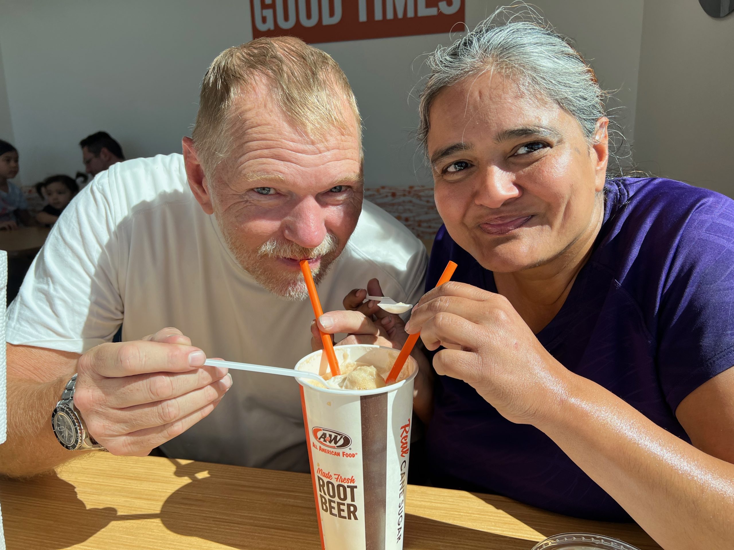
We fuel up at the Outlet malls in Barstow and wait for our Prius to catch up to us at a Del Taco, which boasts of being the original. A little research uncovers that the first Del Taco was at Yermo, just down the road, and that another Del Taco by Barstow Station is the oldest. But I digress.
An earthclipse occurs at about 6 p.m., completely dimming and obscuring the Sun and accurately predicted by scientists. We watch the Sun fade over the horizon, which means we will be night riding the hundred-plus miles to the Dunes. Riding up Kelbaker Road north from the I-40, the temperature drops into the upper 50s as we summit. The long underwear is a good choice now. Gearing up and gearing down is the ongoing battle of any long-distance bike ride. The only guideline I can go by is that the next road segment will not correlate with the previous one because of the altitude, the time of day, changing weather conditions, and even traffic conditions.
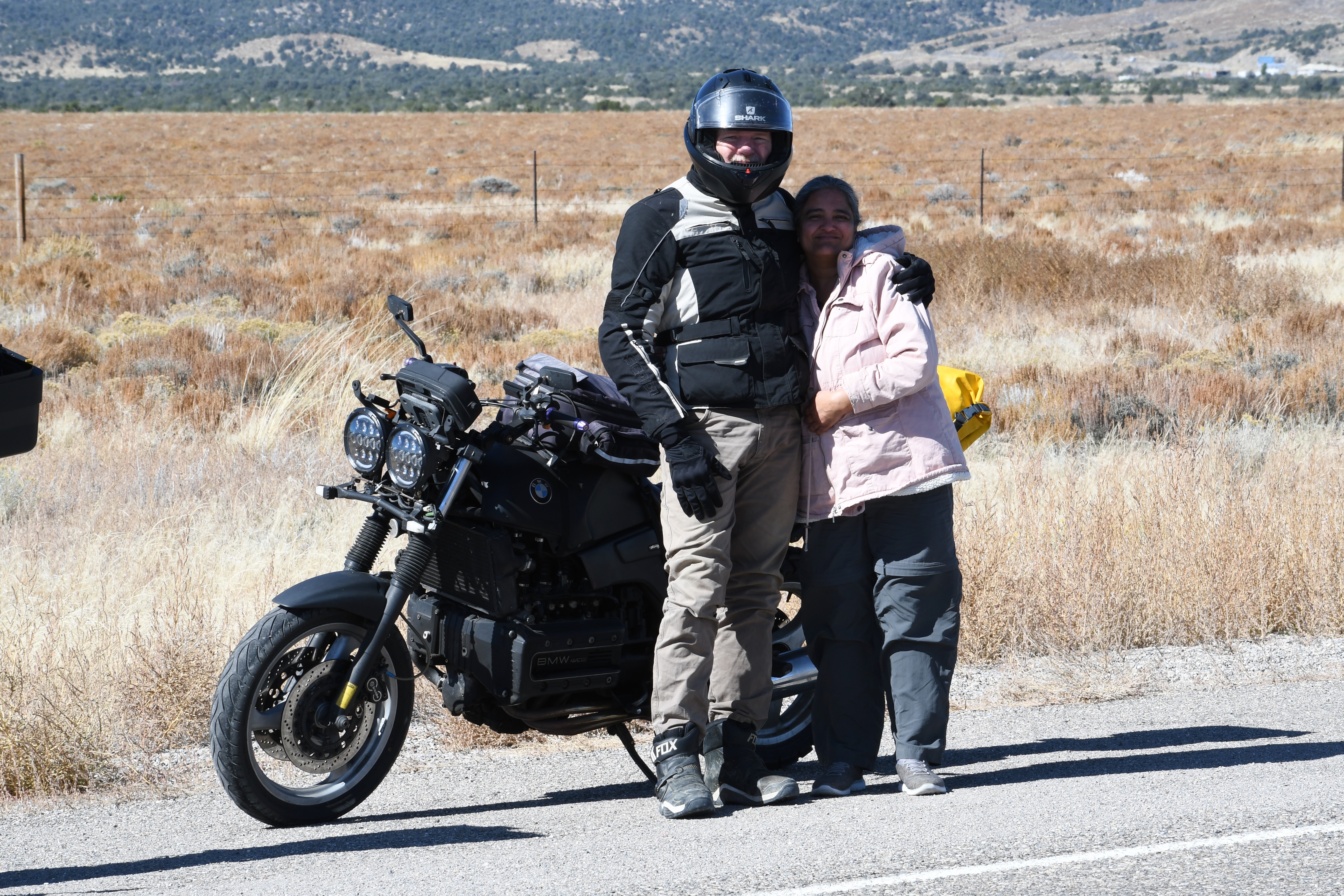
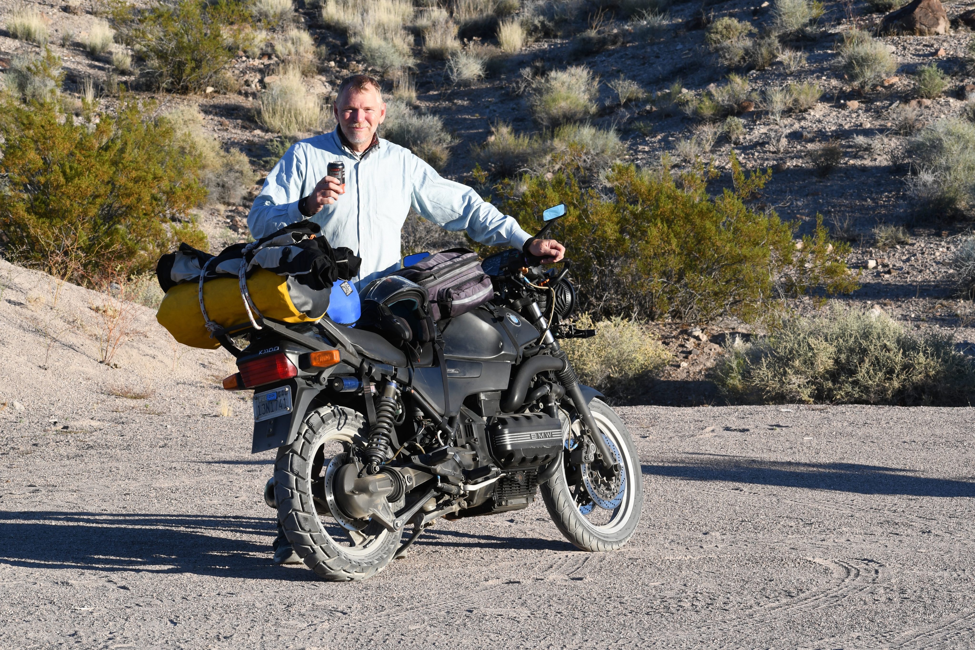
We head down the dirt road that fronts the Kelso dunes, looking for a spot to camp, a challenging feat in the dark. One that I’m not up to. I see an open area on the side of the road that isn’t marked with a no camping sign. I slow down to see it better in the dark, hit a sandy spot, and drop the bike. It is a slow-motion fall, and I walk off the bike as it goes down—just like old times.
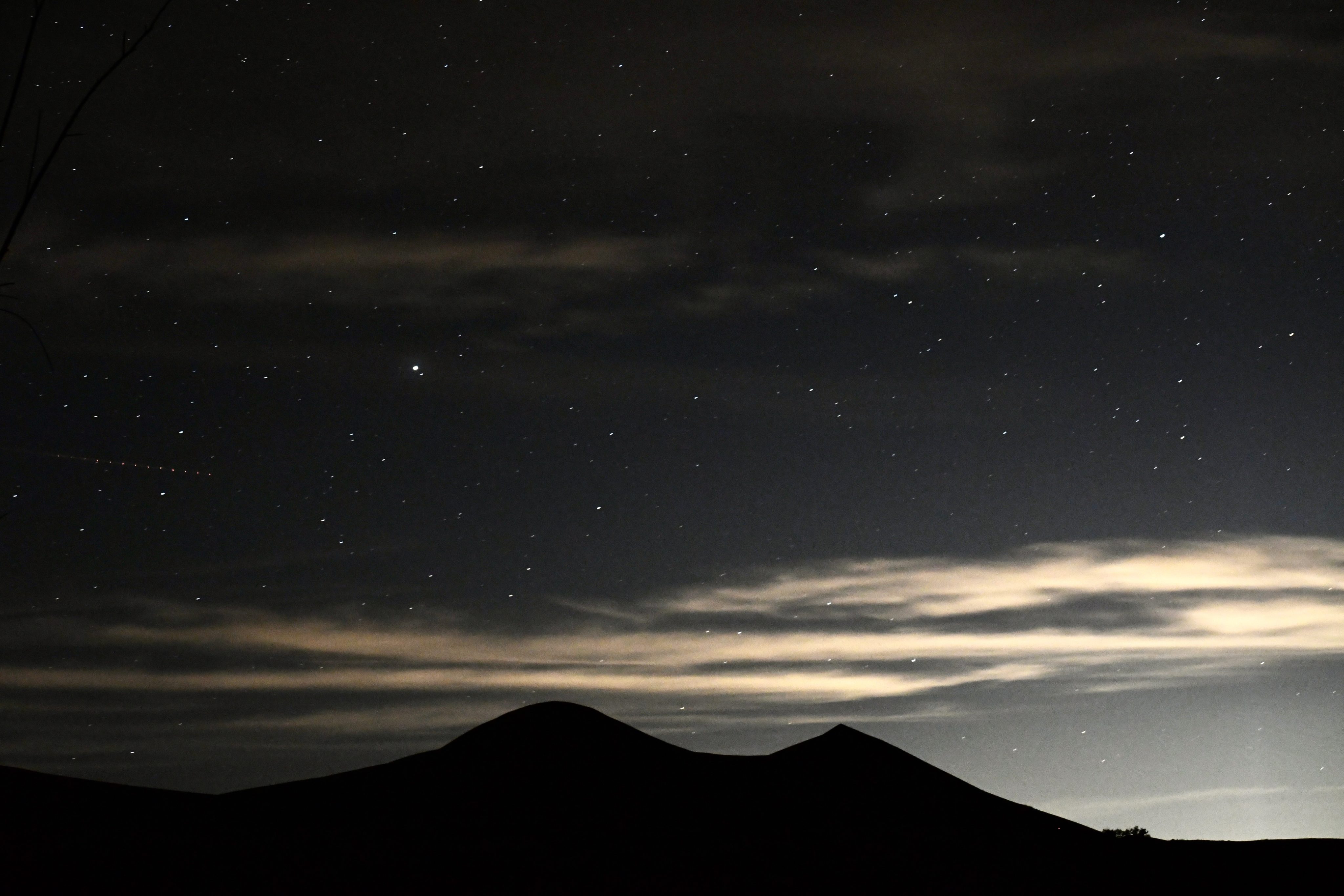
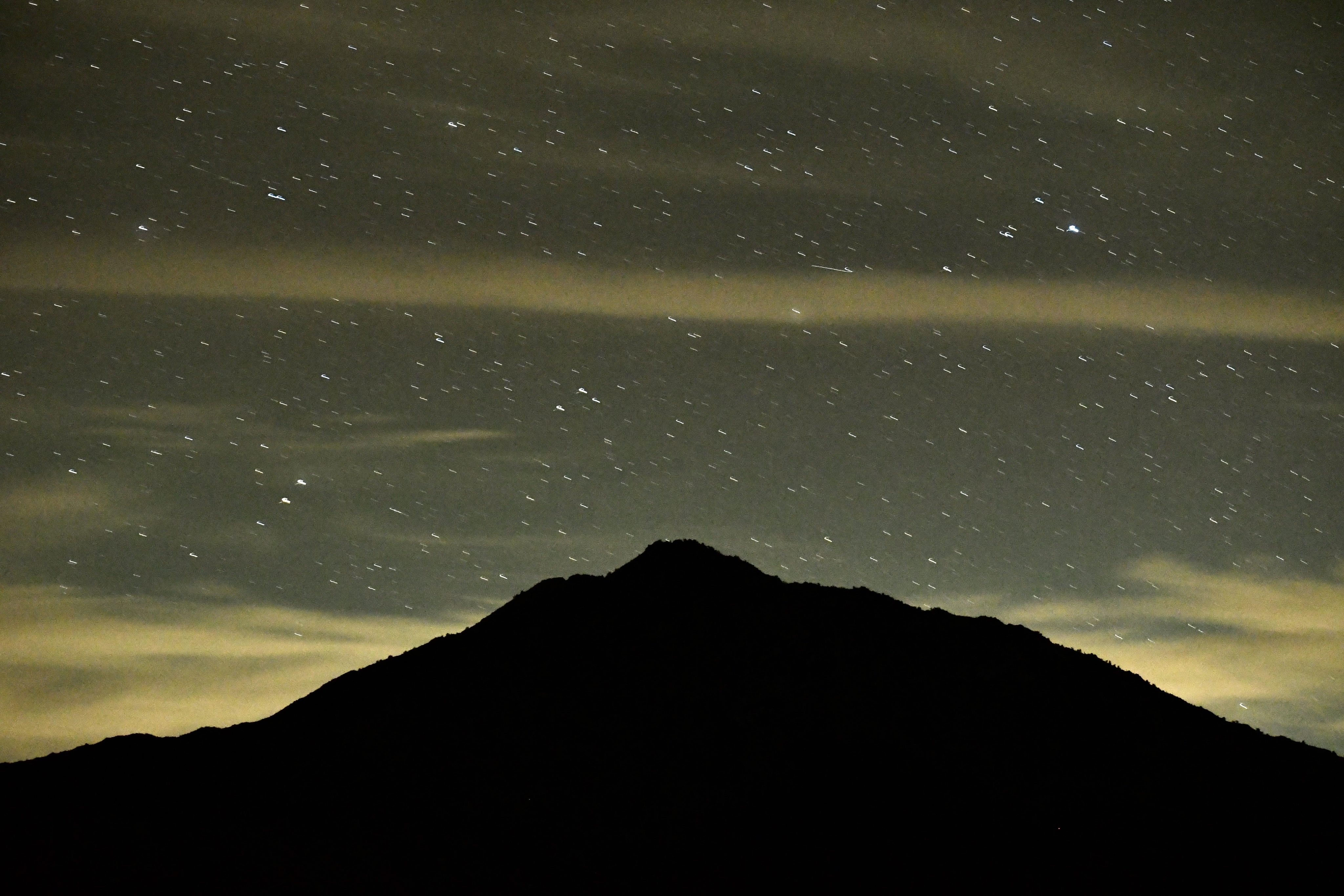
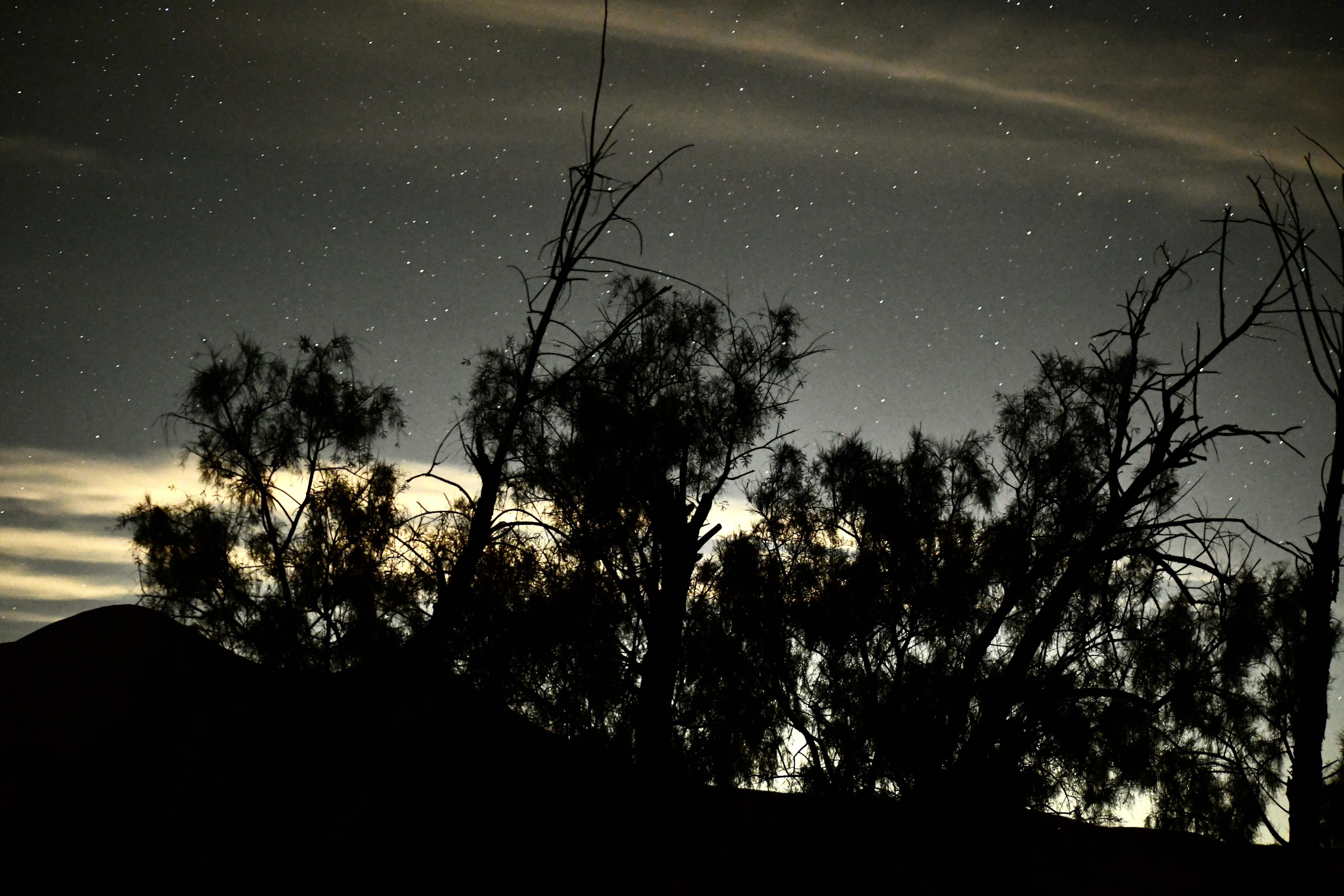
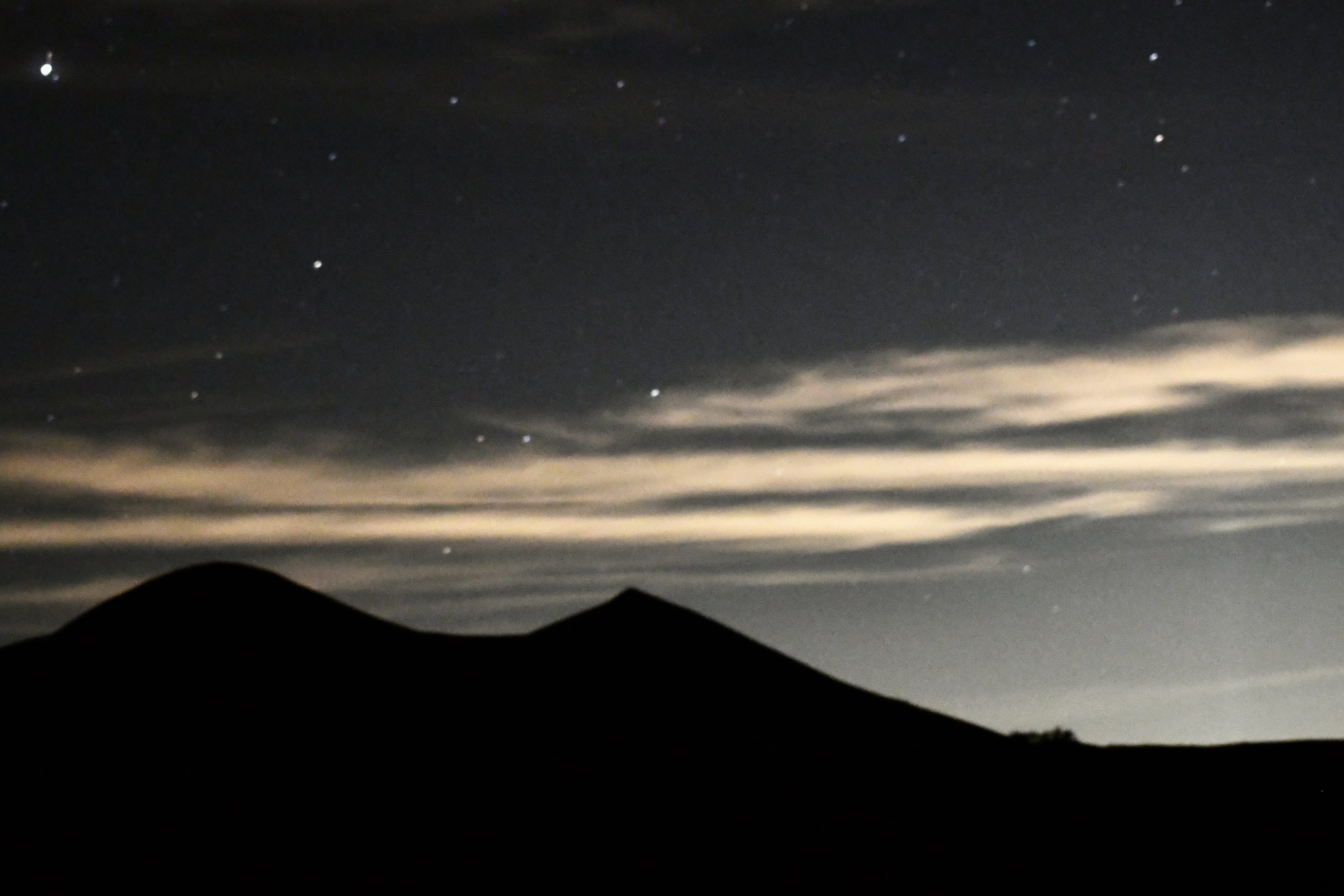
The campsite is just down the road, though. They’ve added vault toilets since the last time I was here Singing Dunes, a welcome addition as far as I’m concerned. We have a few drinks and finish up the Indian food brought for the ride, but no one is hungry after our snack at Del Taco. We compete on shooting star counts in the Milky Way banded sky. The urban glow of Las Vegas and Los Angeles show on either horizon. After everyone else turns in, I stay up for another hour to work on my nighttime photography skills.
Day 2: 330 miles. Kelso Dunes to Ely, Nevada
“There was nowhere to go but everywhere, so just keep on rolling under the stars.”
Jack Kerouac, On the Road
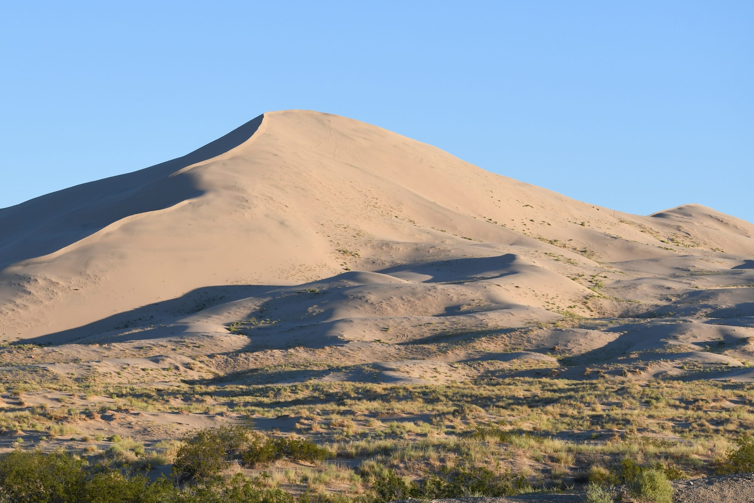
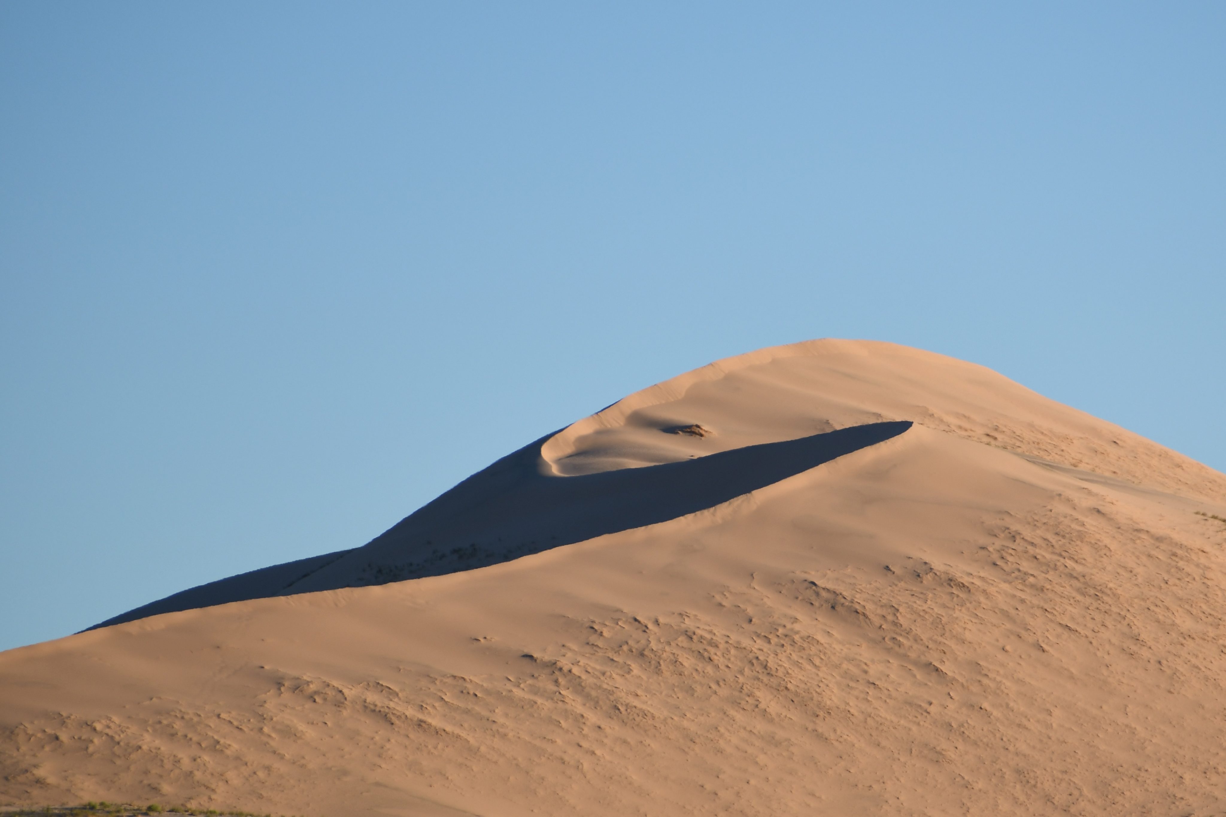
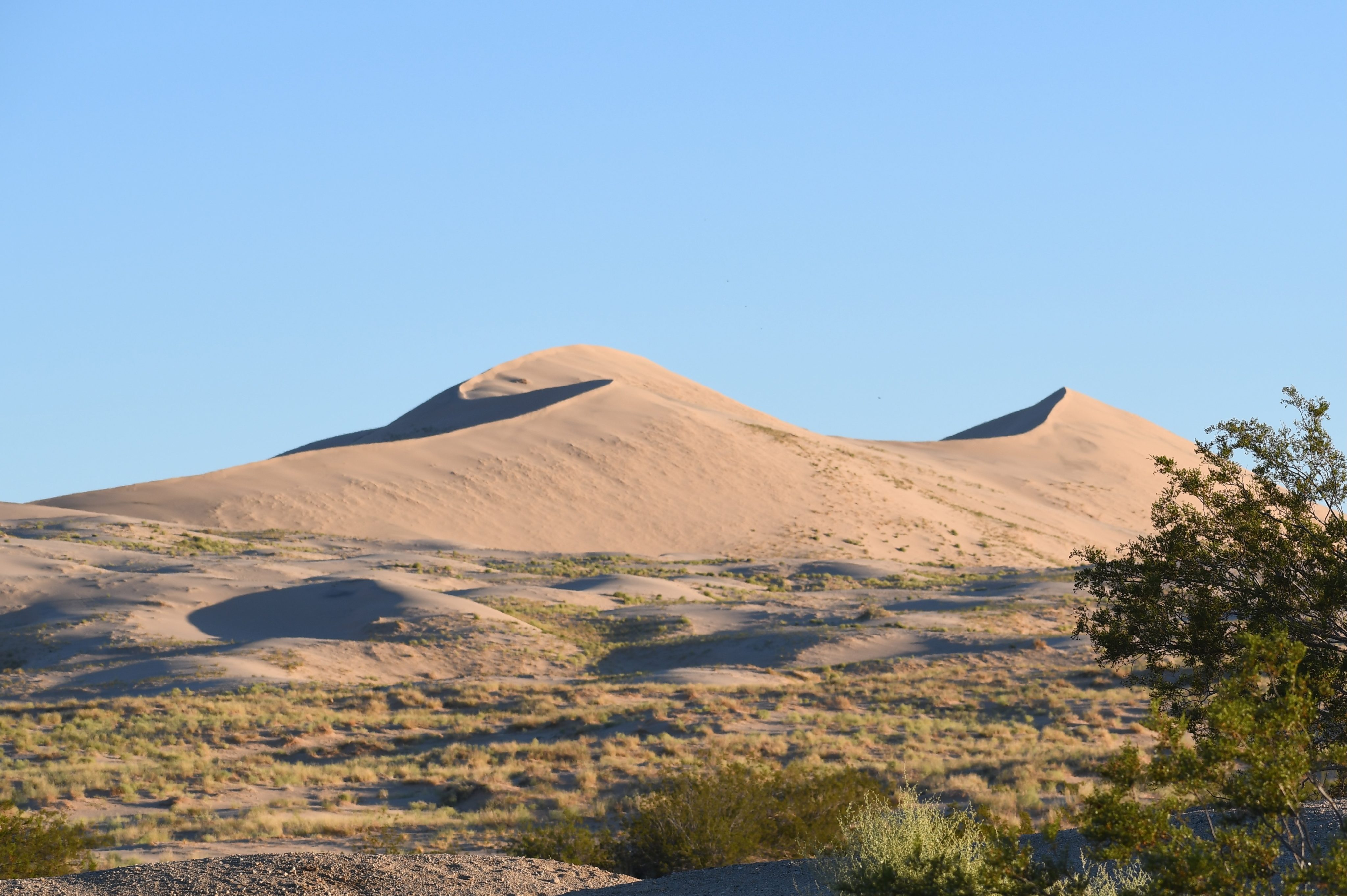
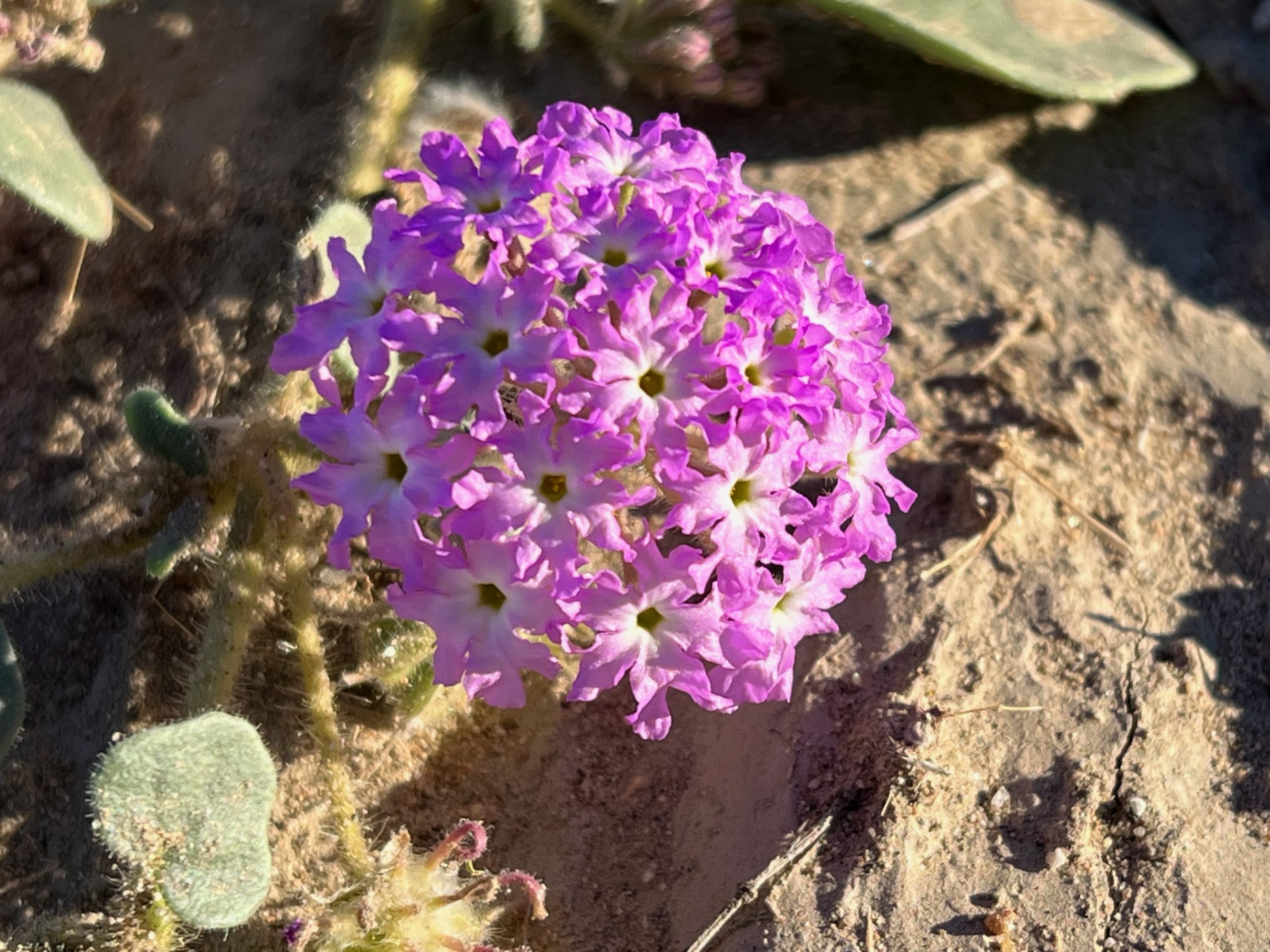
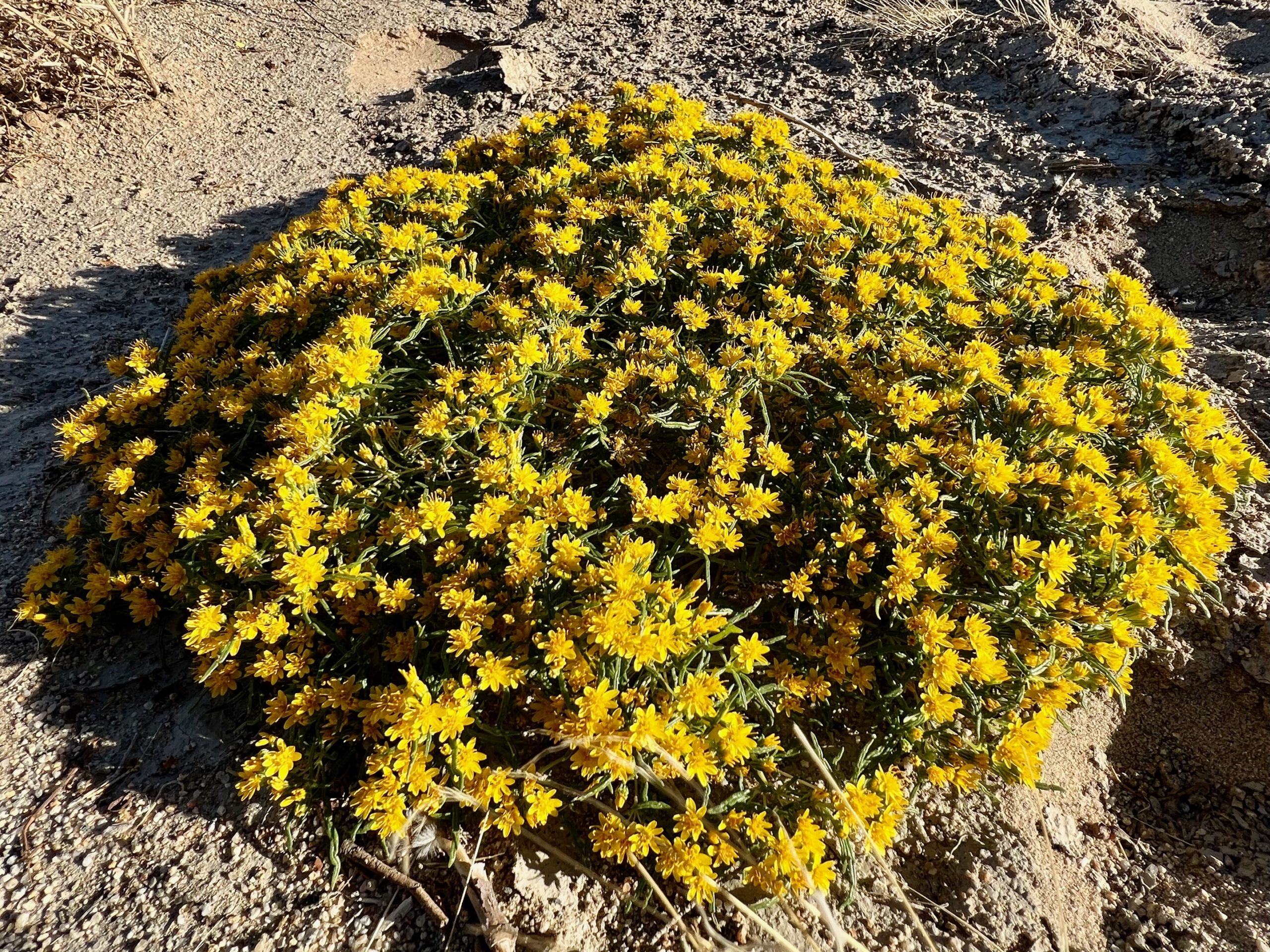
The morning light illuminates the dunes from the east, making nice shadows on their west sides, perfect for Dune photography. Sand verbana and chinchweed add a lovely purple and yellow color to the landscape.
The big decision of the morning is whether to drive to Baker or Primm. Baker is closer. We know we have enough gas to make it. Primm will save us nearly an hour if we cut across the Mojave National Preserve, but the gas situation would be precarious. Outside the major cities, gas stations are a precious commodity for those riding on a motorcycle. Take advantage of every opportunity to fuel when gas stations are fifty to seventy-five miles apart.
So, we opt for Primm, turning right at the Kelbaker train depot down the creatively named Kelso-Cima road, which takes you from Kelso to Cima. We keep the speed at a gas-saving 65 mph, which gives us the time to soak in the creosote-lined valleys that lead up to the rugged mountains in mid-distance. As we reach higher elevations, we roll through a Joshua tree forest, a sparse arrangement of spikey-leaved trees where tree neighbors give each other a wide berth. Hole-in-the-wall campground is just twelve miles down the road. I hear its frigid, windy hillsides calling us for a future visit.
We make it to Primm, not exactly brimming with fuel but enough left to get us there without panic. Primm has an interstate vibe with high-volume gas stations and a motorcycle club blaring out music at top volume. We stutter our way through Vegas, admiring its skyline but not so much its traffic.
On the Highway 93 turn North into the heartland of Nevada, I ignore my advice never to waste an opportunity to fuel up. The next town on the map is Alamo, about seventy-five miles north. I expect a sign saying, “next services in so many miles,” but I never see it. There is no guarantee that we can gas up there.
The 93 is a road where, one day, someone said, “We need a route from the I-15 to Alamo.” An engineer took a ruler and drew a line from one place to another. The road skirts the Desert National Wildlife Range on its west side, which has abundant water for an October desert and a veneer of green. We pull into the Visitor Center a few miles short of Alamo. I have to think that Lisa Williams, the ranger in charge, doesn’t see that many people and welcomes our interruption. Lisa advises us to visit a BLM office on the way up to Ely to find a decent place to camp. Why I remember her name, I don’t know, but the imagined isolation of her mid-Nevada outpost piques my interest in the type of person that could endure it.
We fill up at Alamo and decide to head up the 318 instead of the 93 to Great Basin. It’s already getting late, and we want to avoid wandering around in unknown territory, trying to find a place to camp in the dark. The 318 is a more direct route to Ely, where we must gas up after the 150-mile trip, a road devoid of gas stations.
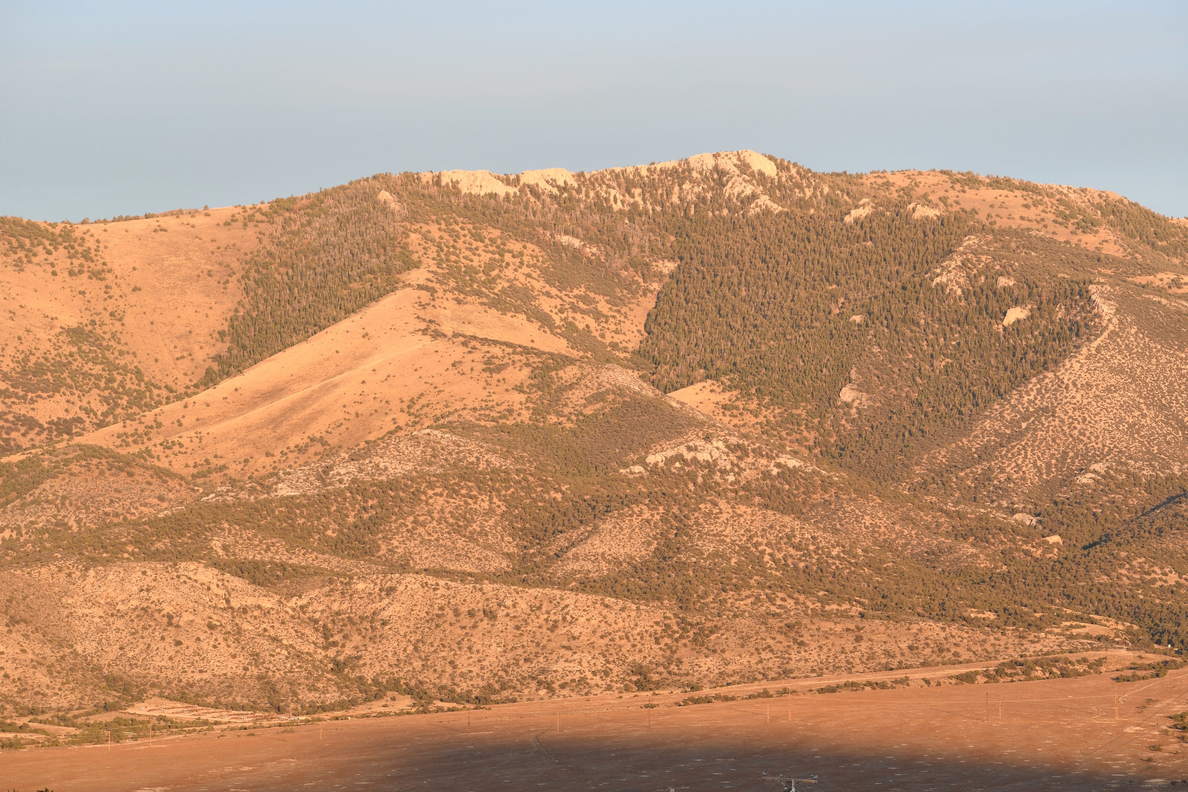
As we progress, the roadsides become more vibrant, with yellow rabbitbrush (ID not confirmed) lining the road, patches of white grass in matts of red, and a veneer of green. It’s a full spectrum experience. The road cuts through a gorgeous cliff section that comes up to the shoulders and opens into a long basin surrounded by mountains. The beauty of the roadside flowers, the mid-distant green, and the mountain-rimmed horizons astound me. But my riding companion tells me not to be fooled. The remnants of Hurricane Hilary came this way and dumped more water in one day than it usually gets in a year. We witness a second spring, the plants either taking advantage of or fooled by this watery aberration. We are seeing the brochure, not the Nevada we would return to.
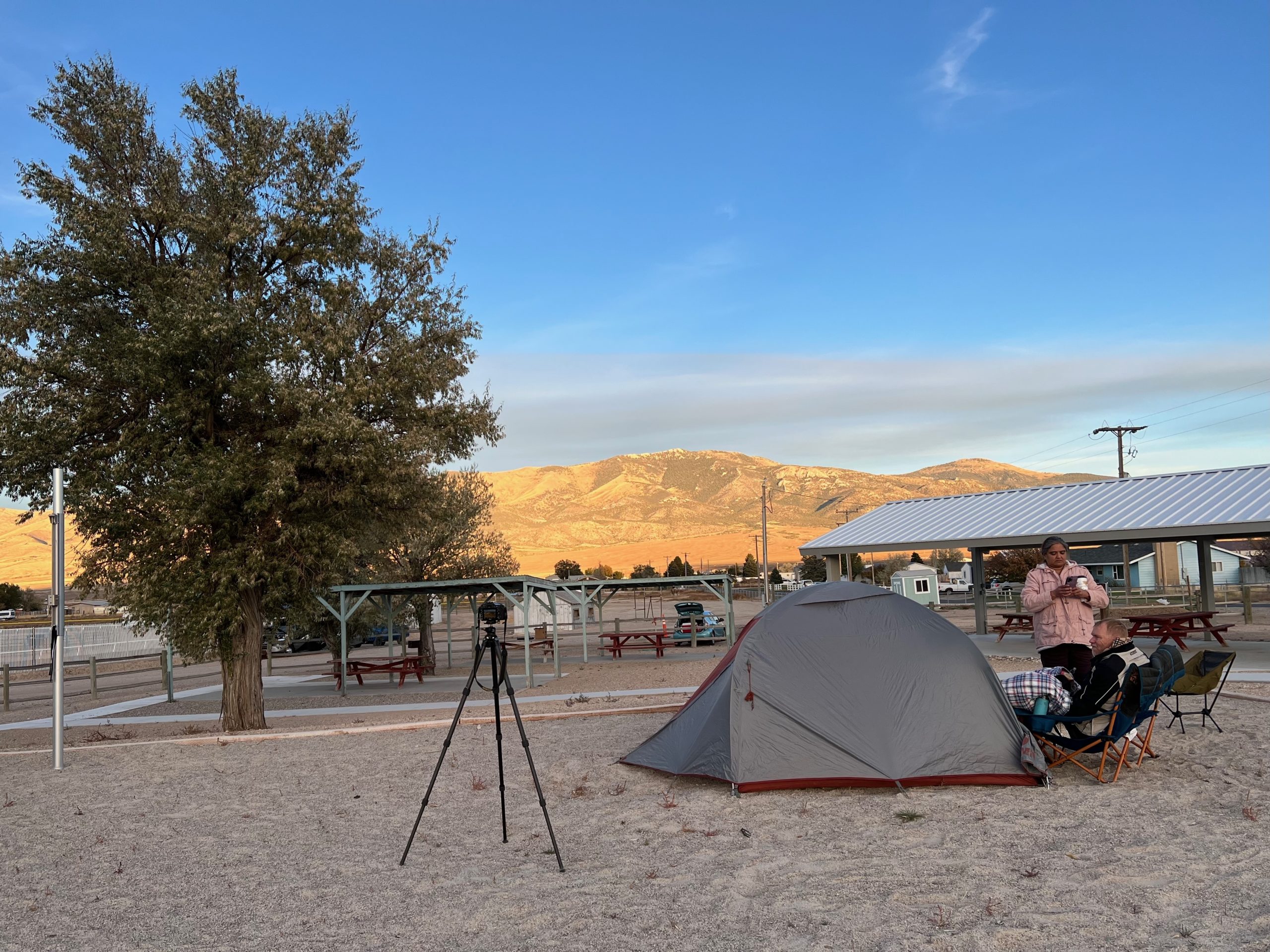
In Ely, the register lady at the gas station says to head out of town and pull off at any dirt road. She says they expect tens of thousands of people, a regular Woodstock event, in my estimation. In Ely, or somewhat north of it, we find an ad-hoc campground next to a horse track willing to put us up for the night for a mere sixty dollars cash, a little bit of event gouging in my opinion. Wasn’t Woodstock a free concert? We pitch our tents on the volleyball courts of a local park and set up a kitchen on one of the park picnic benches. Another scientifically-predicted earthclipse obscures the Sun from our view. The temperature drops to an overnight low of thirty degrees. The long day of riding and the cold night send us to an early tent.
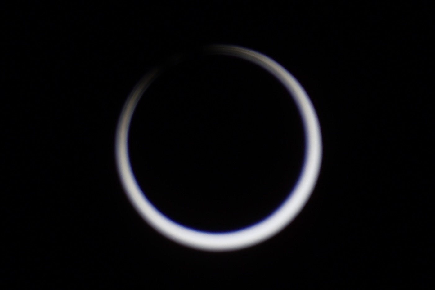
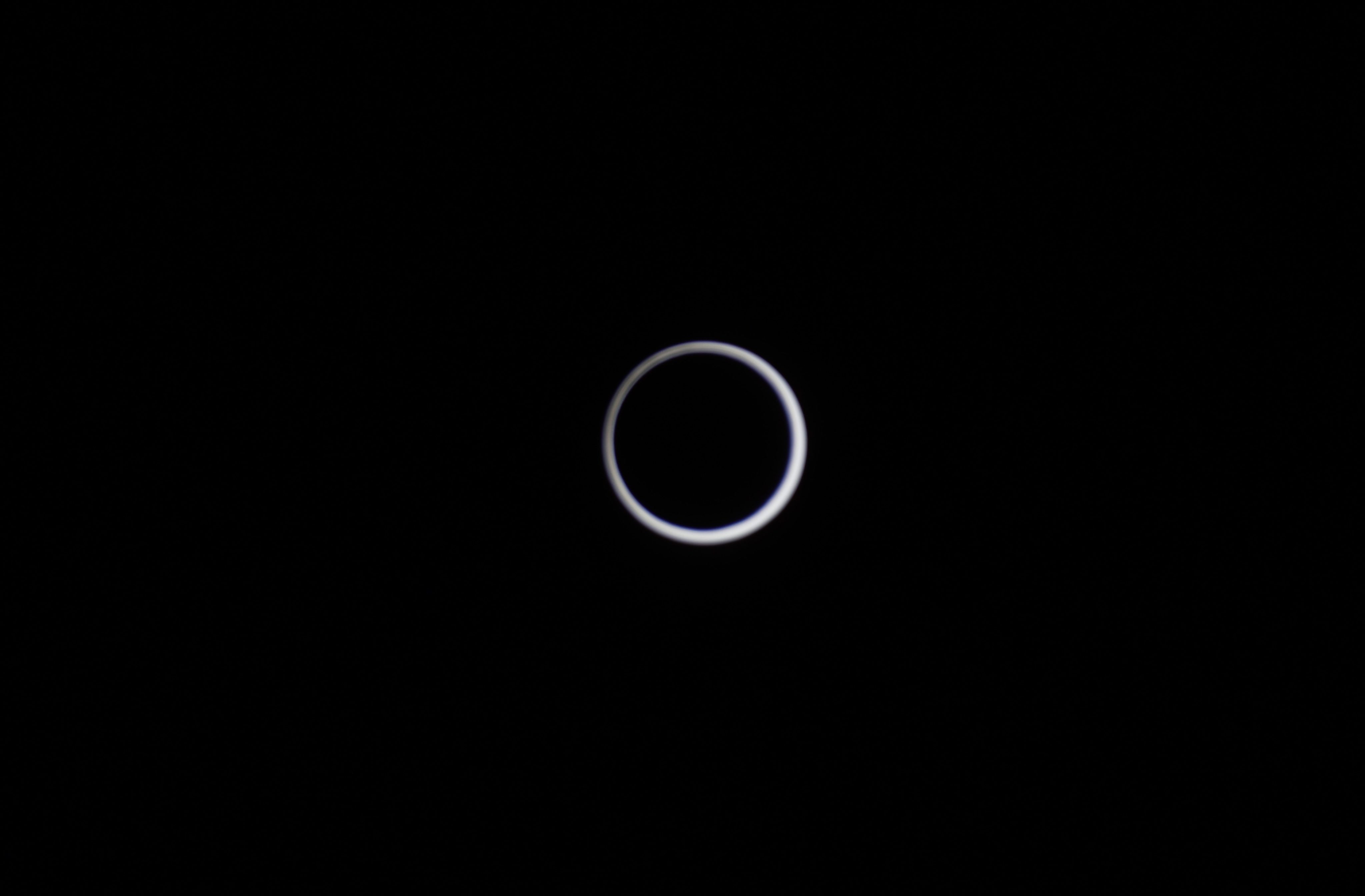
Annularity.
“The black dragon swallows the sun, everything is silent; the moon has eclipsed, and the white rabbit has eclipsed.”(黑龙吞日,万籁寂静;月有食色,白兔已蚀
Ancient Chinese Eclipse poem, possibly manufactured by ChatGPT.
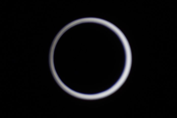
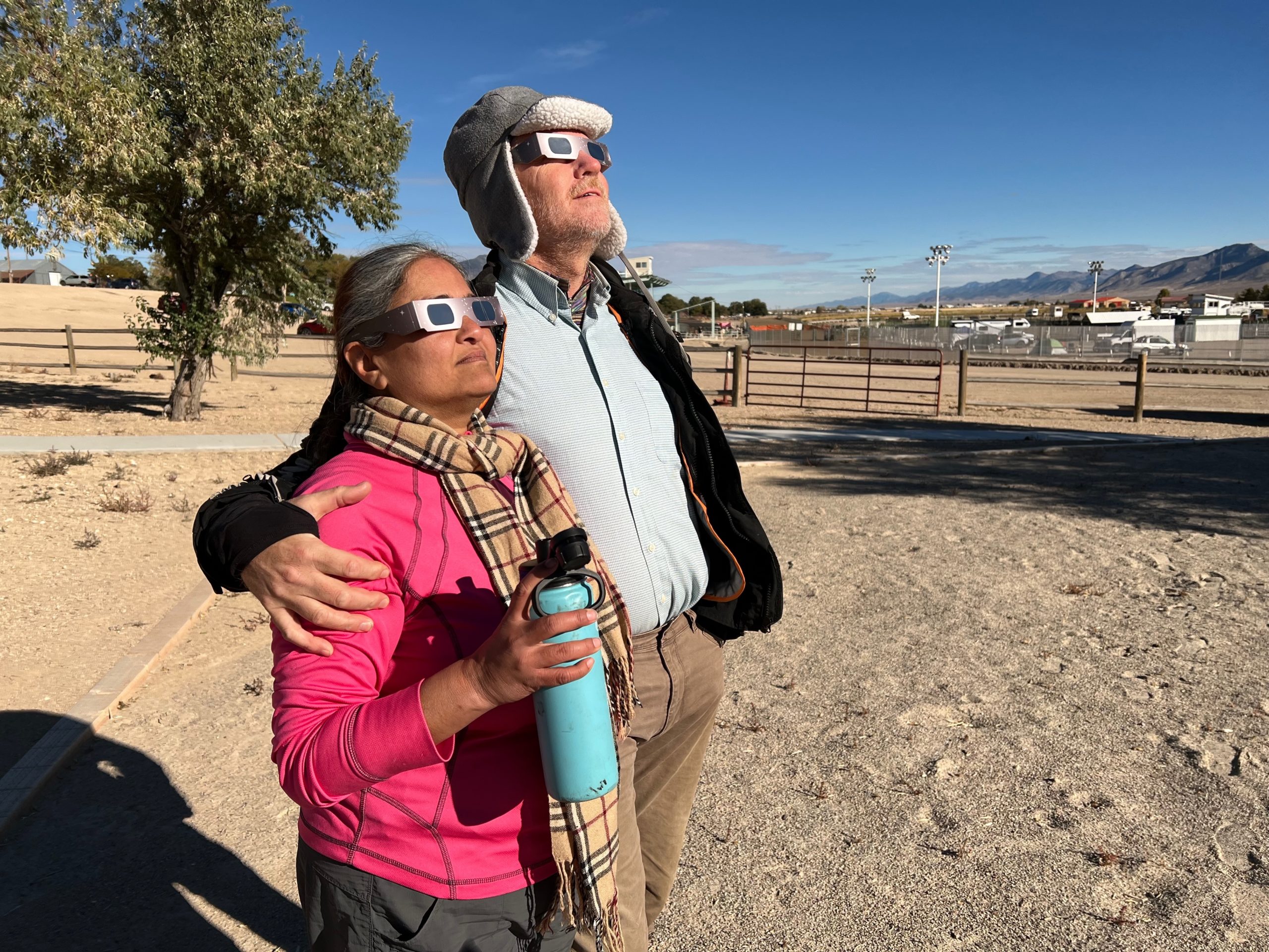
In the morning, the worry is the clouds. A thin layer obscures the Sun when we first wake. The Sun is covered but visible. Still, it is not the ideal viewing conditions when a thick band of clouds intervenes between you and annularity. But the clouds drift off, and the moon takes its first bite out of the Sun, a nick in the perfection of its sphericality. The event is on.
The complete unfolding of a solar eclipse is not exactly a horse race, and in the interim between viewings, we discuss the celestial mechanics of a solar eclipse.
Begin Digression: Fast forward to the story’s future, now my past. The trip resumes at “End Digression.”
As the eclipse progressed, I explained the annular version of the solar eclipse as the difference between apogee and perigee. But later, it occurred to me, what are the odds that apogee and perigee line up precisely at the point where the moon’s orbit crosses the ecliptic? That would be an extraordinary coincidence if solar eclipses depended on that alignment. Why wouldn’t the eclipse occur at some other intersection point of the moon’s orbit with the ecliptic? Spoiler alert: it does. But I’ve never heard anyone describe a thick “ring of fire” or a “thin ring of fire.” And in retrospect, I do not know how close we were to full annularity.
I waded through at least fifty different online articles, seeking an answer. Either I couldn’t ask the question the right way, or the general understanding of the qualitative mechanics of an eclipse needs to be better understood. I suspect the latter, but I finally hit an article that explained it in a way I understood. I will regurgitate (my understanding) here.
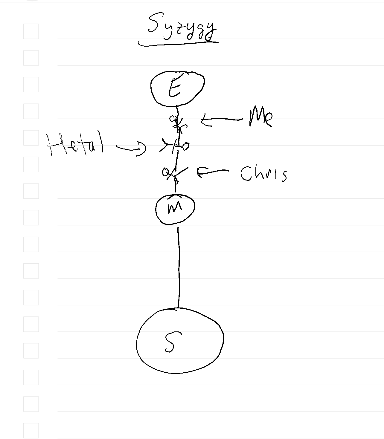
An eclipse occurs at syzygy, the configuration of the Sun, the Earth, myself, my companions, and the moon in a straight line, like the pieces on a shish kebab skewer. Syzygy has no common etymology with Zzyzx, the exit to nowhere from the I-15 in the Mojave. They don’t even rhyme. But again, I digress.
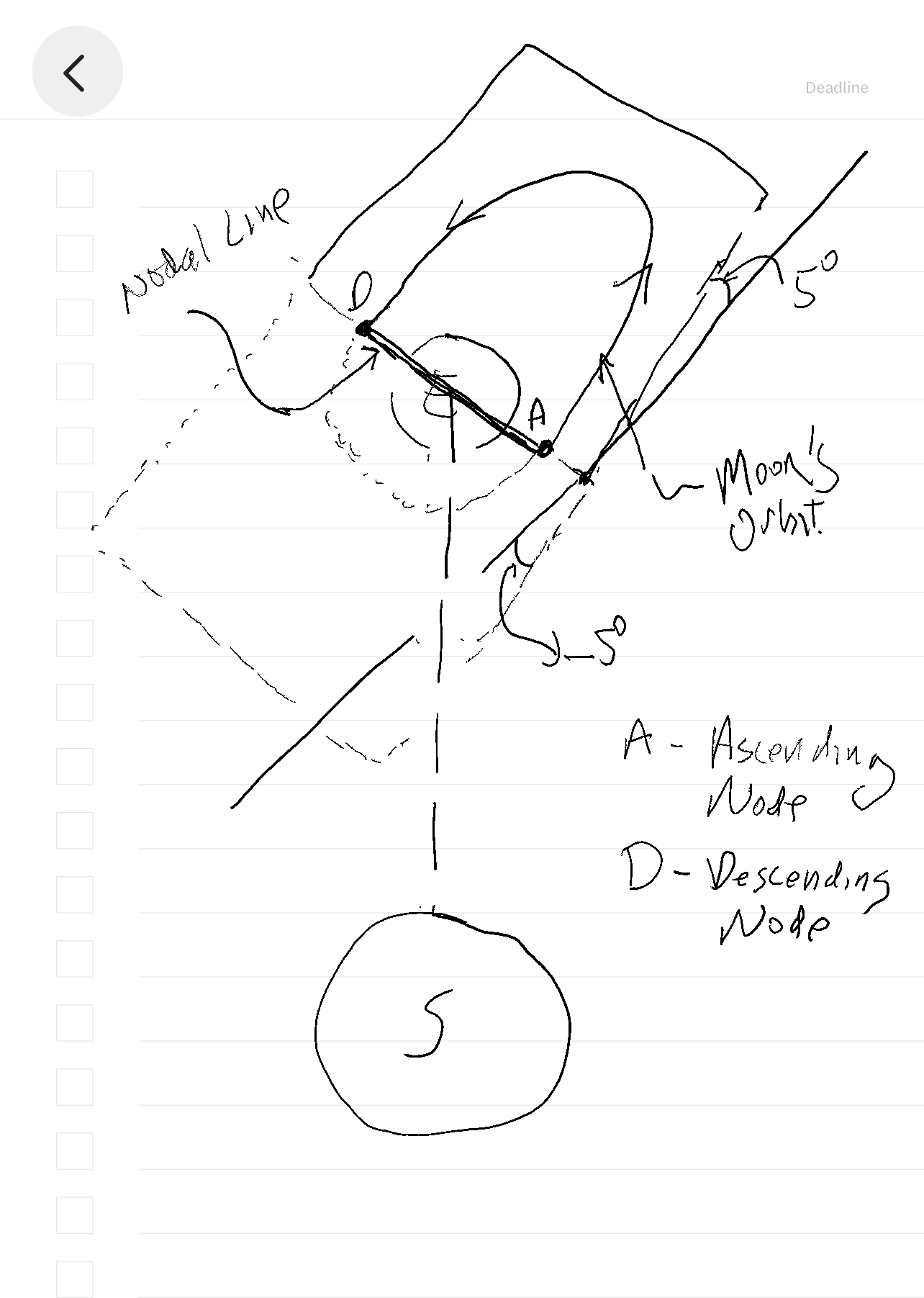
It took me a while to visualize all the different orbital motions. So, let’s start with the most basic. The ecliptic is the plane of the Earth’s orbit about the Sun. The plane of the moon’s orbit about the Earth is inclined by five degrees with respect to the ecliptic. The nodal line is where the plane of the moon’s orbit and the ecliptic intersect.
There are two nodal points. The ascending node is when the moon goes from below the ecliptic to above. The descending node is when the moon goes from above the ecliptic to below. And if you follow the path of the October 14th eclipse, it cuts across the Earth from Northwest to Southeast. The April 7th eclipse of 2024 will cut across the Earth from Southwest to Northeast. In the first case, the moon moves from above to below the ecliptic. In the second, the moon is moving from below to above.

The Earth is at one of the two focus points of the ellipse of the moon’s orbit. When the moon is at perigee, it is closest to the Earth. As a side note, when the full moon corresponds with perigee, it is called a super moon. When the moon is at apogee, it is farthest from the Earth. The line from apogee to perigee is called the apsidal line.
An eclipse can only occur when the nodal line points directly at the Sun, sometimes referred to as the eclipse season. A solar eclipse occurs during a new moon when the new moon crosses the ecliptic in front of the Earth in relation to the Sun, and a lunar eclipse occurs during a full moon when the full moon crosses the ecliptic behind the Earth in relation to the Sun.
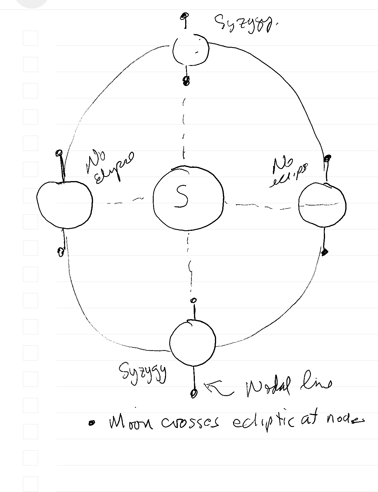
The orientation of the nodal line with respect to the line from the Earth to the Sun changes as the Earth moves around the Sun. In three months, the nodal line will be perpendicular to the line pointing directly from the Earth to the Sun. In three more months, the nodal line will again align with the Sun, but this time with the opposite nodal point facing the Sun. So, you would expect to see an eclipse every six months.
So far, so good?
Now, we start with the complications. First, the most eclipses recorded in a year is five, not two. One of those extra eclipses is a happenstance of the calendar. The first eclipse of that year occurred in early January, the second in June, and the third in late December. In other words, the eclipses occur every six months, as expected. They happen to fall on the year boundary.
Each of the other two extra eclipses occurred one month apart from another eclipse. I infer that the nodal line orientation had a similar aberration to the calendar in that there is a window for an eclipse of about a month. If the first eclipse occurs at the beginning of that window, the second eclipse occurs at the end. So, occasionally, you can sneak in an extra eclipse in a month. In the record year of five eclipses, this happened twice.
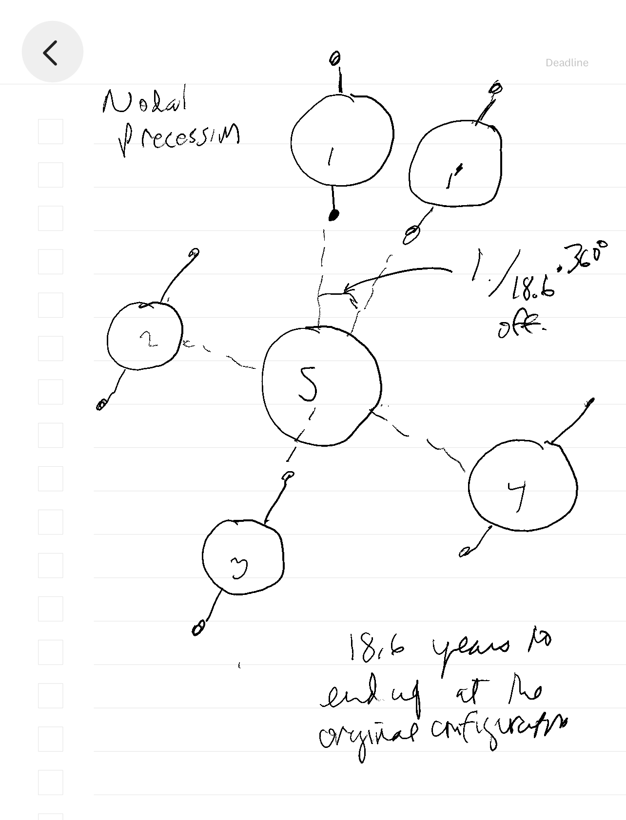
The second complication is that eclipses aren’t on an exact one-year cycle. In other words, the nodal line will not be in the same orientation with respect to the Sun after a complete orbit. In fact, it will be off by 1/18.6 of the Earth’s orbit or about three-quarters of a month per year. The nodal line has an 18.6-year precession. It takes 18.6 years for the nodal line to return to the same orientation at the exact location in the orbit. Ancient astronomers could predict eclipses based on this cycle without knowing celestial mechanics. Good day to you, Mr. Newton.
The third complication is that total and annular eclipses do not necessarily alternate every six months. There is even something called a hybrid eclipse, where the eclipse starts out as totality but ends in annularity.
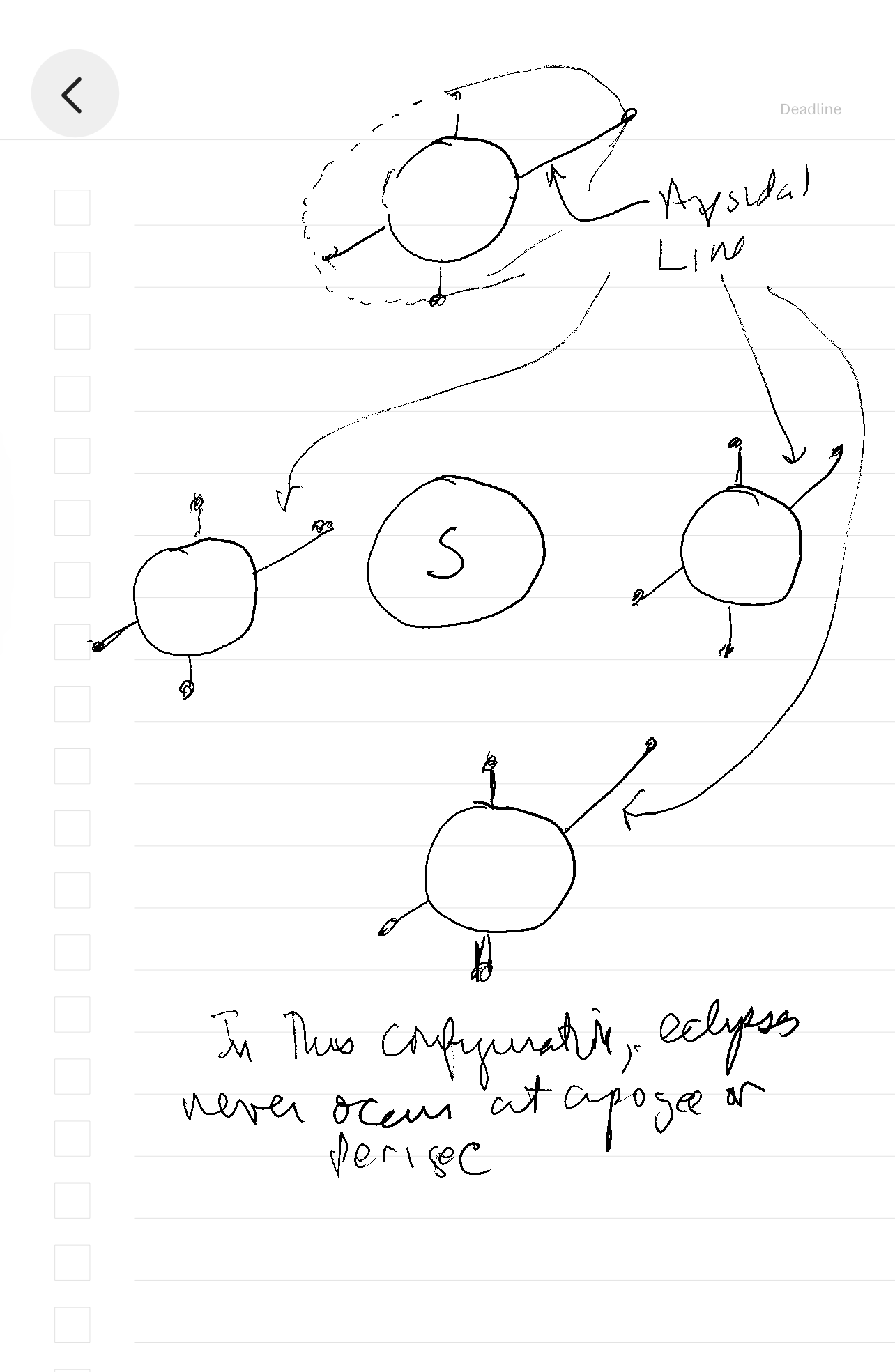
Now, we can go to the part bugging me, which I could find little about. If the apsidal line is perpendicular to the nodal line at syzygy, the moon would always be at the same distance from the Earth when an eclipse occurs. The focal point is equidistant from the ellipse perpendicular to the apsidal line. If this were always the case, the eclipse would always be the same kind. It would be either annular or total eclipses or even hybrid, but whichever one, it would always be the same.
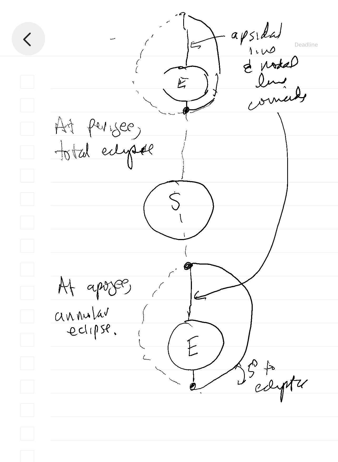
If the apsidal line is coincident with the nodal line, we would have both annular and total eclipses separated by six months. On one side of the Earth’s orbit, the apogee would be between the Sun and the Earth, while on the other side of the Earth’s orbit, the perigee would be between the Sun and the Earth. Six months from the annular eclipse of October 14th, there will be a total eclipse on April 7th.
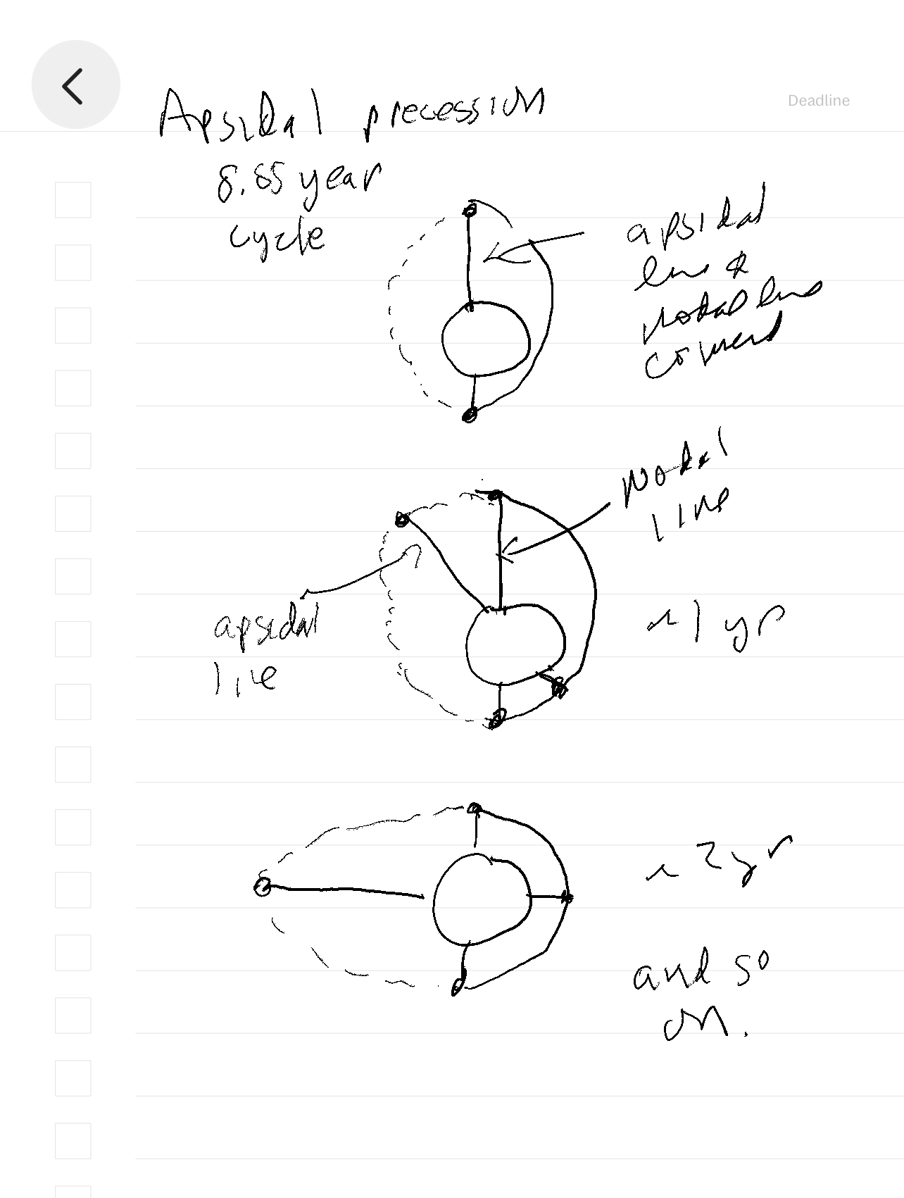
But this alternation is only sometimes the case. It turns out that the apsidal line also precesses over 8.85 years. See [https://en.wikipedia.org/wiki/Apsidal_precession] for a good graphic showing this. The apsidal line will change with respect to the nodal line so that you wouldn’t expect an exact six-month progression of annular to total eclipse. It reverses after 4.425 years. If a total eclipse occurs in October, 4.425 years later, the annular eclipse will occur in October, not correcting for other factors.
Syzygy, nodal line procession, and apsidal line procession are my deeper, qualitative understanding of the eclipses. I know a lot more than when I started. Regardless of what I know, the fact that I showed up at a time and place predicted to have an annular eclipse, which it did with flawless precision, is a tremendous and tremendously underappreciated accomplishment for astronomy and physics.
End Digression: Return to the story present.
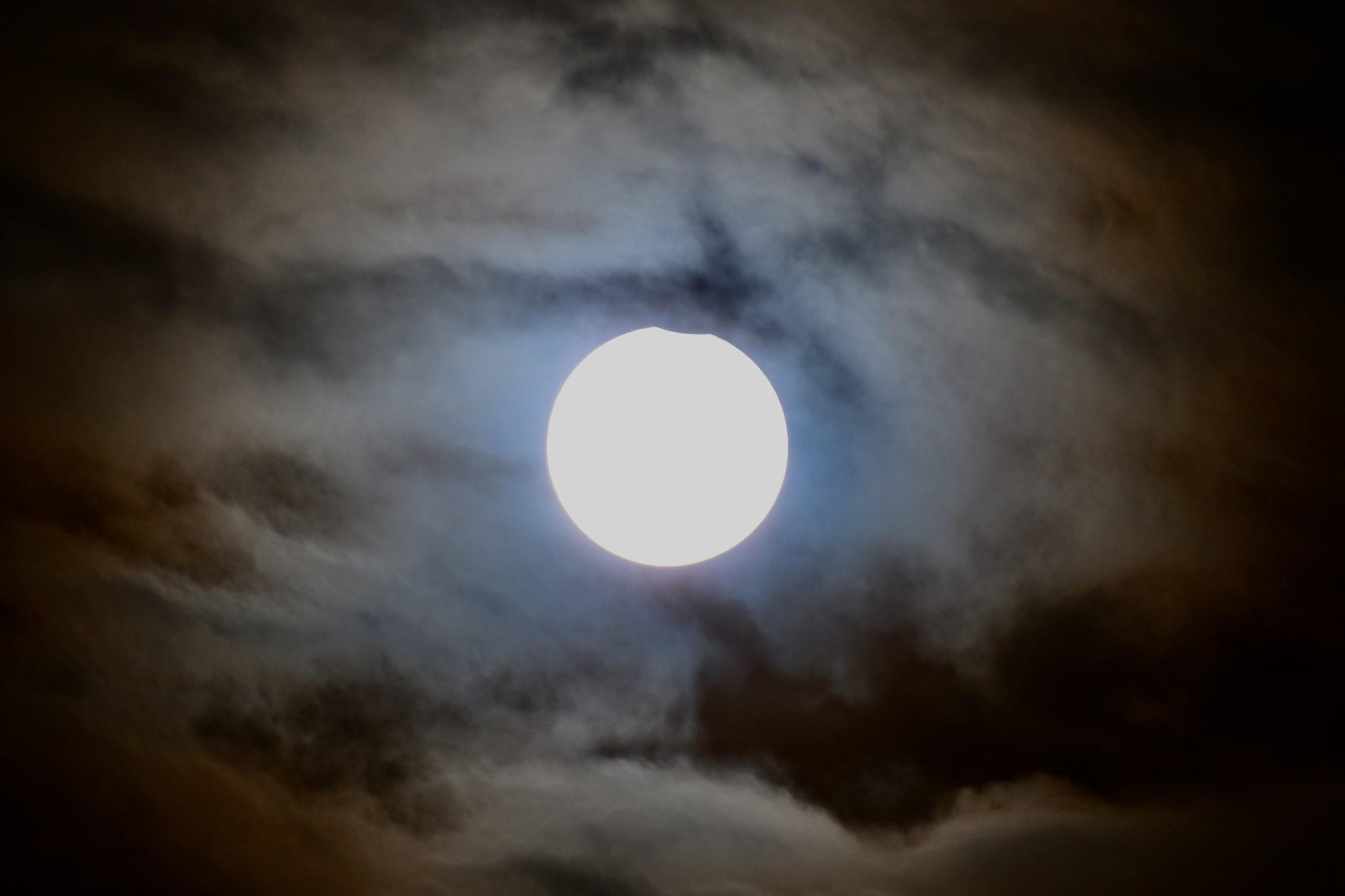
I check the eclipse’s progress every few minutes and snap a picture. The annular eclipse doesn’t viscerally move me like totality. You can’t see it without unique ISO-rated sunglasses. The Earth doesn’t go dark, only a little dim. If you are observant, you might notice that your shadow gets slightly fuzzy, with the two light sources coming from either side of the horns.
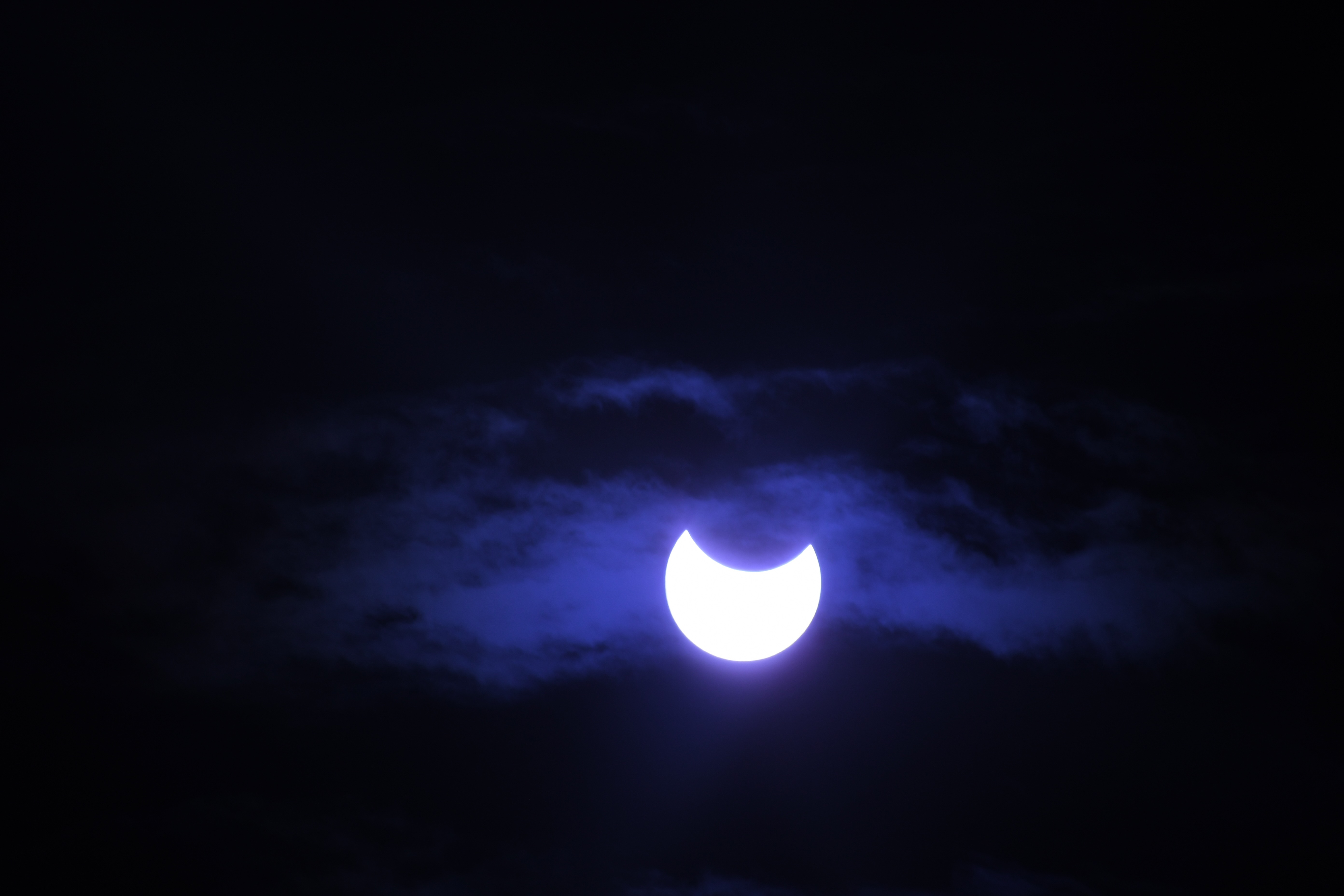
Still, watching the moon’s progression covering the Sun is a thrill. I’m not sure if the black dragon eats the Sun or the Sun puts its fiery jaw around the moon, only to find it indigestible and have to regurgitate it. The event culminates when the U of fire becomes the ring of fire, achieving syzygy. Even at this juncture of conjunction, the Sun is far too bright to look at directly. I snap some pictures and put the camera aside to take the time to appreciate what will likely be a once-in-my-lifetime event.
When the ring disappears and the regurgitation starts, the event is over for all except the high-end photographers who want to film the entire end-to-end progression. The Woodstock event is twenty or thirty people watching and photographing from the dirt parking lot beside the racetrack. Most of them pack up their equipment and tents and leave. For me, it’s like a baseball game. You can only go after the last out in the ninth inning. When that last dark node at the edge of the Sun’s perimeter, a black diamond if you will, disappears, it’s time to return to more Earthly pursuits.
Day 3: 200 miles. Ely to BLM land somewhere south of Alamo.
“The only people for me are the mad ones, the ones who are mad to live, mad to talk, mad to be saved, desirous of everything at the same time, the ones who never yawn or say a commonplace thing, but burn, burn, burn like fabulous yellow roman candles exploding like spiders across the sky.”
Jack Kerouac, On the Road
With the return of full sunlight, the temperature has soared to 50 degrees (sarcasm). I wear most of my warm-weather gear as we head out of town. We plan to procure one of those lakeside campgrounds we saw at the Desert National Wildlife Range, just north of the visitor center we stopped at, taking the long way to Alamo, heading east toward Great Basin National Park on U.S. 50, then following 93 south to Caliente.
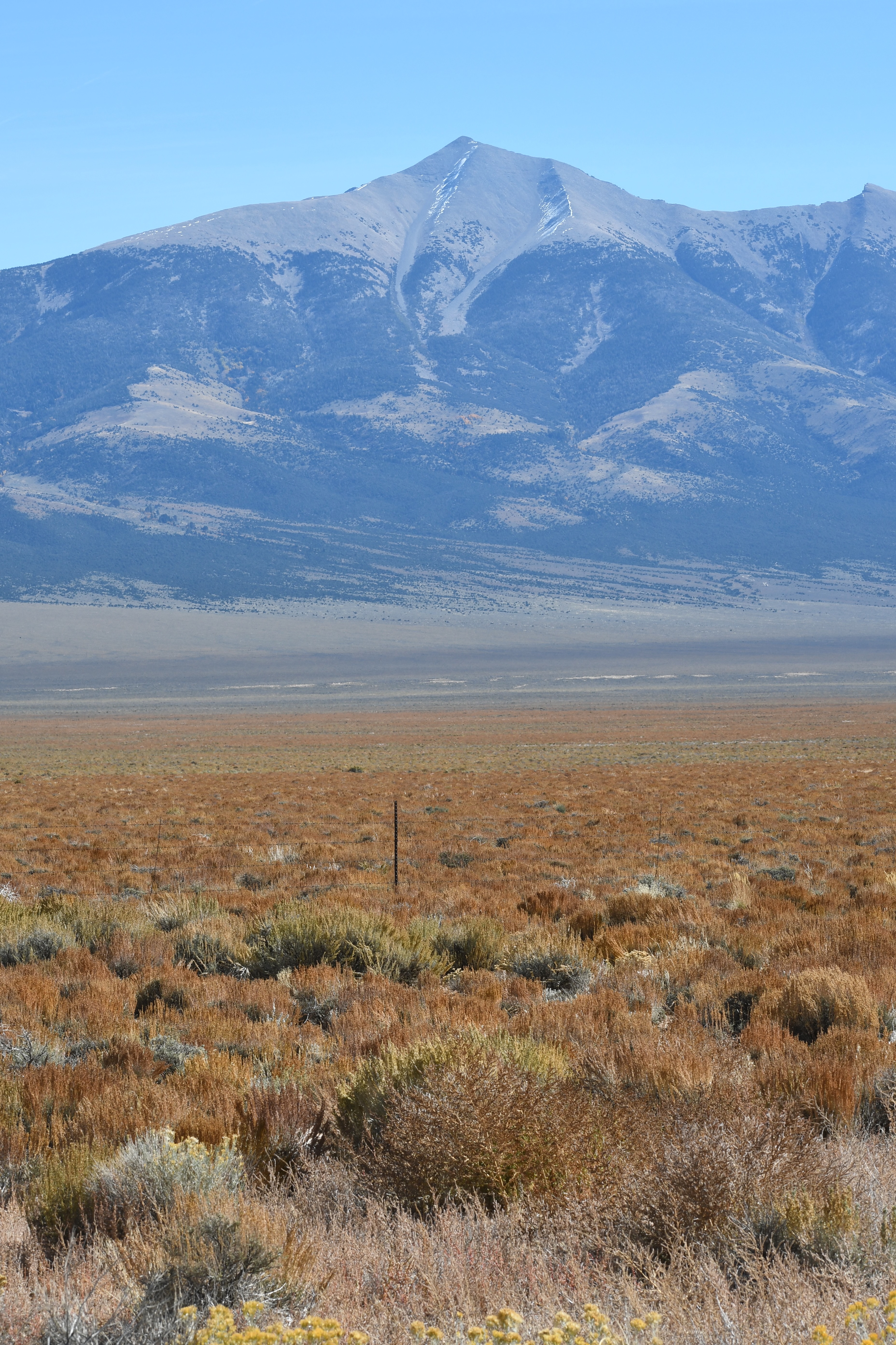
As we turn south onto the 93, we stop for a photo op of Wheeler Peak, the 13,000-foot peak inside Great Basin National Park I climbed six years earlier on my trip to achieve totality. I remember sucking oxygen back then. Six years later, I doubt I have the cardiovascular endurance to summit. I will stick to safer things like driving five hundred and fifty miles back home on a motorcycle through Riverside traffic.
Great Basin is a vast geographic area extending over Nevada, Utah, California, and Oregon. We ride in a basin within the basin that stretches for a hundred miles, lined with distant mountains on either side and lots of cold in the middle. After reaching Pioche, we drop in elevation, and the world becomes a warmer place.
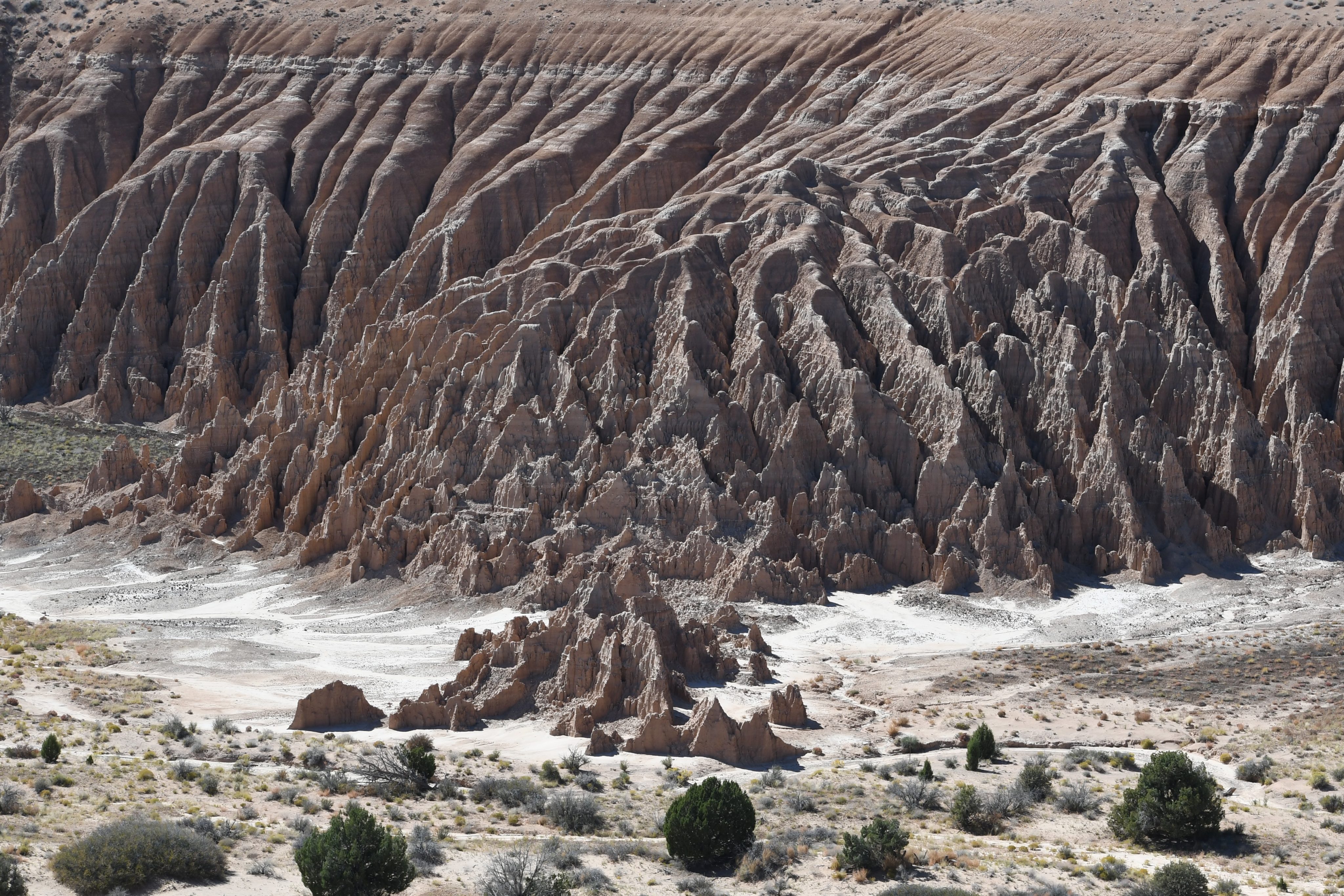

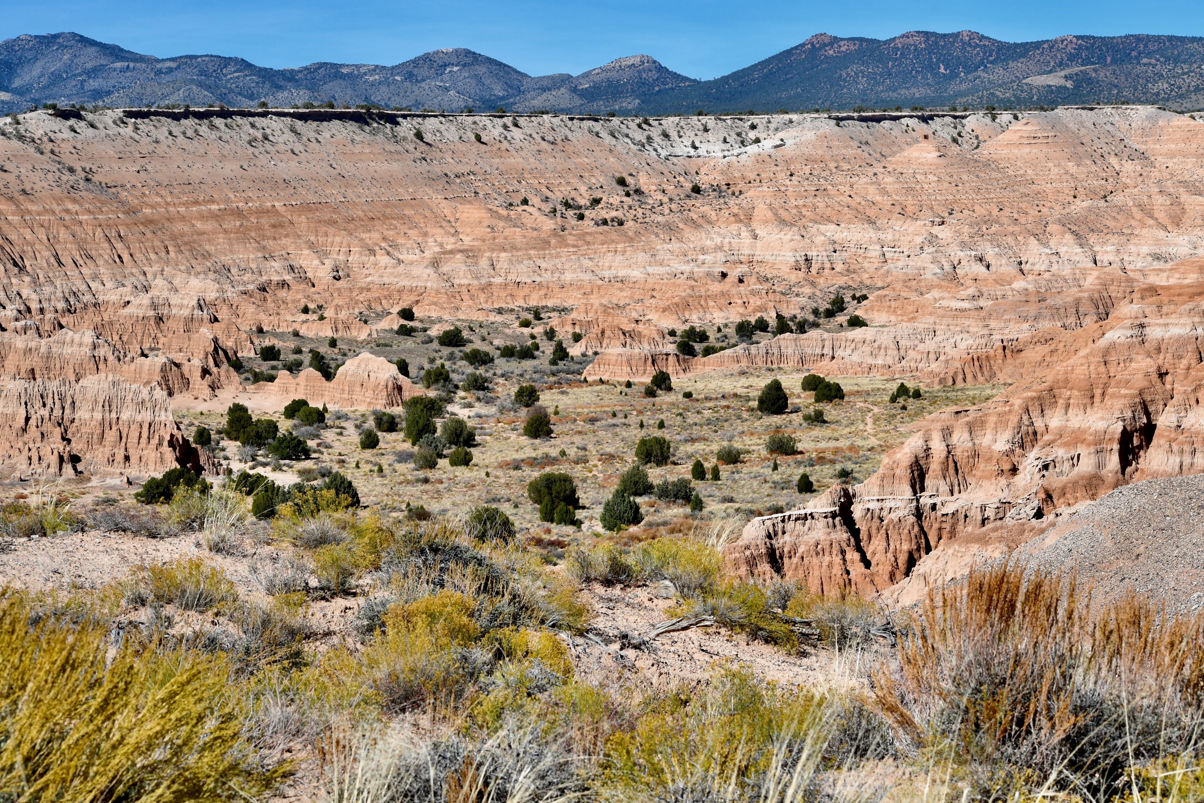
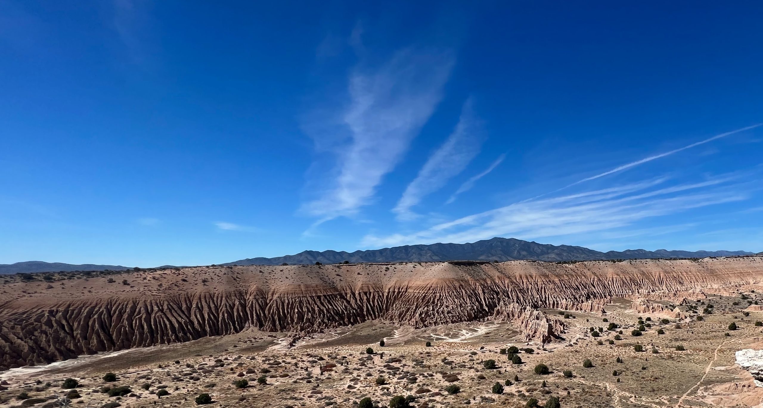
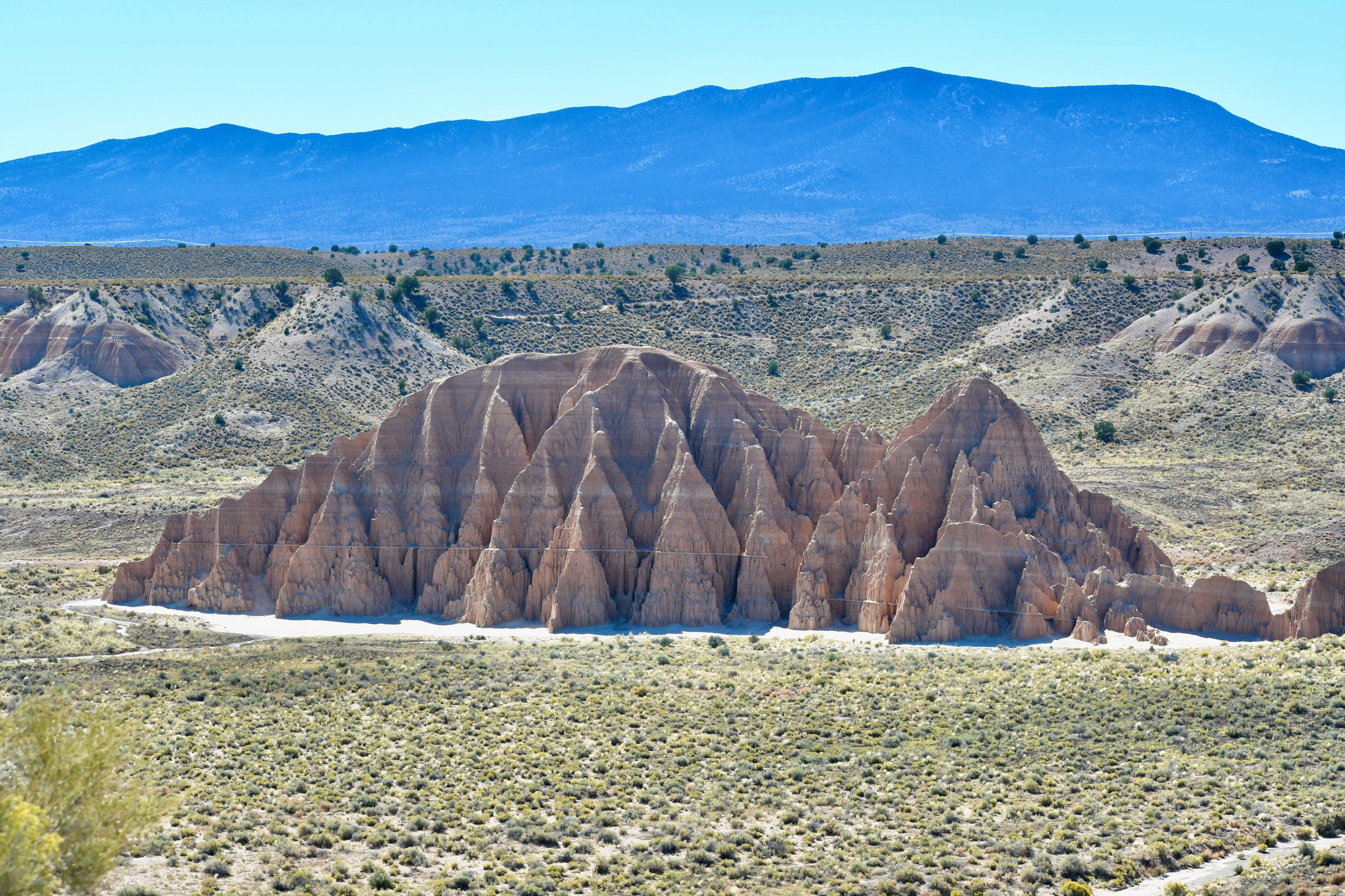
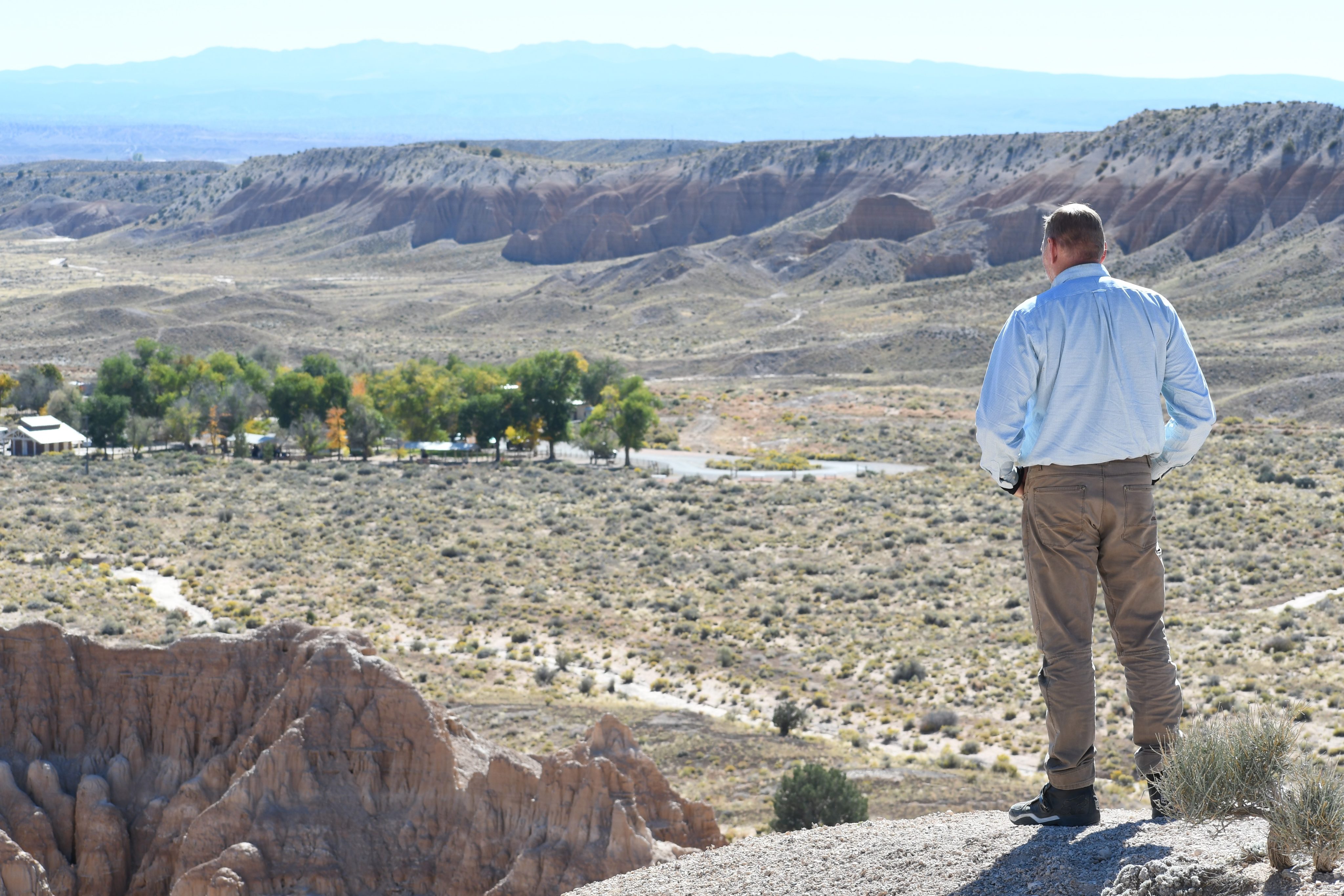
Just after Pioche, we stumble onto Cathedral Gorge State Park, a hidden gem in the heart of Nevada. A scenic overlook provides spectacular views into the weather-eroded gorge and a self-guided walking tour describing the sparse but not barren flora. The namesake feature is a cathedral structure jutting upward from the canyon’s floor. The lengthy gorge has an extended, rippled wall banded with tans and browns, fronting a distant mountain range.
We stop for gas at Sinclair and food at the J&J fast food restaurant for greasy and unsettling fare. Exiting the town through a narrow canyon and passing more scenic country, we elevate through the picturesque countryside of juniper trees, descend into another basin, and pass on the opportunity to hunt for trilobites. Fool! How often will I get the chance to mine for trilobites? Torschlusspanik. So much to do. So little time.
Our dreams of a lakeside campsite in the Upper Pahranagat Lake campground evaporated like gasoline on a Nevada highway. In the Paiute language, Pahranagat means “Valley of Shining Water.” I translate it as mocking water because all the campsites were fully occupied, the Visitor Center was closed, and the park was infested with Park Rangers, making a stealth camp impossible.
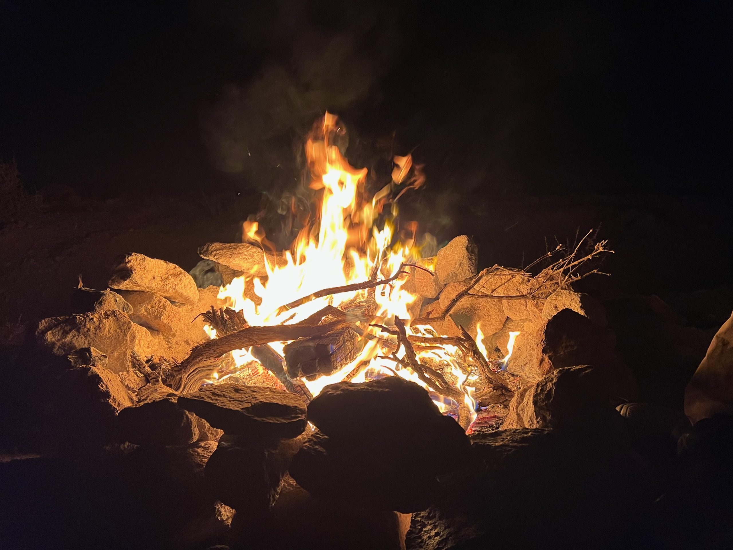
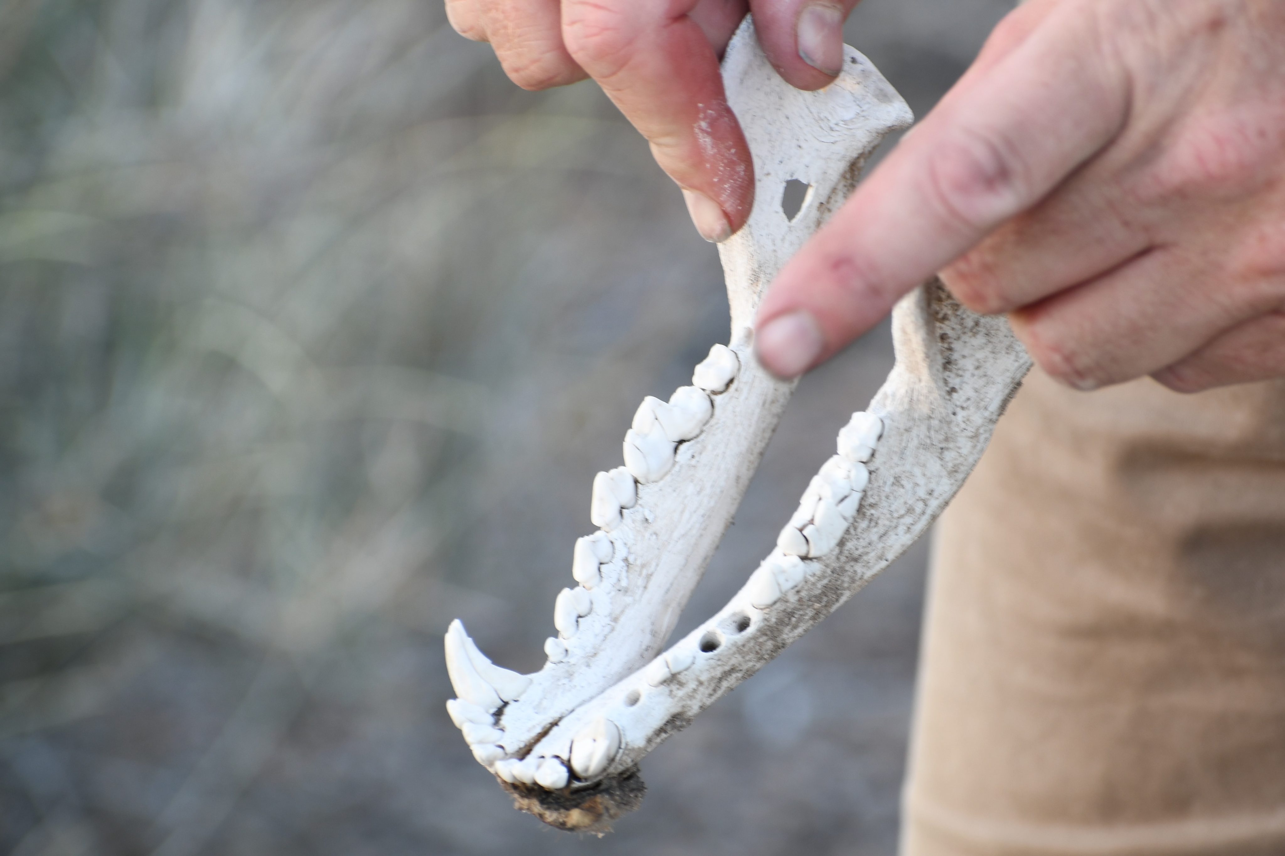
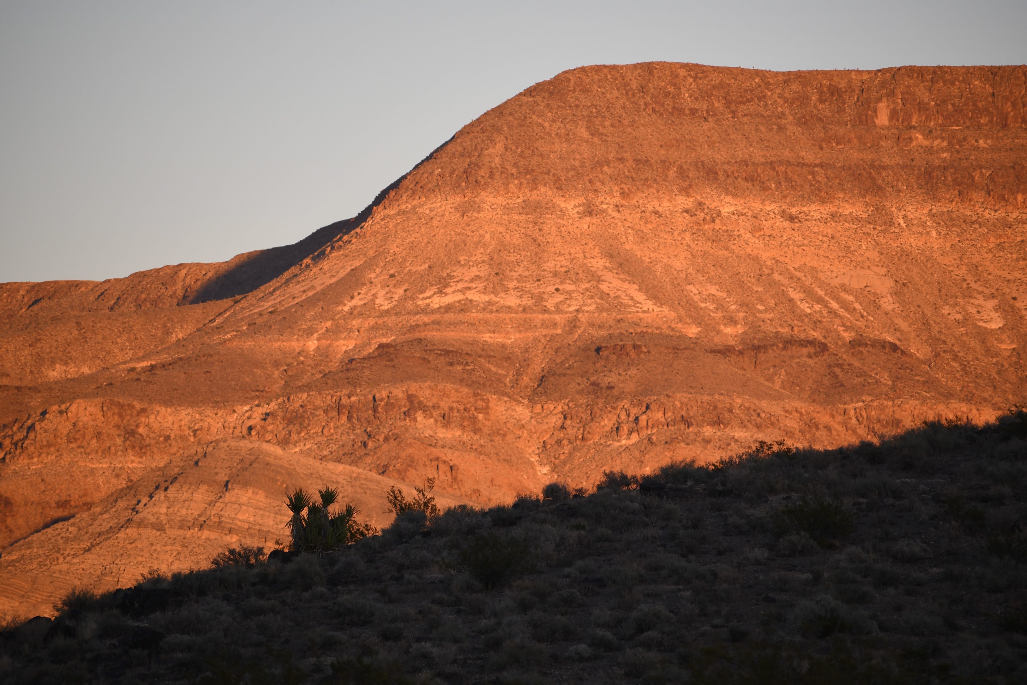
Our leader finds us a stealth site on the other side of the highway, down a dirt road to nowhere, as far as I can tell. We have the place to ourselves, but the price for primitive camping is the open-air, wallless bathrooms. We aren’t the first to camp there but benefit from this arrangement with boards and half-burnt firewood to start a fire. We watch the hillsides paint red in the sunset of another Earthclipse and speculate on the previous owner of a sizable, carnivorous jawbone. After dinner, we start a sizable fire that lasts late into the night, and so does the drinking. The conversations are all a hazy memory. We talked about seeing totality next April and, at some point, decided the benchmark of outdoor experience is how often you’ve taken an outdoor crap. Such is the talk of campfires.
Day 4: 400 miles. Somewhere south of Alamo to Escondido
“…we gotta go and never stop going ‘till we get there.”
Jack Kerouac, On the Road
There’s not much to say about this day other than I elevated my outdoor ranking leaving more than footprints buried at our primitive campsite. We slog all the miles, fast miles, on the long, straight highways and the I-15, eating at gas-station restaurants and concentrating on negotiating through the post-eclipse traffic. In Riverside, the temps soar to 102, a seventy-degree temperature swing from the freezing temperatures of Ely, still wearing my long underwear. But after a long day, we all make it home safe and sound, and I like to think better for the experience.